Property Record
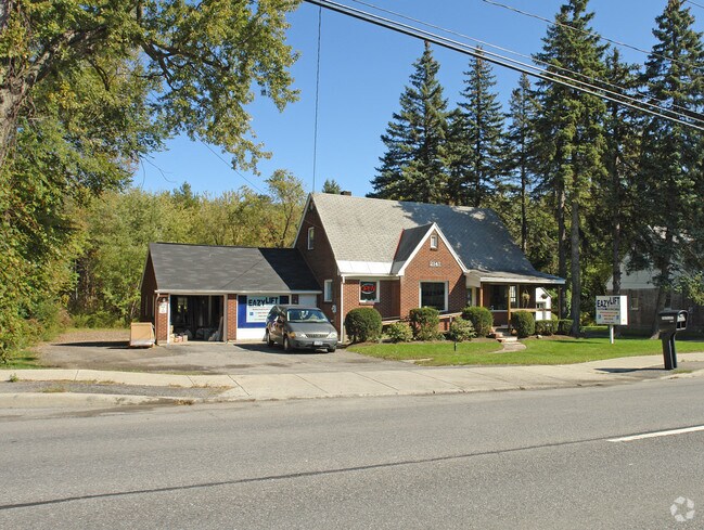
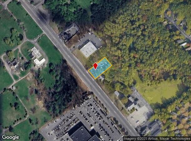
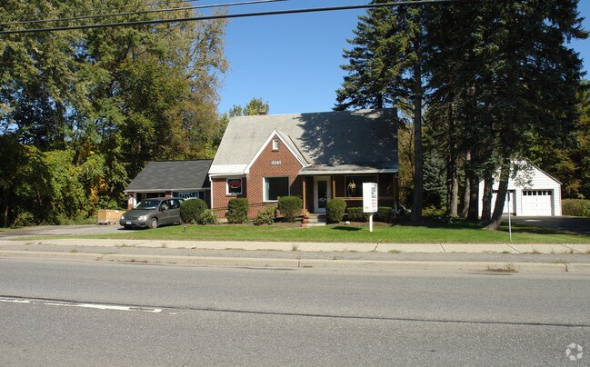
2141 Central Ave, Schenectady, NY 12304
NEARBY LISTINGS FOR SALE OR LEASE
Property Detail
2141 Central Ave
012689-016-002-0002-025-000-0000
N-2131 E-2139 S-10-37
Storesoffices
Albany
X
New York
36001C0044D
25.000
2025
0.46 AC
2024
Central Avenue Corridor
013803
Albany/Schenectady/Troy
1,655 SF
Albany-Schenectady-Troy, NY
DEMOGRAPHICS near 2141 Central Ave
1 Mile
3 Mile
5 Mile
2024 Total Population
4,621
39,767
141,649
2029 Population
4,650
40,703
145,913
Pop Growth 2024-2029
+ 0.63%
+ 2.35%
+ 3.01%
Average Age
43
43
41
2024 Total Households
1,952
16,065
57,662
HH Growth 2024-2029
+ 0.67%
+ 2.43%
+ 3.14%
Median Household Inc
$67,458
$91,782
$80,745
Avg Household Size
2.30
2.40
2.30
2024 Avg HH Vehicles
2.00
2.00
2.00
Median Home Value
$256,896
$252,194
$232,173
Median Year Built
1973
1968
1961
Nearby Places
Map Layers
Map Styles
 Street
 Aerial
- Restaurants
- Banks
- Shops
- Fitness
- Groceries
PUBLIC TRANSPORTATION
COMMUTER RAIL
DRIVE
WALK
Distance
13 min
6.5 mi
AIRPORT
Albany International
DRIVE
WALK
Distance
Albany International
16 min
7.2 mi
Nearby Properties
Address
Land Use
TOTAL SIZE
Lot Size
Zoning
Address
Land Use
TOTAL SIZE
Lot Size
Zoning
11,700 SF
43.80 AC
R2
Address
Land Use
TOTAL SIZE
Lot Size
Zoning
102,862 SF
32.45 AC
CS
Address
Land Use
TOTAL SIZE
Lot Size
Zoning
120,755 SF
33.88 AC
R1
Address
Land Use
TOTAL SIZE
Lot Size
Zoning
266,600 SF
22.60 AC
47
Address
Land Use
TOTAL SIZE
Lot Size
Zoning
167,222 SF
15.65 AC
14
Address
Land Use
TOTAL SIZE
Lot Size
Zoning
67,526 SF
9.40 AC
R1
Address
Land Use
TOTAL SIZE
Lot Size
Zoning
103.30 AC
LC
Address
Land Use
TOTAL SIZE
Lot Size
Zoning
4,680 SF
11.39 AC
CH
Address
Land Use
TOTAL SIZE
Lot Size
Zoning
78,326 SF
27.47 AC
R40
Address
Land Use
TOTAL SIZE
Lot Size
Zoning
117,074 SF
25.30 AC
CN
Address
Land Use
TOTAL SIZE
Lot Size
Zoning
45,896 SF
10.20 AC
03 - MULTI
Address
Land Use
TOTAL SIZE
Lot Size
Zoning
25,112 SF
13.16 AC
04 - FARM
Address
Land Use
TOTAL SIZE
Lot Size
Zoning
Address
Land Use
TOTAL SIZE
Lot Size
Zoning
79,041 SF
13.20 AC
CN
Address
Land Use
TOTAL SIZE
Lot Size
Zoning
120,373 SF
9.68 AC
CS
Address
Land Use
TOTAL SIZE
Lot Size
Zoning
97,440 SF
8.15 AC
B-2
Address
Land Use
TOTAL SIZE
Lot Size
Zoning
99,620 SF
15 AC
45
Address
Land Use
TOTAL SIZE
Lot Size
Zoning
111,915 SF
15.04 AC
05 - COMME
Address
Land Use
TOTAL SIZE
Lot Size
Zoning
117 AC
06 - INDUS
Address
Land Use
TOTAL SIZE
Lot Size
Zoning
68,080 SF
6.22 AC
CS
Address
Land Use
TOTAL SIZE
Lot Size
Zoning
30.20 AC
LC
Address
Land Use
TOTAL SIZE
Lot Size
Zoning
6,889 SF
284.30 AC
F
Address
Land Use
TOTAL SIZE
Lot Size
Zoning
89,589 SF
17.40 AC
45
Address
Land Use
TOTAL SIZE
Lot Size
Zoning
3,630 SF
174.59 AC
08 - GOVER
Address
Land Use
TOTAL SIZE
Lot Size
Zoning
6,944 SF
13.02 AC
R3
Address
Land Use
TOTAL SIZE
Lot Size
Zoning
111,888 SF
9.60 AC
17
Address
Land Use
TOTAL SIZE
Lot Size
Zoning
102,028 SF
11.65 AC
CS
Address
Land Use
TOTAL SIZE
Lot Size
Zoning
32,830 SF
17.85 AC
12
Address
Land Use
TOTAL SIZE
Lot Size
Zoning
79,544 SF
9.28 AC
45
Address
Land Use
TOTAL SIZE
Lot Size
Zoning
92,244 SF
21.51 AC
04 - FARM
The World's #1 Commercial Real Estate Marketplace
Connect with us
© 2025 CoStar Group
The information above has been obtained from sources believed reliable. While we do not doubt its accuracy we have not verified it and make no guarantee, warranty or representation about it. It is your responsibility to independently confirm its accuracy and completeness. Any projections, opinions, assumptions, or estimates used are for example only and do not represent the current or future performance of the property. The value of this transaction to you depends on tax and other factors which should be evaluated by your tax, financial, and legal advisors. You and your advisors should conduct a careful, independent investigation of the property to determine to your satisfaction the suitability of the property for your needs.