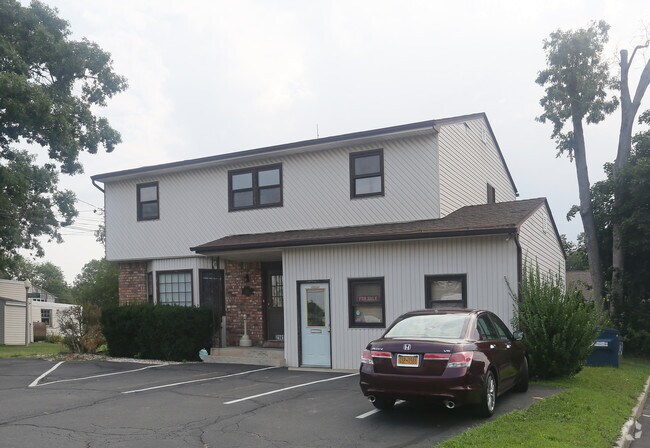
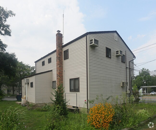
Property Record
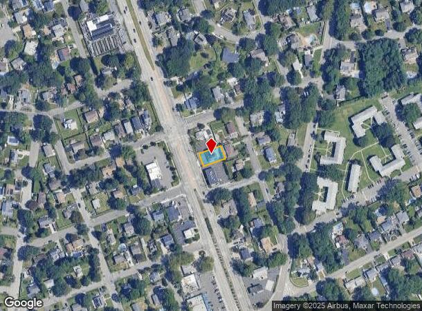
2141 Deer Park Ave, Deer Park, NY 11729
NEARBY LISTINGS FOR SALE OR LEASE
Property Detail
2141 Deer Park Ave
Nassau County-Suffolk County, NY
Deer Pk Terraceo Sub
0100-022-00-01-00-002-000
FILED MAP 529 SEC 7 BLK 17 LOTS 6, 7 & 8
Commercialnec
Suffolk
X
New York
36103C0640H
2
2024
0.14 AC
2024
Western Suffolk
112216
Long Island (New York)
DEMOGRAPHICS near 2141 Deer Park Ave
1 Mile
3 Mile
5 Mile
2024 Total Population
14,092
82,055
241,119
2029 Population
13,837
80,463
235,239
Pop Growth 2024-2029
(1.81%)
(1.94%)
(2.44%)
Average Age
41
40
40
2024 Total Households
4,446
24,832
72,619
HH Growth 2024-2029
(2.07%)
(2.15%)
(2.61%)
Median Household Inc
$128,289
$123,336
$124,048
Avg Household Size
3.10
3.20
3.10
2024 Avg HH Vehicles
2.00
2.00
2.00
Median Home Value
$567,141
$495,114
$480,230
Median Year Built
1966
1965
1964
Nearby Places
- Restaurants
- Banks
- Shops
- Fitness
- Groceries
PUBLIC TRANSPORTATION
COMMUTER RAIL
Wyandanch Station (Ronkonkoma Branch - Long Island Rail Road)
DRIVE
WALK
Distance
Wyandanch Station (Ronkonkoma Branch - Long Island Rail Road)
5 min
3.1 mi
Deer Park Station (Ronkonkoma Branch - Long Island Rail Road)
DRIVE
WALK
Distance
Deer Park Station (Ronkonkoma Branch - Long Island Rail Road)
7 min
3.4 mi
AIRPORT
Long Island MacArthur
DRIVE
WALK
Distance
Long Island MacArthur
23 min
15.5 mi
John F Kennedy International
DRIVE
WALK
Distance
John F Kennedy International
43 min
32.5 mi
Freight Ports
NY - Red Hook Container Terminal
DRIVE
WALK
Distance
NY - Red Hook Container Terminal
59 min
41.3 mi
Nearby Properties
Address
Land Use
TOTAL SIZE
Lot Size
Zoning
Address
Land Use
TOTAL SIZE
Lot Size
Zoning
4.81 AC
AAA
Address
Land Use
TOTAL SIZE
Lot Size
Zoning
371.18 AC
AAA
Address
Land Use
TOTAL SIZE
Lot Size
Zoning
4.39 AC
AAA
Address
Land Use
TOTAL SIZE
Lot Size
Zoning
23.91 AC
IND1
Address
Land Use
TOTAL SIZE
Lot Size
Zoning
117.66 AC
AAA
Address
Land Use
TOTAL SIZE
Lot Size
Zoning
109.45 AC
AAA
Address
Land Use
TOTAL SIZE
Lot Size
Zoning
12 AC
A
Address
Land Use
TOTAL SIZE
Lot Size
Zoning
16.23 AC
A
Address
Land Use
TOTAL SIZE
Lot Size
Zoning
18.37 AC
IND1
Address
Land Use
TOTAL SIZE
Lot Size
Zoning
20.13 AC
Address
Land Use
TOTAL SIZE
Lot Size
Zoning
777,483 SF
80.70 AC
GA
Address
Land Use
TOTAL SIZE
Lot Size
Zoning
14.63 AC
IND1
Address
Land Use
TOTAL SIZE
Lot Size
Zoning
13.28 AC
IND1
Address
Land Use
TOTAL SIZE
Lot Size
Zoning
756 SF
0.36 AC
B1
Address
Land Use
TOTAL SIZE
Lot Size
Zoning
9.20 AC
IND1
Address
Land Use
TOTAL SIZE
Lot Size
Zoning
10.95 AC
IND1
Address
Land Use
TOTAL SIZE
Lot Size
Zoning
13.81 AC
IND1
Address
Land Use
TOTAL SIZE
Lot Size
Zoning
3.31 AC
R40
Address
Land Use
TOTAL SIZE
Lot Size
Zoning
512 SF
10.55 AC
IND1
Address
Land Use
TOTAL SIZE
Lot Size
Zoning
9.79 AC
IND1
Address
Land Use
TOTAL SIZE
Lot Size
Zoning
1.88 AC
AAA
Address
Land Use
TOTAL SIZE
Lot Size
Zoning
8 AC
IND1
Address
Land Use
TOTAL SIZE
Lot Size
Zoning
9.30 AC
Address
Land Use
TOTAL SIZE
Lot Size
Zoning
10.16 AC
Address
Land Use
TOTAL SIZE
Lot Size
Zoning
7.32 AC
IND1
Address
Land Use
TOTAL SIZE
Lot Size
Zoning
6.60 AC
IND1
Address
Land Use
TOTAL SIZE
Lot Size
Zoning
7.50 AC
Address
Land Use
TOTAL SIZE
Lot Size
Zoning
42.07 AC
IND2
Address
Land Use
TOTAL SIZE
Lot Size
Zoning
6.95 AC
IND1
Address
Land Use
TOTAL SIZE
Lot Size
Zoning
7.04 AC
IND1
The World's #1 Commercial Real Estate Marketplace
Connect with us
© 2025 CoStar Group
The information above has been obtained from sources believed reliable. While we do not doubt its accuracy we have not verified it and make no guarantee, warranty or representation about it. It is your responsibility to independently confirm its accuracy and completeness. Any projections, opinions, assumptions, or estimates used are for example only and do not represent the current or future performance of the property. The value of this transaction to you depends on tax and other factors which should be evaluated by your tax, financial, and legal advisors. You and your advisors should conduct a careful, independent investigation of the property to determine to your satisfaction the suitability of the property for your needs.