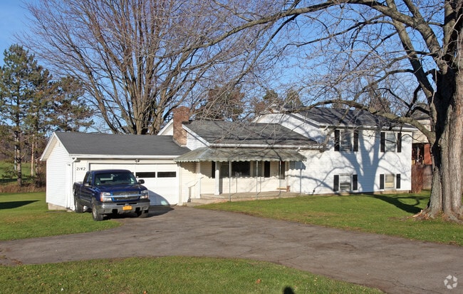
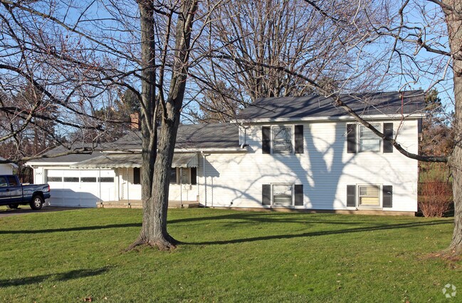
Property Record
2142 Penfield Rd, Penfield, NY 14526
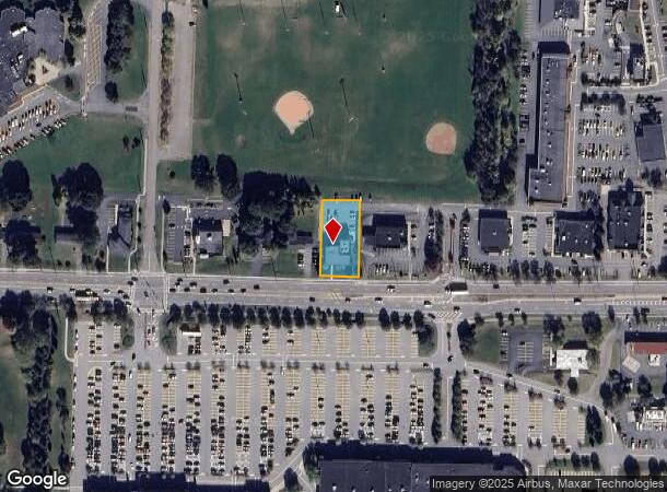
NEARBY LISTINGS FOR SALE OR LEASE
Property Detail
2142 Penfield Rd
Rochester, NY
Charles L Harris Farm
264200-139-080-0001-073-000
0037-13-04 HARRIS 3 L31 01
Professionalbldglegalinsurancerealestateetc
Monroe
X
New York
36055C0240G
73.000
2025
0.46 AC
2024
Northeast
011601
Rochester
5,734 SF
DEMOGRAPHICS near 2142 Penfield Rd
1 Mile
3 Mile
5 Mile
2024 Total Population
9,758
46,971
109,985
2029 Population
9,634
46,232
108,543
Pop Growth 2024-2029
(1.27%)
(1.57%)
(1.31%)
Average Age
44
43
44
2024 Total Households
4,030
19,969
46,046
HH Growth 2024-2029
(1.34%)
(1.71%)
(1.39%)
Median Household Inc
$77,237
$79,921
$89,796
Avg Household Size
2.30
2.30
2.30
2024 Avg HH Vehicles
2.00
2.00
2.00
Median Home Value
$233,616
$236,106
$245,376
Median Year Built
1981
1973
1973
Nearby Places
- Restaurants
- Banks
- Shops
- Fitness
- Groceries
PUBLIC TRANSPORTATION
AIRPORT
Frederick Douglass/Greater Rochester International
DRIVE
WALK
Distance
Frederick Douglass/Greater Rochester International
23 min
13.4 mi
Freight Ports
Albany, NY Port
DRIVE
WALK
Distance
Albany, NY Port
265 min
220.9 mi
Nearby Properties
Address
Land Use
TOTAL SIZE
Lot Size
Zoning
Address
Land Use
TOTAL SIZE
Lot Size
Zoning
640 SF
84.10 AC
RA-2
Address
Land Use
TOTAL SIZE
Lot Size
Zoning
408,790 SF
31.90 AC
02 - SINGL
Address
Land Use
TOTAL SIZE
Lot Size
Zoning
3,752 SF
36.50 AC
MR
Address
Land Use
TOTAL SIZE
Lot Size
Zoning
251,359 SF
46.83 AC
GB
Address
Land Use
TOTAL SIZE
Lot Size
Zoning
2,902 SF
127.70 AC
CEMETERY
Address
Land Use
TOTAL SIZE
Lot Size
Zoning
364,800 SF
28.40 AC
R-1-15
Address
Land Use
TOTAL SIZE
Lot Size
Zoning
65,750 SF
42.60 AC
APT
Address
Land Use
TOTAL SIZE
Lot Size
Zoning
193,120 SF
10.83 AC
INDUSTRIAL
Address
Land Use
TOTAL SIZE
Lot Size
Zoning
283,456 SF
40.76 AC
R-1-20
Address
Land Use
TOTAL SIZE
Lot Size
Zoning
105,768 SF
51.10 AC
R-B
Address
Land Use
TOTAL SIZE
Lot Size
Zoning
74,490 SF
16.20 AC
MIXED USE
Address
Land Use
TOTAL SIZE
Lot Size
Zoning
88,859 SF
82.38 AC
RES B
Address
Land Use
TOTAL SIZE
Lot Size
Zoning
90,684 SF
20.51 AC
LI
Address
Land Use
TOTAL SIZE
Lot Size
Zoning
38,776 SF
10.33 AC
MR
Address
Land Use
TOTAL SIZE
Lot Size
Zoning
4,210 SF
14.85 AC
PDD
Address
Land Use
TOTAL SIZE
Lot Size
Zoning
114,692 SF
27.10 AC
RES B
Address
Land Use
TOTAL SIZE
Lot Size
Zoning
247,668 SF
36.68 AC
GB
Address
Land Use
TOTAL SIZE
Lot Size
Zoning
48,582 SF
18.08 AC
APT
Address
Land Use
TOTAL SIZE
Lot Size
Zoning
50,387 SF
4.10 AC
02 - SINGL
Address
Land Use
TOTAL SIZE
Lot Size
Zoning
105,674 SF
9.02 AC
MUD
Address
Land Use
TOTAL SIZE
Lot Size
Zoning
12,024 SF
17 AC
MR
Address
Land Use
TOTAL SIZE
Lot Size
Zoning
182,943 SF
15.83 AC
LI
Address
Land Use
TOTAL SIZE
Lot Size
Zoning
123,630 SF
11.72 AC
GB
Address
Land Use
TOTAL SIZE
Lot Size
Zoning
85,838 SF
3.70 AC
R-C
Address
Land Use
TOTAL SIZE
Lot Size
Zoning
153,371 SF
13.80 AC
05 - COMME
Address
Land Use
TOTAL SIZE
Lot Size
Zoning
62,776 SF
3.24 AC
LI
Address
Land Use
TOTAL SIZE
Lot Size
Zoning
287,176 SF
22.11 AC
M-1
Address
Land Use
TOTAL SIZE
Lot Size
Zoning
104,432 SF
14.82 AC
GB
Address
Land Use
TOTAL SIZE
Lot Size
Zoning
52,732 SF
1.81 AC
05 - COMME
Address
Land Use
TOTAL SIZE
Lot Size
Zoning
71,551 SF
9.80 AC
R-1-15
The World's #1 Commercial Real Estate Marketplace
Connect with us
© 2025 CoStar Group
The information above has been obtained from sources believed reliable. While we do not doubt its accuracy we have not verified it and make no guarantee, warranty or representation about it. It is your responsibility to independently confirm its accuracy and completeness. Any projections, opinions, assumptions, or estimates used are for example only and do not represent the current or future performance of the property. The value of this transaction to you depends on tax and other factors which should be evaluated by your tax, financial, and legal advisors. You and your advisors should conduct a careful, independent investigation of the property to determine to your satisfaction the suitability of the property for your needs.