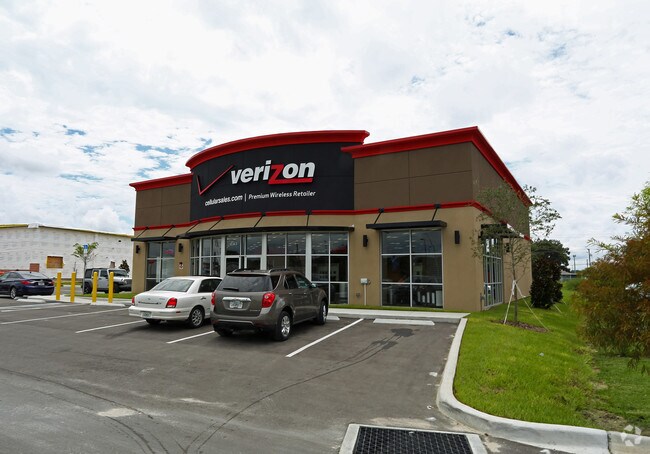
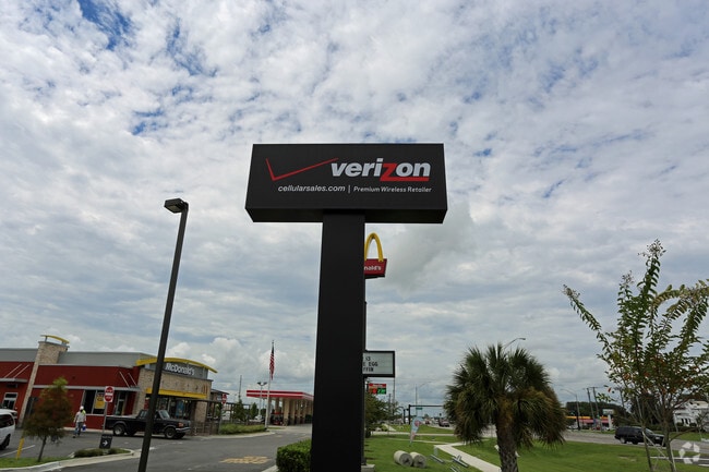
Property Record
2143 Us Highway 92 W, Auburndale, FL 33823

NEARBY LISTINGS FOR SALE OR LEASE
Property Detail
2143 Us Highway 92 W
Lakeland-Winter Haven, FL
Lombardi Landing Unit Two
25-28-09-321377-000013
LOMBARDI LANDING UNIT TWO PB 156 PGS 20 & 21 LOT 1C
Storebuilding
Polk
X
Florida
12105C0340G
1c
2024
0.76 AC
2025
Polk County
011721
Tampa/St Petersburg
4,032 SF
DEMOGRAPHICS near 2143 Us Highway 92 W
1 Mile
3 Mile
5 Mile
2024 Total Population
3,835
29,199
75,927
2029 Population
4,574
35,041
91,767
Pop Growth 2024-2029
+ 19.27%
+ 20.01%
+ 20.86%
Average Age
38
41
41
2024 Total Households
1,457
11,166
29,271
HH Growth 2024-2029
+ 19.22%
+ 19.93%
+ 20.82%
Median Household Inc
$44,275
$54,439
$55,555
Avg Household Size
2.60
2.60
2.50
2024 Avg HH Vehicles
2.00
2.00
2.00
Median Home Value
$180,692
$168,576
$175,061
Median Year Built
1977
1984
1984
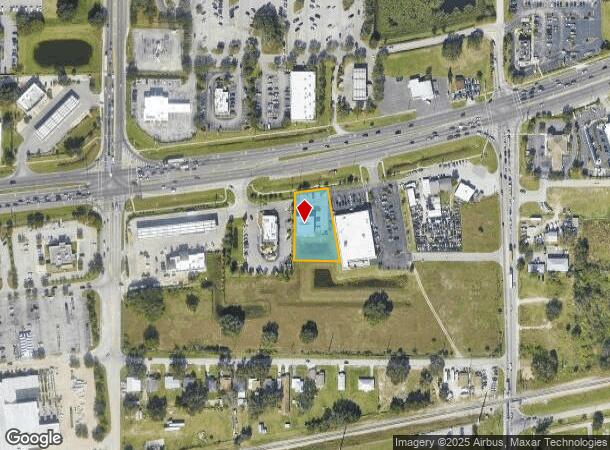
Nearby Places
Map Layers
Map Styles
 Street
 Aerial
- Restaurants
- Banks
- Shops
- Fitness
- Groceries
SALE & LEASE HISTORY
LISTING DATE
SALE/LEASE

Mar 02, 2022
For Sale
Nearby Properties
Address
Land Use
TOTAL SIZE
Lot Size
Zoning
Address
Land Use
TOTAL SIZE
Lot Size
Zoning
831,600 SF
51.22 AC
Address
Land Use
TOTAL SIZE
Lot Size
Zoning
811,392 SF
47.70 AC
Address
Land Use
TOTAL SIZE
Lot Size
Zoning
942,646 SF
91.30 AC
R3
Address
Land Use
TOTAL SIZE
Lot Size
Zoning
275,220 SF
94.53 AC
Address
Land Use
TOTAL SIZE
Lot Size
Zoning
238,721 SF
11.66 AC
GI
Address
Land Use
TOTAL SIZE
Lot Size
Zoning
202,567 SF
189.02 AC
RE1
Address
Land Use
TOTAL SIZE
Lot Size
Zoning
110,108 SF
10 AC
Address
Land Use
TOTAL SIZE
Lot Size
Zoning
136,724 SF
4.62 AC
GI
Address
Land Use
TOTAL SIZE
Lot Size
Zoning
200,200 SF
10.29 AC
Address
Land Use
TOTAL SIZE
Lot Size
Zoning
108,360 SF
4.23 AC
GI
Address
Land Use
TOTAL SIZE
Lot Size
Zoning
188,553 SF
29.12 AC
Address
Land Use
TOTAL SIZE
Lot Size
Zoning
178,899 SF
10.09 AC
GI
Address
Land Use
TOTAL SIZE
Lot Size
Zoning
241,319 SF
5.67 AC
Address
Land Use
TOTAL SIZE
Lot Size
Zoning
291,428 SF
59.34 AC
Address
Land Use
TOTAL SIZE
Lot Size
Zoning
129,567 SF
11.72 AC
C3
Address
Land Use
TOTAL SIZE
Lot Size
Zoning
135,247 SF
22.49 AC
C4
Address
Land Use
TOTAL SIZE
Lot Size
Zoning
91,962 SF
19.46 AC
R4
Address
Land Use
TOTAL SIZE
Lot Size
Zoning
191,975 SF
14.28 AC
HI
Address
Land Use
TOTAL SIZE
Lot Size
Zoning
174,108 SF
4.82 AC
Address
Land Use
TOTAL SIZE
Lot Size
Zoning
126,384 SF
4.67 AC
CH
Address
Land Use
TOTAL SIZE
Lot Size
Zoning
320,765 SF
14.93 AC
GI
Address
Land Use
TOTAL SIZE
Lot Size
Zoning
268,800 SF
9.22 AC
Address
Land Use
TOTAL SIZE
Lot Size
Zoning
42,400 SF
121.06 AC
RC
Address
Land Use
TOTAL SIZE
Lot Size
Zoning
106,376 SF
18.36 AC
Address
Land Use
TOTAL SIZE
Lot Size
Zoning
243,600 SF
35.47 AC
C4
Address
Land Use
TOTAL SIZE
Lot Size
Zoning
42,668 SF
9.44 AC
R2
Address
Land Use
TOTAL SIZE
Lot Size
Zoning
169,925 SF
11.88 AC
C3
Address
Land Use
TOTAL SIZE
Lot Size
Zoning
309,124 SF
31.33 AC
XX
Address
Land Use
TOTAL SIZE
Lot Size
Zoning
231,000 SF
10.10 AC
Address
Land Use
TOTAL SIZE
Lot Size
Zoning
80,280 SF
25.05 AC
The World's #1 Commercial Real Estate Marketplace
Connect with us
© 2025 CoStar Group
The information above has been obtained from sources believed reliable. While we do not doubt its accuracy we have not verified it and make no guarantee, warranty or representation about it. It is your responsibility to independently confirm its accuracy and completeness. Any projections, opinions, assumptions, or estimates used are for example only and do not represent the current or future performance of the property. The value of this transaction to you depends on tax and other factors which should be evaluated by your tax, financial, and legal advisors. You and your advisors should conduct a careful, independent investigation of the property to determine to your satisfaction the suitability of the property for your needs.