Property Record
2145 E Main St, Leesburg, FL 34748


NEARBY LISTINGS FOR SALE OR LEASE
Property Detail
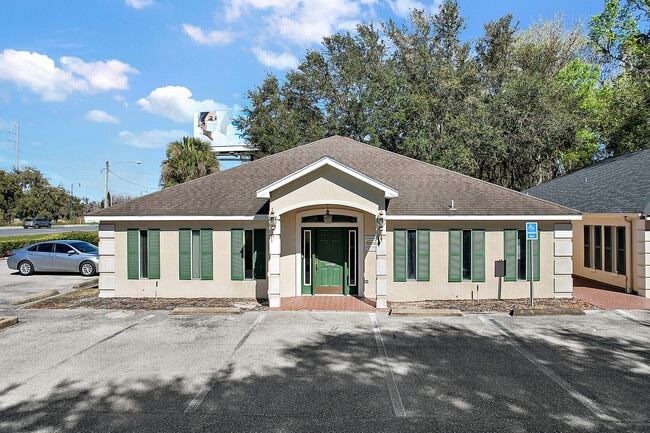
2145 E Main St
20-19-25-0003-000-06400
FROM NE COR OF GOV LOT 4 RUN S 00DEG 27MIN 16SEC W 789.32 FT TO SELY R/W LINE OF US HWY 441 S 49DEG 02MIN 00SEC W ALONG SAID HWY 41 FT FOR POB CONT S 49DEG 02MIN 00SEC W 105 FT S 40DEG 58MIN 00SEC E 102.15 FT N 49DEG 02MIN 00SEC E 105 FT N 40DEG 58MI
Medicalbuilding
Lake
AE
Florida
12069C0330E
4
2024
0.25 AC
2026
Lake County
030307
Orlando
2,538 SF
Orlando-Kissimmee-Sanford, FL
DEMOGRAPHICS near 2145 E Main St
1 Mile
3 Mile
5 Mile
2024 Total Population
5,132
17,778
57,744
2029 Population
6,009
20,921
67,837
Pop Growth 2024-2029
+ 17.09%
+ 17.68%
+ 17.48%
Average Age
44
45
46
2024 Total Households
2,105
7,734
25,525
HH Growth 2024-2029
+ 16.96%
+ 17.87%
+ 17.45%
Median Household Inc
$54,140
$48,120
$44,074
Avg Household Size
2.40
2.20
2.20
2024 Avg HH Vehicles
2.00
1.00
2.00
Median Home Value
$175,483
$197,138
$151,408
Median Year Built
1988
1984
1983
Nearby Places
Map Layers
Map Styles
 Street
 Aerial
- Restaurants
- Banks
- Shops
- Fitness
- Groceries
SALE & LEASE HISTORY
LISTING DATE
SALE/LEASE

Jan 10, 2025
For Lease
Feb 28, 2022
For Lease
Nearby Properties
Address
Land Use
TOTAL SIZE
Lot Size
Zoning
Address
Land Use
TOTAL SIZE
Lot Size
Zoning
3,531 SF
23.43 AC
P
Address
Land Use
TOTAL SIZE
Lot Size
Zoning
131,655 SF
9.98 AC
RP
Address
Land Use
TOTAL SIZE
Lot Size
Zoning
63,584 SF
22.24 AC
PUD
Address
Land Use
TOTAL SIZE
Lot Size
Zoning
5,760 SF
110.52 AC
R1
Address
Land Use
TOTAL SIZE
Lot Size
Zoning
290,514 SF
50.14 AC
PUD
Address
Land Use
TOTAL SIZE
Lot Size
Zoning
183,700 SF
11.66 AC
R2
Address
Land Use
TOTAL SIZE
Lot Size
Zoning
60,700 SF
784.12 AC
P
Address
Land Use
TOTAL SIZE
Lot Size
Zoning
299,920 SF
7.45 AC
PUD
Address
Land Use
TOTAL SIZE
Lot Size
Zoning
137,622 SF
18.33 AC
C3
Address
Land Use
TOTAL SIZE
Lot Size
Zoning
88,611 SF
112.12 AC
R1
Address
Land Use
TOTAL SIZE
Lot Size
Zoning
35,820 SF
3.71 AC
R3
Address
Land Use
TOTAL SIZE
Lot Size
Zoning
39,164 SF
7.25 AC
Address
Land Use
TOTAL SIZE
Lot Size
Zoning
79,456 SF
9.44 AC
C3
Address
Land Use
TOTAL SIZE
Lot Size
Zoning
17,141 SF
113.94 AC
R1
Address
Land Use
TOTAL SIZE
Lot Size
Zoning
147,000 SF
9.04 AC
M1
Address
Land Use
TOTAL SIZE
Lot Size
Zoning
162,928 SF
9.52 AC
R3
Address
Land Use
TOTAL SIZE
Lot Size
Zoning
35,040 SF
5.36 AC
C3
Address
Land Use
TOTAL SIZE
Lot Size
Zoning
5,886 SF
19.13 AC
R2
Address
Land Use
TOTAL SIZE
Lot Size
Zoning
35,116 SF
3.18 AC
C3
Address
Land Use
TOTAL SIZE
Lot Size
Zoning
81,821 SF
12.30 AC
Address
Land Use
TOTAL SIZE
Lot Size
Zoning
48,478 SF
1.61 AC
CIP
Address
Land Use
TOTAL SIZE
Lot Size
Zoning
146,773 SF
5.05 AC
P
Address
Land Use
TOTAL SIZE
Lot Size
Zoning
77,075 SF
4.66 AC
CP
Address
Land Use
TOTAL SIZE
Lot Size
Zoning
37,310 SF
4.39 AC
Address
Land Use
TOTAL SIZE
Lot Size
Zoning
59,664 SF
2.33 AC
C3
Address
Land Use
TOTAL SIZE
Lot Size
Zoning
35,568 SF
2.87 AC
C3
Address
Land Use
TOTAL SIZE
Lot Size
Zoning
37,983 SF
5.54 AC
C3
Address
Land Use
TOTAL SIZE
Lot Size
Zoning
41,137 SF
4.99 AC
R3
Address
Land Use
TOTAL SIZE
Lot Size
Zoning
124,495 SF
6.49 AC
R3
Address
Land Use
TOTAL SIZE
Lot Size
Zoning
15.48 AC
The World's #1 Commercial Real Estate Marketplace
Connect with us
© 2026 CoStar Group
The information above has been obtained from sources believed reliable. While we do not doubt its accuracy we have not verified it and make no guarantee, warranty or representation about it. It is your responsibility to independently confirm its accuracy and completeness. Any projections, opinions, assumptions, or estimates used are for example only and do not represent the current or future performance of the property. The value of this transaction to you depends on tax and other factors which should be evaluated by your tax, financial, and legal advisors. You and your advisors should conduct a careful, independent investigation of the property to determine to your satisfaction the suitability of the property for your needs.