Property Record
2147 Providence Rd, Northbridge, MA 01534

Property Detail
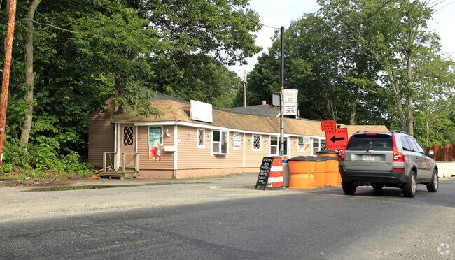
2147 Providence Rd
NBRI-000022-000002
Worcester
Restaurantbuilding
Massachusetts
AE The base floodplain where base flood elevations are provided. AE Zones are now used on new format FIRMs instead of A1-A30 Zones.
0.22 AC
2025
Outlying Worcester
2025
Boston
750300
Worcester, MA
1,871 SF
NEARBY LISTINGS FOR SALE OR LEASE
DEMOGRAPHICS near 2147 Providence Rd
1 mile
3 mile
5 mile
2025 Total Population
4,282
24,619
50,873
2030 Population
4,375
25,290
52,233
Pop Growth 2025-2030
+ 2.17%
+ 2.73%
+ 2.67%
Average Age
44
41
42
2025 Total Households
1,681
9,375
19,456
HH Growth 2025-2030
+ 2.26%
+ 2.82%
+ 2.76%
Median Household Inc
$114,068
$122,644
$126,634
Avg Household Size
2.50
2.60
2.60
2025 Avg HH Vehicles
2.00
2.00
2.00
Median Home Value
$483,196
$520,721
$525,680
Median Year Built
1973
1977
1979
Nearby Places
Map Layers
Map Styles
 Street
 Aerial
Layers
 Traffic
 Biking
Places
Listings with unknown addresses are not visible on the map
- Restaurants
- Banks
- Shops
- Fitness
- Groceries
PUBLIC TRANSPORTATION
COMMUTER RAIL
Grafton (Framingham/Worcester Line - Massachusetts Bay Transportation Authority Commuter Rail (Purple Line))
Drive
Walk
Distance
Grafton (Framingham/Worcester Line - Massachusetts Bay Transportation Authority Commuter Rail (Purple Line))
19 min
9.0 mi
AIRPORT
Worcester Regional
Drive
Walk
Distance
Worcester Regional
33 min
18.4 mi
Rhode Island Tf Green International
Drive
Walk
Distance
Rhode Island Tf Green International
58 min
39.2 mi
General Edward Lawrence Logan International
Drive
Walk
Distance
General Edward Lawrence Logan International
65 min
44.7 mi
Freight Ports
Port of Boston
Drive
Walk
Distance
Port of Boston
64 min
43.0 mi
Nearby Properties
Address
Land Use
TOTAL SIZE
Lot Size
Zoning
Address
Land Use
TOTAL SIZE
Lot Size
Zoning
161,541 SF
30.04 AC
Address
Land Use
TOTAL SIZE
Lot Size
Zoning
173,667 SF
2.44 AC
Address
Land Use
TOTAL SIZE
Lot Size
Zoning
147,000 SF
28.41 AC
5
Address
Land Use
TOTAL SIZE
Lot Size
Zoning
159,250 SF
28.89 AC
2
Address
Land Use
TOTAL SIZE
Lot Size
Zoning
99,891 SF
17.37 AC
1
Address
Land Use
TOTAL SIZE
Lot Size
Zoning
50.49 AC
Address
Land Use
TOTAL SIZE
Lot Size
Zoning
37,781 SF
29.16 AC
Address
Land Use
TOTAL SIZE
Lot Size
Zoning
12.93 AC
Address
Land Use
TOTAL SIZE
Lot Size
Zoning
22,520 SF
7.03 AC
Address
Land Use
TOTAL SIZE
Lot Size
Zoning
55,671 SF
3.53 AC
Address
Land Use
TOTAL SIZE
Lot Size
Zoning
2,576 SF
3.37 AC
5
Address
Land Use
TOTAL SIZE
Lot Size
Zoning
67,716 SF
42.39 AC
Address
Land Use
TOTAL SIZE
Lot Size
Zoning
12.65 AC
Address
Land Use
TOTAL SIZE
Lot Size
Zoning
51,441 SF
3.50 AC
3
Address
Land Use
TOTAL SIZE
Lot Size
Zoning
87,250 SF
4.46 AC
6
Address
Land Use
TOTAL SIZE
Lot Size
Zoning
19,913 SF
0.78 AC
Address
Land Use
TOTAL SIZE
Lot Size
Zoning
17.12 AC
Address
Land Use
TOTAL SIZE
Lot Size
Zoning
26.11 AC
Address
Land Use
TOTAL SIZE
Lot Size
Zoning
6.17 AC
Address
Land Use
TOTAL SIZE
Lot Size
Zoning
2.72 AC
Address
Land Use
TOTAL SIZE
Lot Size
Zoning
1.79 AC
Address
Land Use
TOTAL SIZE
Lot Size
Zoning
23,326 SF
33.14 AC
7
Address
Land Use
TOTAL SIZE
Lot Size
Zoning
57,554 SF
2.19 AC
Address
Land Use
TOTAL SIZE
Lot Size
Zoning
28,875 SF
0.61 AC
Address
Land Use
TOTAL SIZE
Lot Size
Zoning
44,668 SF
3.84 AC
Address
Land Use
TOTAL SIZE
Lot Size
Zoning
146.25 AC
Address
Land Use
TOTAL SIZE
Lot Size
Zoning
52,700 SF
3.98 AC
Address
Land Use
TOTAL SIZE
Lot Size
Zoning
5.78 AC
OLI
Address
Land Use
TOTAL SIZE
Lot Size
Zoning
22,864 SF
3.96 AC
1
Address
Land Use
TOTAL SIZE
Lot Size
Zoning
54.40 AC
The World's #1 Commercial Real Estate Marketplace
Connect with us
© 2026 CoStar Group
The information above has been obtained from sources believed reliable. While we do not doubt its accuracy we have not verified it and make no guarantee, warranty or representation about it. It is your responsibility to independently confirm its accuracy and completeness. Any projections, opinions, assumptions, or estimates used are for example only and do not represent the current or future performance of the property. The value of this transaction to you depends on tax and other factors which should be evaluated by your tax, financial, and legal advisors. You and your advisors should conduct a careful, independent investigation of the property to determine to your satisfaction the suitability of the property for your needs.