Property Record
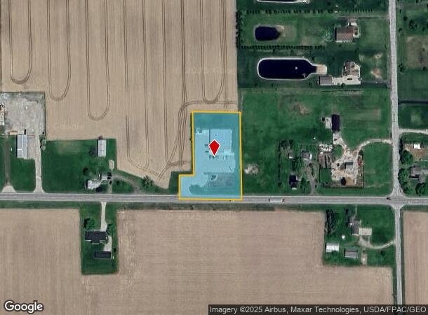
2148 Us Highway 20, Swanton, OH 43558


NEARBY LISTINGS FOR SALE OR LEASE
-
-
View all Swanton listings for sale on LoopNet.com
Property Detail
2148 Us Highway 20
01-001688-02.000
4E-9S-23 W199.97 E914.71 S365 SE SE 1.8124AC
Storebuilding
Fulton
X
Ohio
26091C0475D
1.81 AC
2024
Fulton County
2024
Toledo
040100
Toledo, OH
7,428 SF
DEMOGRAPHICS near 2148 Us Highway 20
1 Mile
3 Mile
5 Mile
2024 Total Population
345
1,808
4,557
2029 Population
331
1,756
4,426
Pop Growth 2024-2029
(4.06%)
(2.88%)
(2.87%)
Average Age
42
41
42
2024 Total Households
129
673
1,730
HH Growth 2024-2029
(3.88%)
(2.82%)
(2.89%)
Median Household Inc
$87,500
$81,579
$82,263
Avg Household Size
2.70
2.70
2.60
2024 Avg HH Vehicles
3.00
2.00
3.00
Median Home Value
$210,294
$192,856
$194,957
Median Year Built
1965
1952
1955
Nearby Places
Map Layers
Map Styles
 Street
 Aerial
- Restaurants
- Banks
- Shops
- Fitness
- Groceries
PUBLIC TRANSPORTATION
AIRPORT
Eugene F Kranz Toledo Express
DRIVE
WALK
Distance
Eugene F Kranz Toledo Express
26 min
13.0 mi
Freight Ports
Port of Toledo
DRIVE
WALK
Distance
Port of Toledo
42 min
26.5 mi
SALE & LEASE HISTORY
LISTING DATE
SALE/LEASE

Nov 13, 2019
For Sale
Feb 25, 2022
For Sale
Nearby Properties
Address
Land Use
TOTAL SIZE
Lot Size
Zoning
Address
Land Use
TOTAL SIZE
Lot Size
Zoning
6,036 SF
14.26 AC
Address
Land Use
TOTAL SIZE
Lot Size
Zoning
76,650 SF
10.04 AC
M2
Address
Land Use
TOTAL SIZE
Lot Size
Zoning
1,580 SF
146.25 AC
Address
Land Use
TOTAL SIZE
Lot Size
Zoning
1,747 SF
97.71 AC
Address
Land Use
TOTAL SIZE
Lot Size
Zoning
332.12 AC
Address
Land Use
TOTAL SIZE
Lot Size
Zoning
2,043 SF
278.74 AC
Address
Land Use
TOTAL SIZE
Lot Size
Zoning
232.72 AC
Address
Land Use
TOTAL SIZE
Lot Size
Zoning
2,169 SF
159 AC
Address
Land Use
TOTAL SIZE
Lot Size
Zoning
2,245 SF
135.21 AC
Address
Land Use
TOTAL SIZE
Lot Size
Zoning
Address
Land Use
TOTAL SIZE
Lot Size
Zoning
227.84 AC
Address
Land Use
TOTAL SIZE
Lot Size
Zoning
235.35 AC
Address
Land Use
TOTAL SIZE
Lot Size
Zoning
3,058 SF
159 AC
Address
Land Use
TOTAL SIZE
Lot Size
Zoning
1,520 SF
136.15 AC
Address
Land Use
TOTAL SIZE
Lot Size
Zoning
Address
Land Use
TOTAL SIZE
Lot Size
Zoning
2,549 SF
95.73 AC
Address
Land Use
TOTAL SIZE
Lot Size
Zoning
9,329 SF
0.44 AC
S1
Address
Land Use
TOTAL SIZE
Lot Size
Zoning
1,734 SF
159.72 AC
Address
Land Use
TOTAL SIZE
Lot Size
Zoning
Address
Land Use
TOTAL SIZE
Lot Size
Zoning
203.99 AC
Address
Land Use
TOTAL SIZE
Lot Size
Zoning
1,510 SF
178.98 AC
Address
Land Use
TOTAL SIZE
Lot Size
Zoning
2,088 SF
199 AC
Address
Land Use
TOTAL SIZE
Lot Size
Zoning
1,684 SF
159 AC
Address
Land Use
TOTAL SIZE
Lot Size
Zoning
2,097 SF
157.38 AC
Address
Land Use
TOTAL SIZE
Lot Size
Zoning
1,526 SF
157.06 AC
Address
Land Use
TOTAL SIZE
Lot Size
Zoning
Address
Land Use
TOTAL SIZE
Lot Size
Zoning
185.48 AC
Address
Land Use
TOTAL SIZE
Lot Size
Zoning
2,213 SF
114.58 AC
Address
Land Use
TOTAL SIZE
Lot Size
Zoning
1,836 SF
159 AC
Address
Land Use
TOTAL SIZE
Lot Size
Zoning
184.58 AC
The World's #1 Commercial Real Estate Marketplace
Connect with us
© 2026 CoStar Group
The information above has been obtained from sources believed reliable. While we do not doubt its accuracy we have not verified it and make no guarantee, warranty or representation about it. It is your responsibility to independently confirm its accuracy and completeness. Any projections, opinions, assumptions, or estimates used are for example only and do not represent the current or future performance of the property. The value of this transaction to you depends on tax and other factors which should be evaluated by your tax, financial, and legal advisors. You and your advisors should conduct a careful, independent investigation of the property to determine to your satisfaction the suitability of the property for your needs.