Property Record
215 5Th St, Waynesboro, VA 22980


NEARBY LISTINGS FOR SALE OR LEASE
Property Detail
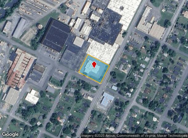
215 5Th St
36 2 - 2
1.152 ACRES (PT OF BLOCK 24) BCMM&L
Industrialgeneral
Waynesboro
AE
Virginia
51125C0025C
1.15 AC
2025
Staunton & Harrisonburg
2025
Other Market Areas
003200
Staunton-Stuarts Draft, VA
10,548 SF
DEMOGRAPHICS near 215 5Th St
1 Mile
3 Mile
5 Mile
2024 Total Population
8,664
25,066
33,695
2029 Population
9,380
26,910
35,736
Pop Growth 2024-2029
+ 8.26%
+ 7.36%
+ 6.06%
Average Age
39
42
43
2024 Total Households
3,703
10,771
14,291
HH Growth 2024-2029
+ 8.29%
+ 7.34%
+ 6.09%
Median Household Inc
$37,234
$49,896
$55,360
Avg Household Size
2.30
2.30
2.30
2024 Avg HH Vehicles
2.00
2.00
2.00
Median Home Value
$155,804
$209,446
$238,894
Median Year Built
1972
1973
1979
Nearby Places
Map Layers
Map Styles
 Street
 Aerial
- Restaurants
- Banks
- Shops
- Fitness
- Groceries
PUBLIC TRANSPORTATION
AIRPORT
Charlottesville-Albemarle
DRIVE
WALK
Distance
Charlottesville-Albemarle
50 min
34.5 mi
SALE & LEASE HISTORY
LISTING DATE
SALE/LEASE

Sep 24, 2016
For Sale
Feb 04, 2021
For Sale
Nearby Properties
Address
Land Use
TOTAL SIZE
Lot Size
Zoning
Address
Land Use
TOTAL SIZE
Lot Size
Zoning
150,944 SF
22.24 AC
RG-5
Address
Land Use
TOTAL SIZE
Lot Size
Zoning
165,670 SF
5.31 AC
R-O
Address
Land Use
TOTAL SIZE
Lot Size
Zoning
25,100 SF
11.54 AC
PUD
Address
Land Use
TOTAL SIZE
Lot Size
Zoning
11,510 SF
8.31 AC
PUD
Address
Land Use
TOTAL SIZE
Lot Size
Zoning
73,371 SF
13.23 AC
H-B
Address
Land Use
TOTAL SIZE
Lot Size
Zoning
2.08 AC
RG-5
Address
Land Use
TOTAL SIZE
Lot Size
Zoning
191,715 SF
22.54 AC
H-B
Address
Land Use
TOTAL SIZE
Lot Size
Zoning
48,888 SF
9.01 AC
RG-5
Address
Land Use
TOTAL SIZE
Lot Size
Zoning
121,275 SF
18.39 AC
RG-5
Address
Land Use
TOTAL SIZE
Lot Size
Zoning
947 SF
13.62 AC
RG-5
Address
Land Use
TOTAL SIZE
Lot Size
Zoning
29,582 SF
5.36 AC
PUD
Address
Land Use
TOTAL SIZE
Lot Size
Zoning
301,338 SF
21.52 AC
H-I
Address
Land Use
TOTAL SIZE
Lot Size
Zoning
75,609 SF
12.01 AC
RS-7
Address
Land Use
TOTAL SIZE
Lot Size
Zoning
8,050 SF
4.50 AC
R-MF
Address
Land Use
TOTAL SIZE
Lot Size
Zoning
96,070 SF
27.10 AC
H-B
Address
Land Use
TOTAL SIZE
Lot Size
Zoning
5,624 SF
74.80 AC
H-I
Address
Land Use
TOTAL SIZE
Lot Size
Zoning
31,977 SF
5.07 AC
RS-12
Address
Land Use
TOTAL SIZE
Lot Size
Zoning
460 SF
144.09 AC
H-I
Address
Land Use
TOTAL SIZE
Lot Size
Zoning
7,512 SF
6.39 AC
R-MF
Address
Land Use
TOTAL SIZE
Lot Size
Zoning
1,844 SF
8.39 AC
R-MF
Address
Land Use
TOTAL SIZE
Lot Size
Zoning
2,460 SF
31.78 AC
PUD
Address
Land Use
TOTAL SIZE
Lot Size
Zoning
5,108 SF
20.66 AC
RG-5
Address
Land Use
TOTAL SIZE
Lot Size
Zoning
8,880 SF
3.21 AC
R-MF
Address
Land Use
TOTAL SIZE
Lot Size
Zoning
840 SF
1.70 AC
C-B
Address
Land Use
TOTAL SIZE
Lot Size
Zoning
41,574 SF
5.29 AC
H-B
Address
Land Use
TOTAL SIZE
Lot Size
Zoning
2,393 SF
6.81 AC
R-MF
Address
Land Use
TOTAL SIZE
Lot Size
Zoning
7,128 SF
3.75 AC
R-MF
Address
Land Use
TOTAL SIZE
Lot Size
Zoning
7,178 SF
4.16 AC
R-MF
Address
Land Use
TOTAL SIZE
Lot Size
Zoning
62,626 SF
1.15 AC
R-MF
Address
Land Use
TOTAL SIZE
Lot Size
Zoning
54,021 SF
9.74 AC
RS-7
The World's #1 Commercial Real Estate Marketplace
Connect with us
© 2026 CoStar Group
The information above has been obtained from sources believed reliable. While we do not doubt its accuracy we have not verified it and make no guarantee, warranty or representation about it. It is your responsibility to independently confirm its accuracy and completeness. Any projections, opinions, assumptions, or estimates used are for example only and do not represent the current or future performance of the property. The value of this transaction to you depends on tax and other factors which should be evaluated by your tax, financial, and legal advisors. You and your advisors should conduct a careful, independent investigation of the property to determine to your satisfaction the suitability of the property for your needs.