Property Record
215 E 2Nd St, Roanoke, IN 46783
NEARBY LISTINGS FOR SALE OR LEASE
-
-
View all Roanoke listings for lease on LoopNet.com
Property Detail
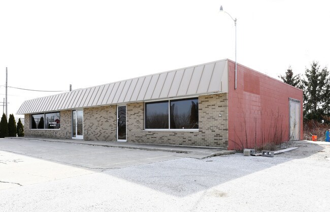
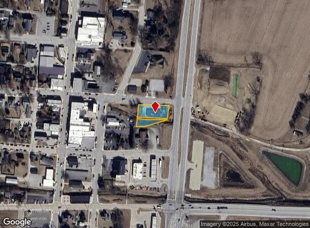
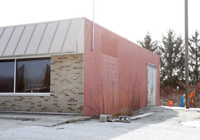
215 E 2Nd St
Huntington, IN
Hendrys Add
35-01-14-300-011.100-007
020-00111-00 HENDRYS ADD LOT 15 HENDRYS ADD PT LOT 16
Storebuilding
Huntington
AE
Indiana
18069C0178D
15,16
2024
0.36 AC
2024
Fort Wayne
961300
Other Market Areas
2,874 SF
DEMOGRAPHICS near 215 E 2Nd St
1 mile
3 mile
5 mile
2024 Total Population
2,031
3,793
8,311
2029 Population
2,035
3,807
8,428
Pop Growth 2024-2029
+ 0.20%
+ 0.37%
+ 1.41%
Average Age
42
42
41
2024 Total Households
842
1,548
3,181
HH Growth 2024-2029
+ 0.24%
+ 0.32%
+ 1.32%
Median Household Inc
$73,794
$77,060
$90,236
Avg Household Size
2.40
2.40
2.60
2024 Avg HH Vehicles
2.00
2.00
2.00
Median Home Value
$194,285
$203,475
$247,076
Median Year Built
1988
1989
1988
Nearby Places
Map Layers
Map Styles
 Street
 Aerial
Transit
 Traffic
 Biking
Places
Listings with unknown addresses are not visible on the map
- Restaurants
- Banks
- Shops
- Fitness
- Groceries
PUBLIC TRANSPORTATION
AIRPORT
Fort Wayne International
Drive
Walk
Distance
Fort Wayne International
19 min
10.7 mi
SALE & LEASE HISTORY
LISTING DATE
SALE/LEASE

Feb 06, 2018
For Lease
Nearby Properties
Address
Land Use
TOTAL SIZE
Lot Size
Zoning
Address
Land Use
TOTAL SIZE
Lot Size
Zoning
99,688 SF
87.88 AC
Address
Land Use
TOTAL SIZE
Lot Size
Zoning
94,605 SF
111.48 AC
Address
Land Use
TOTAL SIZE
Lot Size
Zoning
114,304 SF
283.30 AC
Address
Land Use
TOTAL SIZE
Lot Size
Zoning
16,569 SF
19.15 AC
Address
Land Use
TOTAL SIZE
Lot Size
Zoning
9,040 SF
38 AC
Address
Land Use
TOTAL SIZE
Lot Size
Zoning
76,960 SF
152.71 AC
Address
Land Use
TOTAL SIZE
Lot Size
Zoning
11,913 SF
33.47 AC
Address
Land Use
TOTAL SIZE
Lot Size
Zoning
10,043 SF
20.02 AC
Address
Land Use
TOTAL SIZE
Lot Size
Zoning
5,960 SF
11.29 AC
Address
Land Use
TOTAL SIZE
Lot Size
Zoning
6,169 SF
5.99 AC
Address
Land Use
TOTAL SIZE
Lot Size
Zoning
33,420 SF
577.70 AC
Address
Land Use
TOTAL SIZE
Lot Size
Zoning
7,425 SF
17.66 AC
Address
Land Use
TOTAL SIZE
Lot Size
Zoning
13,355 SF
127.93 AC
Address
Land Use
TOTAL SIZE
Lot Size
Zoning
7,674 SF
1.02 AC
Address
Land Use
TOTAL SIZE
Lot Size
Zoning
7,394 SF
13.02 AC
Address
Land Use
TOTAL SIZE
Lot Size
Zoning
6,794 SF
3.56 AC
Address
Land Use
TOTAL SIZE
Lot Size
Zoning
4,072 SF
19.48 AC
Address
Land Use
TOTAL SIZE
Lot Size
Zoning
2,392 SF
26.72 AC
Address
Land Use
TOTAL SIZE
Lot Size
Zoning
6,982 SF
5.31 AC
Address
Land Use
TOTAL SIZE
Lot Size
Zoning
4,019 SF
11.35 AC
Address
Land Use
TOTAL SIZE
Lot Size
Zoning
8,010 SF
1.39 AC
Address
Land Use
TOTAL SIZE
Lot Size
Zoning
1,740 SF
69.93 AC
Address
Land Use
TOTAL SIZE
Lot Size
Zoning
42,872 SF
4.95 AC
Address
Land Use
TOTAL SIZE
Lot Size
Zoning
285.96 AC
Address
Land Use
TOTAL SIZE
Lot Size
Zoning
4,256 SF
41.36 AC
Address
Land Use
TOTAL SIZE
Lot Size
Zoning
5,959 SF
10.32 AC
Address
Land Use
TOTAL SIZE
Lot Size
Zoning
5,114 SF
15.36 AC
Address
Land Use
TOTAL SIZE
Lot Size
Zoning
8,651 SF
12.59 AC
Address
Land Use
TOTAL SIZE
Lot Size
Zoning
7,041 SF
252.60 AC
Address
Land Use
TOTAL SIZE
Lot Size
Zoning
8,370 SF
2.51 AC
The World's #1 Commercial Real Estate Marketplace
Connect with us
© 2026 CoStar Group
The information above has been obtained from sources believed reliable. While we do not doubt its accuracy we have not verified it and make no guarantee, warranty or representation about it. It is your responsibility to independently confirm its accuracy and completeness. Any projections, opinions, assumptions, or estimates used are for example only and do not represent the current or future performance of the property. The value of this transaction to you depends on tax and other factors which should be evaluated by your tax, financial, and legal advisors. You and your advisors should conduct a careful, independent investigation of the property to determine to your satisfaction the suitability of the property for your needs.