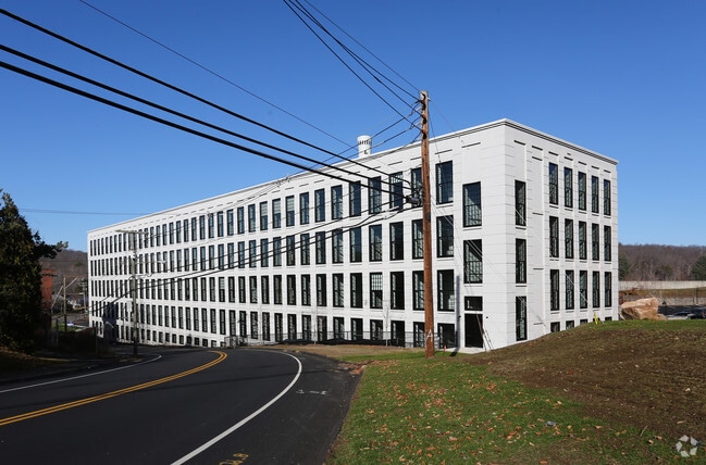
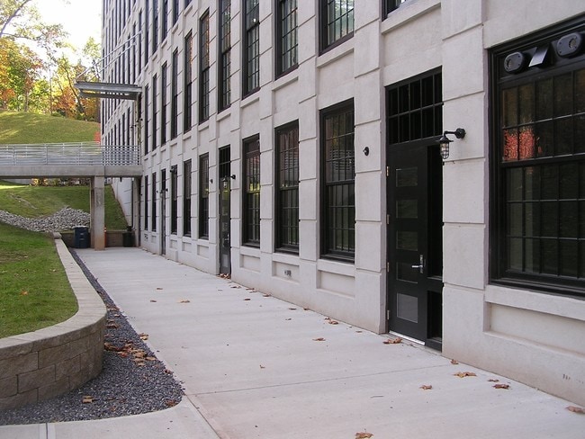
Property Record
215 E Main St, Vernon Rockville, CT 06066

Current Lease Availabilities
Property Detail
215 E Main St
VERN-000045-000123-000016
TOLLAND
Apartment
Connecticut
HDI
16
2024
6.66 AC
2025
Vernon
530100
Hartford
69,368 SF
Hartford-West Hartford-East Hartford, CT
NEARBY LISTINGS FOR SALE OR LEASE
DEMOGRAPHICS near 215 E Main St
1 mile
3 mile
5 mile
2025 Total Population
5,697
31,345
62,539
2030 Population
5,832
32,102
63,903
Pop Growth 2025-2030
+ 2.37%
+ 2.42%
+ 2.18%
Average Age
39
41
42
2025 Total Households
2,558
14,003
26,506
HH Growth 2025-2030
+ 2.42%
+ 2.47%
+ 2.27%
Median Household Inc
$69,432
$83,531
$98,761
Avg Household Size
2.20
2.20
2.30
2025 Avg HH Vehicles
2.00
2.00
2.00
Median Home Value
$250,566
$290,673
$327,800
Median Year Built
1953
1968
1974
Nearby Places
Map Layers
Map Styles
 Street
 Aerial
Transit
 Traffic
 Biking
Places
Listings with unknown addresses are not visible on the map
- Restaurants
- Banks
- Shops
- Fitness
- Groceries
PUBLIC TRANSPORTATION
AIRPORT
Bradley International
Drive
Walk
Distance
Bradley International
44 min
22.5 mi
Freight Ports
Port of New Haven
Drive
Walk
Distance
Port of New Haven
68 min
52.9 mi
Nearby Properties
Address
Land Use
TOTAL SIZE
Lot Size
Zoning
Address
Land Use
TOTAL SIZE
Lot Size
Zoning
3,200 SF
31.39 AC
INDUST
Address
Land Use
TOTAL SIZE
Lot Size
Zoning
63.72 AC
R-22
Address
Land Use
TOTAL SIZE
Lot Size
Zoning
52.04 AC
MF
Address
Land Use
TOTAL SIZE
Lot Size
Zoning
71.60 AC
MF
Address
Land Use
TOTAL SIZE
Lot Size
Zoning
Address
Land Use
TOTAL SIZE
Lot Size
Zoning
188,775 SF
74.13 AC
R-27
Address
Land Use
TOTAL SIZE
Lot Size
Zoning
7.95 AC
DBR
Address
Land Use
TOTAL SIZE
Lot Size
Zoning
29.97 AC
PC
Address
Land Use
TOTAL SIZE
Lot Size
Zoning
11 AC
R-27
Address
Land Use
TOTAL SIZE
Lot Size
Zoning
54.80 AC
PRD
Address
Land Use
TOTAL SIZE
Lot Size
Zoning
15.89 AC
PRD
Address
Land Use
TOTAL SIZE
Lot Size
Zoning
85.13 AC
RW
Address
Land Use
TOTAL SIZE
Lot Size
Zoning
80,487 SF
11.41 AC
DMF
Address
Land Use
TOTAL SIZE
Lot Size
Zoning
31.50 AC
PRD
Address
Land Use
TOTAL SIZE
Lot Size
Zoning
18.49 AC
PRD
Address
Land Use
TOTAL SIZE
Lot Size
Zoning
15.84 AC
R
Address
Land Use
TOTAL SIZE
Lot Size
Zoning
13.44 AC
RC
Address
Land Use
TOTAL SIZE
Lot Size
Zoning
19.38 AC
C
Address
Land Use
TOTAL SIZE
Lot Size
Zoning
8.22 AC
PRD
Address
Land Use
TOTAL SIZE
Lot Size
Zoning
10.30 AC
PRD
Address
Land Use
TOTAL SIZE
Lot Size
Zoning
73,280 SF
0.52 AC
DBR
Address
Land Use
TOTAL SIZE
Lot Size
Zoning
229,674 SF
14.30 AC
CIZ
Address
Land Use
TOTAL SIZE
Lot Size
Zoning
14.80 AC
PRD
Address
Land Use
TOTAL SIZE
Lot Size
Zoning
77,212 SF
19.60 AC
R
Address
Land Use
TOTAL SIZE
Lot Size
Zoning
10.35 AC
PRD
Address
Land Use
TOTAL SIZE
Lot Size
Zoning
12.23 AC
C
Address
Land Use
TOTAL SIZE
Lot Size
Zoning
71,343 SF
26.01 AC
TBP
Address
Land Use
TOTAL SIZE
Lot Size
Zoning
65,721 SF
6.39 AC
RDD
Address
Land Use
TOTAL SIZE
Lot Size
Zoning
63,564 SF
7.52 AC
COMMER
Address
Land Use
TOTAL SIZE
Lot Size
Zoning
12.05 AC
COMMER
The World's #1 Commercial Real Estate Marketplace
Connect with us
© 2026 CoStar Group
The information above has been obtained from sources believed reliable. While we do not doubt its accuracy we have not verified it and make no guarantee, warranty or representation about it. It is your responsibility to independently confirm its accuracy and completeness. Any projections, opinions, assumptions, or estimates used are for example only and do not represent the current or future performance of the property. The value of this transaction to you depends on tax and other factors which should be evaluated by your tax, financial, and legal advisors. You and your advisors should conduct a careful, independent investigation of the property to determine to your satisfaction the suitability of the property for your needs.