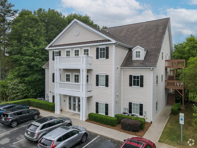
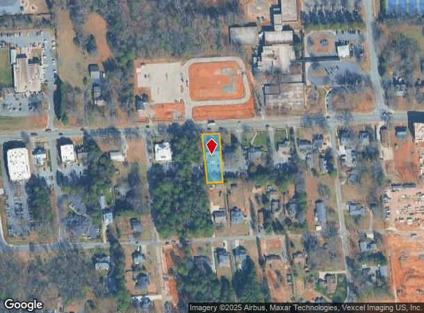
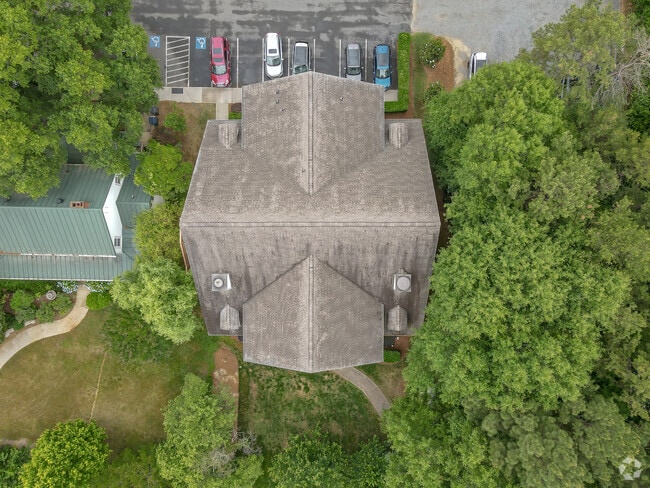
Property Record
215 Gilead Rd, Huntersville, NC 28078
This Property Is For Sale
NEARBY LISTINGS FOR SALE OR LEASE
Property Detail
215 Gilead Rd
Charlotte-Concord-Gastonia, NC-SC
Charlestowne Prof Bldg Condo
017-107-09
UNIT 100 U/F 955-1
Officecondo
Mecklenburg
X
North Carolina
3710464000K
98
2024
0.38 AC
2025
Northeast/I-77
006306
Charlotte
3,349 SF
DEMOGRAPHICS near 215 Gilead Rd
1 Mile
3 Mile
5 Mile
2024 Total Population
7,241
45,257
119,837
2029 Population
7,745
48,081
127,156
Pop Growth 2024-2029
+ 6.96%
+ 6.24%
+ 6.11%
Average Age
38
38
38
2024 Total Households
2,887
16,979
47,010
HH Growth 2024-2029
+ 6.79%
+ 6.33%
+ 6.11%
Median Household Inc
$87,644
$99,807
$99,225
Avg Household Size
2.50
2.60
2.50
2024 Avg HH Vehicles
2.00
2.00
2.00
Median Home Value
$386,511
$380,745
$357,424
Median Year Built
2000
2002
2003
Nearby Places
Map Layers
Map Styles
 Street
 Aerial
- Restaurants
- Banks
- Shops
- Fitness
- Groceries
PUBLIC TRANSPORTATION
AIRPORT
Concord-Padgett Regional
DRIVE
WALK
Distance
Concord-Padgett Regional
20 min
12.4 mi
Charlotte/Douglas International
DRIVE
WALK
Distance
Charlotte/Douglas International
31 min
20.4 mi
Freight Ports
North Charleston Terminal
DRIVE
WALK
Distance
North Charleston Terminal
243 min
212.5 mi
Nearby Properties
Address
Land Use
TOTAL SIZE
Lot Size
Zoning
Address
Land Use
TOTAL SIZE
Lot Size
Zoning
417,671 SF
30.58 AC
CICD
Address
Land Use
TOTAL SIZE
Lot Size
Zoning
382,543 SF
35.81 AC
TR
Address
Land Use
TOTAL SIZE
Lot Size
Zoning
338,136 SF
15.13 AC
Address
Land Use
TOTAL SIZE
Lot Size
Zoning
280,344 SF
21.36 AC
NRCD
Address
Land Use
TOTAL SIZE
Lot Size
Zoning
505,355 SF
37.59 AC
Address
Land Use
TOTAL SIZE
Lot Size
Zoning
223,714 SF
16.93 AC
CB
Address
Land Use
TOTAL SIZE
Lot Size
Zoning
292,144 SF
25.33 AC
NRCD
Address
Land Use
TOTAL SIZE
Lot Size
Zoning
211,601 SF
20.80 AC
Address
Land Use
TOTAL SIZE
Lot Size
Zoning
360,243 SF
26.30 AC
HCCD
Address
Land Use
TOTAL SIZE
Lot Size
Zoning
249,694 SF
41.60 AC
NR
Address
Land Use
TOTAL SIZE
Lot Size
Zoning
541,689 SF
60.98 AC
CB(CD)
Address
Land Use
TOTAL SIZE
Lot Size
Zoning
165,567 SF
22.80 AC
NR
Address
Land Use
TOTAL SIZE
Lot Size
Zoning
217,845 SF
9.58 AC
CB
Address
Land Use
TOTAL SIZE
Lot Size
Zoning
127,866 SF
3.72 AC
Address
Land Use
TOTAL SIZE
Lot Size
Zoning
200,768 SF
3.86 AC
HCCD
Address
Land Use
TOTAL SIZE
Lot Size
Zoning
211,235 SF
49.22 AC
CI
Address
Land Use
TOTAL SIZE
Lot Size
Zoning
315,420 SF
21.83 AC
Address
Land Use
TOTAL SIZE
Lot Size
Zoning
202,245 SF
14.55 AC
NRCD
Address
Land Use
TOTAL SIZE
Lot Size
Zoning
177,149 SF
15.21 AC
CB
Address
Land Use
TOTAL SIZE
Lot Size
Zoning
588,388 SF
38.51 AC
CB
Address
Land Use
TOTAL SIZE
Lot Size
Zoning
150,358 SF
6.01 AC
HC(CD)
Address
Land Use
TOTAL SIZE
Lot Size
Zoning
306,007 SF
22.40 AC
Address
Land Use
TOTAL SIZE
Lot Size
Zoning
120,661 SF
10.50 AC
HC(CD)
Address
Land Use
TOTAL SIZE
Lot Size
Zoning
167,122 SF
5.62 AC
Address
Land Use
TOTAL SIZE
Lot Size
Zoning
156,092 SF
17.20 AC
NRCD
Address
Land Use
TOTAL SIZE
Lot Size
Zoning
442,024 SF
37.16 AC
CB
Address
Land Use
TOTAL SIZE
Lot Size
Zoning
180,542 SF
3.50 AC
HCCD
Address
Land Use
TOTAL SIZE
Lot Size
Zoning
244,960 SF
14.21 AC
Address
Land Use
TOTAL SIZE
Lot Size
Zoning
113,792 SF
174 SF
CI(CD)
Address
Land Use
TOTAL SIZE
Lot Size
Zoning
1,914 SF
2.84 AC
TC
The World's #1 Commercial Real Estate Marketplace
Connect with us
© 2025 CoStar Group
The information above has been obtained from sources believed reliable. While we do not doubt its accuracy we have not verified it and make no guarantee, warranty or representation about it. It is your responsibility to independently confirm its accuracy and completeness. Any projections, opinions, assumptions, or estimates used are for example only and do not represent the current or future performance of the property. The value of this transaction to you depends on tax and other factors which should be evaluated by your tax, financial, and legal advisors. You and your advisors should conduct a careful, independent investigation of the property to determine to your satisfaction the suitability of the property for your needs.