Property Record
215 Jimmy Deloach Pkwy, Port Wentworth, GA 31407
This Property Is For Sale
NEARBY LISTINGS FOR SALE OR LEASE
Property Detail
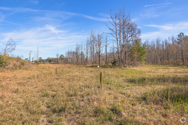
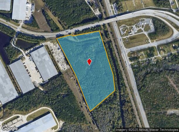
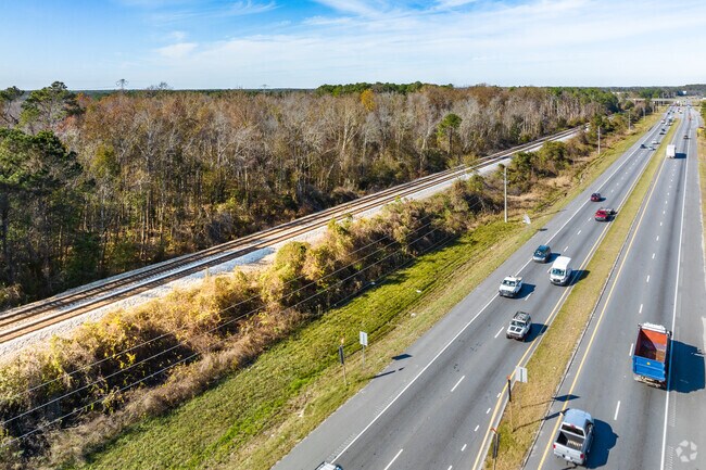
215 Jimmy Deloach Pkwy
Savannah, GA
American Po Rts Services Sub
2098101015
LOT 2A SUB OF LOT 2 AMERICAN PO RTS SERVICES SUB PRB 29P 33 PR
Vacantlandnec
Chatham
AE
Georgia
45053C0475D
2,2a
2024
30.11 AC
2025
N Savannah/Garden City
010701
Savannah
DEMOGRAPHICS near 215 Jimmy Deloach Pkwy
1 Mile
3 Mile
5 Mile
2024 Total Population
1,084
11,151
42,147
2029 Population
1,111
11,791
44,414
Pop Growth 2024-2029
+ 2.49%
+ 5.74%
+ 5.38%
Average Age
43
36
36
2024 Total Households
90
3,663
15,985
HH Growth 2024-2029
+ 3.33%
+ 6.44%
+ 5.57%
Median Household Inc
$54,000
$77,159
$75,843
Avg Household Size
2.40
2.50
2.50
2024 Avg HH Vehicles
2.00
2.00
2.00
Median Home Value
$140,909
$169,609
$208,683
Median Year Built
1990
2007
2006
Nearby Places
Map Layers
Map Styles
 Street
 Aerial
- Restaurants
- Banks
- Shops
- Fitness
- Groceries
PUBLIC TRANSPORTATION
COMMUTER RAIL
Savannah (Palmetto - Amtrak, Silver Meteor - Amtrak, Silver Star - Amtrak)
DRIVE
WALK
Distance
Savannah (Palmetto - Amtrak, Silver Meteor - Amtrak, Silver Star - Amtrak)
18 min
9.3 mi
AIRPORT
Savannah/Hilton Head International
DRIVE
WALK
Distance
Savannah/Hilton Head International
17 min
7.7 mi
Hilton Head
DRIVE
WALK
Distance
Hilton Head
55 min
40.3 mi
Freight Ports
Georgia Ports - Savannah
DRIVE
WALK
Distance
Georgia Ports - Savannah
12 min
5.3 mi
Nearby Properties
Address
Land Use
TOTAL SIZE
Lot Size
Zoning
Address
Land Use
TOTAL SIZE
Lot Size
Zoning
1,008 SF
150 AC
I-H
Address
Land Use
TOTAL SIZE
Lot Size
Zoning
1,400,224 SF
325.62 AC
I-H
Address
Land Use
TOTAL SIZE
Lot Size
Zoning
426,547 SF
15.29 AC
Address
Land Use
TOTAL SIZE
Lot Size
Zoning
432,965 SF
10.09 AC
Address
Land Use
TOTAL SIZE
Lot Size
Zoning
1,275,180 SF
0.02 AC
Address
Land Use
TOTAL SIZE
Lot Size
Zoning
1,164,800 SF
86.22 AC
Address
Land Use
TOTAL SIZE
Lot Size
Zoning
1,115,200 SF
81.30 AC
Address
Land Use
TOTAL SIZE
Lot Size
Zoning
1,099,220 SF
206.18 AC
I-H
Address
Land Use
TOTAL SIZE
Lot Size
Zoning
605,200 SF
59.62 AC
I-H
Address
Land Use
TOTAL SIZE
Lot Size
Zoning
1,003,267 SF
64.07 AC
I-H
Address
Land Use
TOTAL SIZE
Lot Size
Zoning
981,943 SF
69.54 AC
I-H
Address
Land Use
TOTAL SIZE
Lot Size
Zoning
832,000 SF
59.75 AC
I-H
Address
Land Use
TOTAL SIZE
Lot Size
Zoning
588,726 SF
0.30 AC
I-L
Address
Land Use
TOTAL SIZE
Lot Size
Zoning
800,100 SF
44.51 AC
I-H
Address
Land Use
TOTAL SIZE
Lot Size
Zoning
754,000 SF
63.38 AC
I-H
Address
Land Use
TOTAL SIZE
Lot Size
Zoning
750,480 SF
52.93 AC
IH
Address
Land Use
TOTAL SIZE
Lot Size
Zoning
737,500 SF
49.38 AC
I-1
Address
Land Use
TOTAL SIZE
Lot Size
Zoning
70,000 SF
71.90 AC
IH
Address
Land Use
TOTAL SIZE
Lot Size
Zoning
752,000 SF
51.18 AC
Address
Land Use
TOTAL SIZE
Lot Size
Zoning
70.39 AC
Address
Land Use
TOTAL SIZE
Lot Size
Zoning
24,648 SF
23.38 AC
Address
Land Use
TOTAL SIZE
Lot Size
Zoning
27,420 SF
34.55 AC
R1
Address
Land Use
TOTAL SIZE
Lot Size
Zoning
631,800 SF
38.47 AC
Address
Land Use
TOTAL SIZE
Lot Size
Zoning
2,000 SF
24.74 AC
PUDCC
Address
Land Use
TOTAL SIZE
Lot Size
Zoning
9,505 SF
0.07 AC
Address
Land Use
TOTAL SIZE
Lot Size
Zoning
285,905 SF
20.16 AC
I-L
Address
Land Use
TOTAL SIZE
Lot Size
Zoning
20,210 SF
85.60 AC
I-H
Address
Land Use
TOTAL SIZE
Lot Size
Zoning
2,156 SF
36.64 AC
PIL
Address
Land Use
TOTAL SIZE
Lot Size
Zoning
10,600 SF
21.93 AC
PUD
Address
Land Use
TOTAL SIZE
Lot Size
Zoning
515,800 SF
36.16 AC
The World's #1 Commercial Real Estate Marketplace
Connect with us
© 2025 CoStar Group
The information above has been obtained from sources believed reliable. While we do not doubt its accuracy we have not verified it and make no guarantee, warranty or representation about it. It is your responsibility to independently confirm its accuracy and completeness. Any projections, opinions, assumptions, or estimates used are for example only and do not represent the current or future performance of the property. The value of this transaction to you depends on tax and other factors which should be evaluated by your tax, financial, and legal advisors. You and your advisors should conduct a careful, independent investigation of the property to determine to your satisfaction the suitability of the property for your needs.