Property Record
215 Knechtel Way Ne, Bainbridge Island, WA 98110
NEARBY LISTINGS FOR SALE OR LEASE
-
-
View all Bainbridge Island listings for sale on LoopNet.com
Property Detail
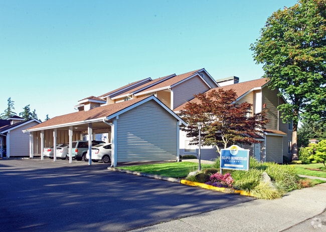
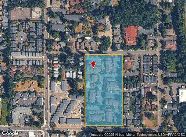
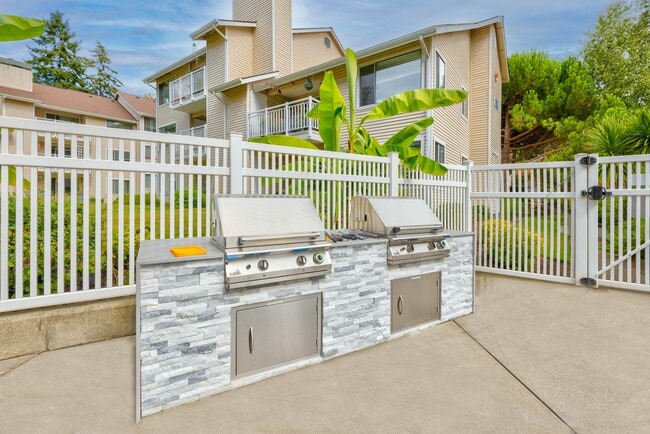
215 Knechtel Way Ne
262502-2-039-2006
PARCEL 1: THAT PORTION OF THE SOUTHWEST QUARTER OF THE NORTHWEST QUARTER OF SECTION 26, TOWNSHIP 25 NORTH, RANGE 2 EAST, W.M., DESCRIBED AS FOLLOWS: BEGINNING AT THE SOUTHWEST CORNER OF SAID SUBDIVISION; THENCE EAST ALONG THE SOUTH LINE OF SAID SUBDI
Multifamilydwelling
Kitsap
X
Washington
53035C0244F
4.62 AC
2025
Winslow
2026
Bremerton/Silverdale
090901
Bremerton-Silverdale, WA
77,910 SF
DEMOGRAPHICS near 215 Knechtel Way Ne
1 Mile
3 Mile
5 Mile
2024 Total Population
7,880
17,741
36,213
2029 Population
8,043
17,983
36,417
Pop Growth 2024-2029
+ 2.07%
+ 1.36%
+ 0.56%
Average Age
49
48
46
2024 Total Households
3,657
7,420
14,345
HH Growth 2024-2029
+ 1.91%
+ 1.36%
+ 0.62%
Median Household Inc
$128,590
$152,877
$132,744
Avg Household Size
2.10
2.30
2.50
2024 Avg HH Vehicles
2.00
2.00
2.00
Median Home Value
$832,866
$931,323
$796,599
Median Year Built
1994
1989
1985
Nearby Places
- Restaurants
- Banks
- Shops
- Fitness
- Groceries
PUBLIC TRANSPORTATION
AIRPORT
Seattle Paine Field International
DRIVE
WALK
Distance
Seattle Paine Field International
79 min
32.9 mi
Freight Ports
Port of Seattle
DRIVE
WALK
Distance
Port of Seattle
91 min
43.2 mi
Nearby Properties
Address
Land Use
TOTAL SIZE
Lot Size
Zoning
Address
Land Use
TOTAL SIZE
Lot Size
Zoning
302,902 SF
0.33 AC
NC3-200 (M
Address
Land Use
TOTAL SIZE
Lot Size
Zoning
124,473 SF
1.40 AC
R-4.3
Address
Land Use
TOTAL SIZE
Lot Size
Zoning
3,872 SF
252.21 AC
R-0.4
Address
Land Use
TOTAL SIZE
Lot Size
Zoning
7.01 AC
CITY
Address
Land Use
TOTAL SIZE
Lot Size
Zoning
74,440 SF
4.36 AC
B/I
Address
Land Use
TOTAL SIZE
Lot Size
Zoning
73,500 SF
4.84 AC
R-2
Address
Land Use
TOTAL SIZE
Lot Size
Zoning
14,536 SF
1.75 AC
MAD
Address
Land Use
TOTAL SIZE
Lot Size
Zoning
29,720 SF
2.75 AC
HS-2
Address
Land Use
TOTAL SIZE
Lot Size
Zoning
52,942 SF
2.07 AC
CORE
Address
Land Use
TOTAL SIZE
Lot Size
Zoning
40,863 SF
3.95 AC
ERICK
Address
Land Use
TOTAL SIZE
Lot Size
Zoning
1,422 SF
1.69 AC
NC
Address
Land Use
TOTAL SIZE
Lot Size
Zoning
26,768 SF
0.46 AC
HS-1
Address
Land Use
TOTAL SIZE
Lot Size
Zoning
43,324 SF
1.54 AC
R-8
Address
Land Use
TOTAL SIZE
Lot Size
Zoning
924 SF
2.36 AC
B/I
Address
Land Use
TOTAL SIZE
Lot Size
Zoning
50,016 SF
1.14 AC
CORE
Address
Land Use
TOTAL SIZE
Lot Size
Zoning
19,826 SF
5.59 AC
R-5
Address
Land Use
TOTAL SIZE
Lot Size
Zoning
46,266 SF
2.22 AC
R-8
Address
Land Use
TOTAL SIZE
Lot Size
Zoning
32,374 SF
4.31 AC
MAD
Address
Land Use
TOTAL SIZE
Lot Size
Zoning
38,262 SF
1.01 AC
MAD
Address
Land Use
TOTAL SIZE
Lot Size
Zoning
38,032 SF
0.90 AC
R-8
Address
Land Use
TOTAL SIZE
Lot Size
Zoning
19,984 SF
7.35 AC
HS-1
Address
Land Use
TOTAL SIZE
Lot Size
Zoning
31,936 SF
2.35 AC
MAD
Address
Land Use
TOTAL SIZE
Lot Size
Zoning
25,695 SF
2.02 AC
B/I
Address
Land Use
TOTAL SIZE
Lot Size
Zoning
460 SF
3.24 AC
R-4.3
Address
Land Use
TOTAL SIZE
Lot Size
Zoning
12,475 SF
0.95 AC
CORE
Address
Land Use
TOTAL SIZE
Lot Size
Zoning
46,699 SF
7.35 AC
HS-1
Address
Land Use
TOTAL SIZE
Lot Size
Zoning
2.10 AC
CITY
Address
Land Use
TOTAL SIZE
Lot Size
Zoning
25,370 SF
0.83 AC
NC
Address
Land Use
TOTAL SIZE
Lot Size
Zoning
17,960 SF
0.51 AC
B/I
The World's #1 Commercial Real Estate Marketplace
Connect with us
© 2025 CoStar Group
The information above has been obtained from sources believed reliable. While we do not doubt its accuracy we have not verified it and make no guarantee, warranty or representation about it. It is your responsibility to independently confirm its accuracy and completeness. Any projections, opinions, assumptions, or estimates used are for example only and do not represent the current or future performance of the property. The value of this transaction to you depends on tax and other factors which should be evaluated by your tax, financial, and legal advisors. You and your advisors should conduct a careful, independent investigation of the property to determine to your satisfaction the suitability of the property for your needs.