No Photo
Property Record
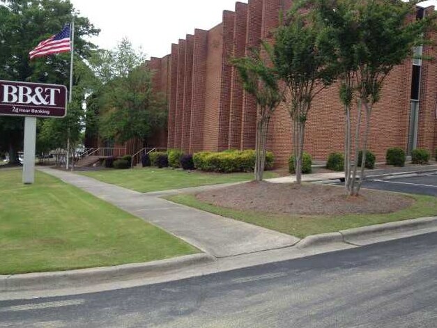
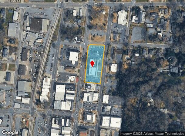
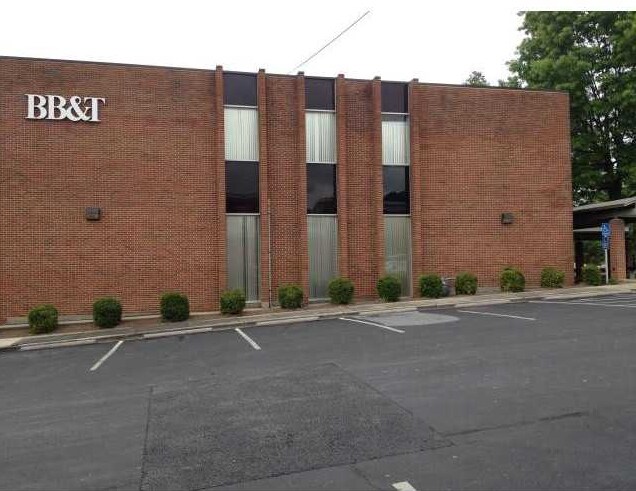
215 N Wall St, Calhoun, GA 30701

NEARBY LISTINGS FOR SALE OR LEASE
Property Detail
215 N Wall St
C24-185
143 205 PCL 30 MAIN BRANCH
Governmentalpublicusegeneral
Gordon
X
Georgia
13213C0275D
1.76 AC
0
Georgia Northwest
2024
Other Market Areas
970400
Calhoun, GA
18,336 SF
DEMOGRAPHICS near 215 N Wall St
1 Mile
3 Mile
5 Mile
2024 Total Population
4,930
25,147
34,210
2029 Population
5,321
26,957
36,640
Pop Growth 2024-2029
+ 7.93%
+ 7.20%
+ 7.10%
Average Age
37
38
39
2024 Total Households
1,885
9,367
12,628
HH Growth 2024-2029
+ 7.80%
+ 6.99%
+ 6.90%
Median Household Inc
$47,321
$42,757
$47,514
Avg Household Size
2.50
2.60
2.60
2024 Avg HH Vehicles
2.00
2.00
2.00
Median Home Value
$219,140
$174,057
$179,843
Median Year Built
1978
1985
1986
Nearby Places
Map Layers
Map Styles
 Street
 Aerial
- Restaurants
- Banks
- Shops
- Fitness
- Groceries
Nearby Properties
Address
Land Use
TOTAL SIZE
Lot Size
Zoning
Address
Land Use
TOTAL SIZE
Lot Size
Zoning
5,040 SF
13.39 AC
C-2
Address
Land Use
TOTAL SIZE
Lot Size
Zoning
215,296 SF
19.94 AC
R-2
Address
Land Use
TOTAL SIZE
Lot Size
Zoning
209,387 SF
42.22 AC
R-1
Address
Land Use
TOTAL SIZE
Lot Size
Zoning
18,640 SF
75.10 AC
C-2
Address
Land Use
TOTAL SIZE
Lot Size
Zoning
192,578 SF
25.47 AC
C-N
Address
Land Use
TOTAL SIZE
Lot Size
Zoning
197,500 SF
14.55 AC
IND-G
Address
Land Use
TOTAL SIZE
Lot Size
Zoning
85,560 SF
3 AC
C-2
Address
Land Use
TOTAL SIZE
Lot Size
Zoning
4,318 SF
19.26 AC
IND-G
Address
Land Use
TOTAL SIZE
Lot Size
Zoning
26,922 SF
19.71 AC
C-4
Address
Land Use
TOTAL SIZE
Lot Size
Zoning
554,897 SF
42.41 AC
IND-G
Address
Land Use
TOTAL SIZE
Lot Size
Zoning
88,000 SF
8.87 AC
IND-G
Address
Land Use
TOTAL SIZE
Lot Size
Zoning
806,290 SF
74.96 AC
IND-G
Address
Land Use
TOTAL SIZE
Lot Size
Zoning
28,481 SF
24.41 AC
R-1B
Address
Land Use
TOTAL SIZE
Lot Size
Zoning
6,956 SF
7 AC
R-2
Address
Land Use
TOTAL SIZE
Lot Size
Zoning
96,533 SF
3.53 AC
R-2
Address
Land Use
TOTAL SIZE
Lot Size
Zoning
4,357 SF
34.97 AC
R-2
Address
Land Use
TOTAL SIZE
Lot Size
Zoning
63,612 SF
8.67 AC
I1
Address
Land Use
TOTAL SIZE
Lot Size
Zoning
73,792 SF
5.38 AC
C-2
Address
Land Use
TOTAL SIZE
Lot Size
Zoning
17,685 SF
25.67 AC
C-2
Address
Land Use
TOTAL SIZE
Lot Size
Zoning
51.30 AC
IND-G
Address
Land Use
TOTAL SIZE
Lot Size
Zoning
16,274 SF
12.25 AC
CU
Address
Land Use
TOTAL SIZE
Lot Size
Zoning
32,360 SF
7.40 AC
IND-G
Address
Land Use
TOTAL SIZE
Lot Size
Zoning
214,593 SF
11.21 AC
IND-G
Address
Land Use
TOTAL SIZE
Lot Size
Zoning
20,072 SF
66.16 AC
A-1
Address
Land Use
TOTAL SIZE
Lot Size
Zoning
11,192 SF
14.97 AC
IND-G
Address
Land Use
TOTAL SIZE
Lot Size
Zoning
57,244 SF
10.60 AC
C-2
Address
Land Use
TOTAL SIZE
Lot Size
Zoning
41,333 SF
2.50 AC
C-2
Address
Land Use
TOTAL SIZE
Lot Size
Zoning
188,378 SF
68.91 AC
IND-G
Address
Land Use
TOTAL SIZE
Lot Size
Zoning
213,100 SF
10.96 AC
IND-G
Address
Land Use
TOTAL SIZE
Lot Size
Zoning
181,728 SF
9.13 AC
IND-G
The World's #1 Commercial Real Estate Marketplace
Connect with us
© 2025 CoStar Group
The information above has been obtained from sources believed reliable. While we do not doubt its accuracy we have not verified it and make no guarantee, warranty or representation about it. It is your responsibility to independently confirm its accuracy and completeness. Any projections, opinions, assumptions, or estimates used are for example only and do not represent the current or future performance of the property. The value of this transaction to you depends on tax and other factors which should be evaluated by your tax, financial, and legal advisors. You and your advisors should conduct a careful, independent investigation of the property to determine to your satisfaction the suitability of the property for your needs.