Property Record
215 Paca St, Cumberland, MD 21502


Property Detail
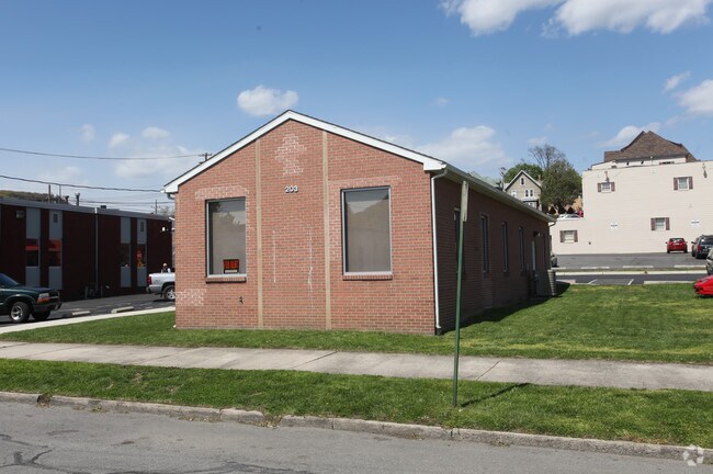
215 Paca St
06-009972
26504 SF IRREG 215 PACA ST
Financialbuilding
Allegany
B-L
Maryland
2025
0.61 AC
2025
Maryland West/Hagerstown
001100
Other Market Areas
3,523 SF
Cumberland, MD-WV
NEARBY LISTINGS FOR SALE OR LEASE
DEMOGRAPHICS near 215 Paca St
1 mile
3 mile
5 mile
2025 Total Population
11,380
29,966
39,511
2030 Population
11,464
29,877
39,190
Pop Growth 2025-2030
+ 0.74%
(0.30%)
(0.81%)
Average Age
42
43
44
2025 Total Households
5,254
12,398
15,556
HH Growth 2025-2030
+ 0.70%
(0.34%)
(0.91%)
Median Household Inc
$44,599
$51,659
$53,939
Avg Household Size
2.10
2.20
2.20
2025 Avg HH Vehicles
1.00
2.00
2.00
Median Home Value
$98,238
$140,394
$147,168
Median Year Built
1948
1951
1954
Nearby Places
Map Layers
Map Styles
 Street
 Aerial
Layers
 Traffic
 Biking
Places
Listings with unknown addresses are not visible on the map
- Restaurants
- Banks
- Shops
- Fitness
- Groceries
PUBLIC TRANSPORTATION
COMMUTER RAIL
Cumberland Amtrak Station (Capitol Limited - Amtrak)
Drive
Walk
Distance
Cumberland Amtrak Station (Capitol Limited - Amtrak)
3 min
16 min
0.8 mi
Freight Ports
Port of Baltimore
Drive
Walk
Distance
Port of Baltimore
159 min
139.3 mi
Nearby Properties
Address
Land Use
TOTAL SIZE
Lot Size
Zoning
Address
Land Use
TOTAL SIZE
Lot Size
Zoning
11,700 SF
35.95 AC
G
Address
Land Use
TOTAL SIZE
Lot Size
Zoning
40,845 SF
26.24 AC
R-O
Address
Land Use
TOTAL SIZE
Lot Size
Zoning
45,960 SF
308.49 AC
G
Address
Land Use
TOTAL SIZE
Lot Size
Zoning
120,680 SF
0.64 AC
Address
Land Use
TOTAL SIZE
Lot Size
Zoning
708 SF
52.22 AC
Address
Land Use
TOTAL SIZE
Lot Size
Zoning
184,242 SF
18.50 AC
R-L
Address
Land Use
TOTAL SIZE
Lot Size
Zoning
64,000 SF
4.57 AC
Address
Land Use
TOTAL SIZE
Lot Size
Zoning
56,963 SF
3.17 AC
Address
Land Use
TOTAL SIZE
Lot Size
Zoning
46,785 SF
6.60 AC
Address
Land Use
TOTAL SIZE
Lot Size
Zoning
151,773 SF
4.48 AC
Address
Land Use
TOTAL SIZE
Lot Size
Zoning
67,844 SF
11.25 AC
Address
Land Use
TOTAL SIZE
Lot Size
Zoning
11,400 SF
47.37 AC
Address
Land Use
TOTAL SIZE
Lot Size
Zoning
38,489 SF
1.46 AC
B-CBD
Address
Land Use
TOTAL SIZE
Lot Size
Zoning
7,452 SF
5.46 AC
Address
Land Use
TOTAL SIZE
Lot Size
Zoning
49,355 SF
7.66 AC
Address
Land Use
TOTAL SIZE
Lot Size
Zoning
48,041 SF
3.62 AC
Address
Land Use
TOTAL SIZE
Lot Size
Zoning
20,000 SF
8.69 AC
Address
Land Use
TOTAL SIZE
Lot Size
Zoning
63,412 SF
5.45 AC
R-PUD
Address
Land Use
TOTAL SIZE
Lot Size
Zoning
65,676 SF
17.50 AC
B-L
Address
Land Use
TOTAL SIZE
Lot Size
Zoning
61,486 SF
5.94 AC
Address
Land Use
TOTAL SIZE
Lot Size
Zoning
50,040 SF
1.52 AC
B-CBD
Address
Land Use
TOTAL SIZE
Lot Size
Zoning
46,845 SF
38.24 AC
R-R
Address
Land Use
TOTAL SIZE
Lot Size
Zoning
56,988 SF
0.34 AC
Address
Land Use
TOTAL SIZE
Lot Size
Zoning
13,014 SF
83.55 AC
R
Address
Land Use
TOTAL SIZE
Lot Size
Zoning
79,296 SF
2.06 AC
R-L
Address
Land Use
TOTAL SIZE
Lot Size
Zoning
59,849 SF
25 AC
R-PUD
Address
Land Use
TOTAL SIZE
Lot Size
Zoning
109,875 SF
39.52 AC
R-S
Address
Land Use
TOTAL SIZE
Lot Size
Zoning
36,794 SF
3.95 AC
I-C
Address
Land Use
TOTAL SIZE
Lot Size
Zoning
720 SF
30 AC
I-G
Address
Land Use
TOTAL SIZE
Lot Size
Zoning
52,402 SF
5.18 AC
The World's #1 Commercial Real Estate Marketplace
Connect with us
© 2026 CoStar Group
The information above has been obtained from sources believed reliable. While we do not doubt its accuracy we have not verified it and make no guarantee, warranty or representation about it. It is your responsibility to independently confirm its accuracy and completeness. Any projections, opinions, assumptions, or estimates used are for example only and do not represent the current or future performance of the property. The value of this transaction to you depends on tax and other factors which should be evaluated by your tax, financial, and legal advisors. You and your advisors should conduct a careful, independent investigation of the property to determine to your satisfaction the suitability of the property for your needs.