Property Record
215 Saint Marys St, Garner, NC 27529


NEARBY LISTINGS FOR SALE OR LEASE
Property Detail
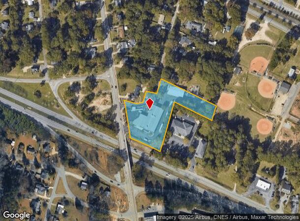
215 Saint Marys St
1711.14-42-9564-000
2 BLD3&4 TR1 UNMITCHI
Commercialnec
Wake
X
North Carolina
3720171100K
2.73 AC
2025
Southeast Wake County
2025
Raleigh/Durham
052815
Raleigh, NC
24,086 SF
DEMOGRAPHICS near 215 Saint Marys St
1 Mile
3 Mile
5 Mile
2024 Total Population
7,737
45,408
125,060
2029 Population
8,397
49,557
136,241
Pop Growth 2024-2029
+ 8.53%
+ 9.14%
+ 8.94%
Average Age
40
39
38
2024 Total Households
3,190
17,505
46,530
HH Growth 2024-2029
+ 8.46%
+ 9.17%
+ 9.11%
Median Household Inc
$60,223
$61,768
$64,143
Avg Household Size
2.30
2.50
2.50
2024 Avg HH Vehicles
2.00
2.00
2.00
Median Home Value
$230,716
$238,322
$251,152
Median Year Built
1986
1991
1995
Nearby Places
Map Layers
Map Styles
 Street
 Aerial
- Restaurants
- Banks
- Shops
- Fitness
- Groceries
PUBLIC TRANSPORTATION
COMMUTER RAIL
Raleigh Union Station (Piedmont - North Carolina by Train (NC Train))
DRIVE
WALK
Distance
Raleigh Union Station (Piedmont - North Carolina by Train (NC Train))
12 min
6.2 mi
AIRPORT
Raleigh-Durham International
DRIVE
WALK
Distance
Raleigh-Durham International
30 min
19.2 mi
Freight Ports
Port of Wilmington
DRIVE
WALK
Distance
Port of Wilmington
145 min
126.7 mi
Nearby Properties
Address
Land Use
TOTAL SIZE
Lot Size
Zoning
Address
Land Use
TOTAL SIZE
Lot Size
Zoning
2,583,746 SF
87.16 AC
HI
Address
Land Use
TOTAL SIZE
Lot Size
Zoning
573,338 SF
19.34 AC
IH
Address
Land Use
TOTAL SIZE
Lot Size
Zoning
435,270 SF
57.90 AC
CMX
Address
Land Use
TOTAL SIZE
Lot Size
Zoning
390,672 SF
30.23 AC
CMX
Address
Land Use
TOTAL SIZE
Lot Size
Zoning
288,761 SF
19.61 AC
MF-B
Address
Land Use
TOTAL SIZE
Lot Size
Zoning
235,588 SF
128.17 AC
OX-3
Address
Land Use
TOTAL SIZE
Lot Size
Zoning
370,651 SF
24.83 AC
IX-3
Address
Land Use
TOTAL SIZE
Lot Size
Zoning
276,494 SF
58.90 AC
R-6
Address
Land Use
TOTAL SIZE
Lot Size
Zoning
275,019 SF
17.04 AC
MF-A
Address
Land Use
TOTAL SIZE
Lot Size
Zoning
298,563 SF
24.19 AC
CMX
Address
Land Use
TOTAL SIZE
Lot Size
Zoning
279,123 SF
22.91 AC
CMX
Address
Land Use
TOTAL SIZE
Lot Size
Zoning
304,813 SF
19.08 AC
MF-A
Address
Land Use
TOTAL SIZE
Lot Size
Zoning
203,766 SF
14.18 AC
MF-A
Address
Land Use
TOTAL SIZE
Lot Size
Zoning
420,962 SF
44 AC
IH
Address
Land Use
TOTAL SIZE
Lot Size
Zoning
220,352 SF
16.82 AC
MF-A
Address
Land Use
TOTAL SIZE
Lot Size
Zoning
340,994 SF
27.24 AC
MF-B
Address
Land Use
TOTAL SIZE
Lot Size
Zoning
260,355 SF
18.48 AC
MF-A
Address
Land Use
TOTAL SIZE
Lot Size
Zoning
275,215 SF
18.17 AC
HI
Address
Land Use
TOTAL SIZE
Lot Size
Zoning
227,910 SF
20.77 AC
MF-A
Address
Land Use
TOTAL SIZE
Lot Size
Zoning
259,480 SF
17.19 AC
HI
Address
Land Use
TOTAL SIZE
Lot Size
Zoning
74,356 SF
6.02 AC
IH
Address
Land Use
TOTAL SIZE
Lot Size
Zoning
2,527 SF
173.31 AC
CMX
Address
Land Use
TOTAL SIZE
Lot Size
Zoning
105,512 SF
19.47 AC
R-6
Address
Land Use
TOTAL SIZE
Lot Size
Zoning
110,680 SF
107.82 AC
IH
Address
Land Use
TOTAL SIZE
Lot Size
Zoning
156,078 SF
67.93 AC
HI
Address
Land Use
TOTAL SIZE
Lot Size
Zoning
166,859 SF
17.79 AC
R4
Address
Land Use
TOTAL SIZE
Lot Size
Zoning
101,311 SF
16.88 AC
NMX
Address
Land Use
TOTAL SIZE
Lot Size
Zoning
98.77 AC
OX-3
Address
Land Use
TOTAL SIZE
Lot Size
Zoning
185,150 SF
27.46 AC
R-6
Address
Land Use
TOTAL SIZE
Lot Size
Zoning
99,963 SF
26.84 AC
R2
The World's #1 Commercial Real Estate Marketplace
Connect with us
© 2025 CoStar Group
The information above has been obtained from sources believed reliable. While we do not doubt its accuracy we have not verified it and make no guarantee, warranty or representation about it. It is your responsibility to independently confirm its accuracy and completeness. Any projections, opinions, assumptions, or estimates used are for example only and do not represent the current or future performance of the property. The value of this transaction to you depends on tax and other factors which should be evaluated by your tax, financial, and legal advisors. You and your advisors should conduct a careful, independent investigation of the property to determine to your satisfaction the suitability of the property for your needs.