Property Record
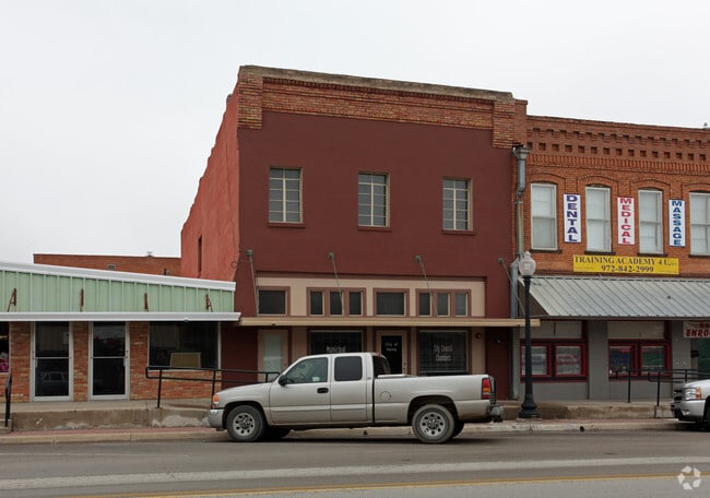
215 W 6Th St, Ferris, TX 75125
This Property Is For Sale
NEARBY LISTINGS FOR SALE OR LEASE
-
-
View all Ferris listings for sale on LoopNet.com
Property Detail
215 W 6Th St
Dallas-Fort Worth-Arlington, TX
O T Ferris-Rev
193426
LOT 17 BLK 6 O T FERRIS-REV 0.066 AC
Commercialnec
Ellis
X
Texas
48113C0670K
17
2024
0.07 AC
2025
Ellis County
060104
Dallas/Ft Worth
4,550 SF
DEMOGRAPHICS near 215 W 6Th St
1 Mile
3 Mile
5 Mile
2024 Total Population
3,589
6,700
18,827
2029 Population
4,544
8,467
22,290
Pop Growth 2024-2029
+ 26.61%
+ 26.37%
+ 18.39%
Average Age
37
37
36
2024 Total Households
1,182
2,188
5,950
HH Growth 2024-2029
+ 26.82%
+ 26.69%
+ 18.99%
Median Household Inc
$60,897
$65,327
$61,431
Avg Household Size
3.00
3.10
3.10
2024 Avg HH Vehicles
2.00
2.00
2.00
Median Home Value
$130,545
$173,908
$179,462
Median Year Built
1979
1991
1994
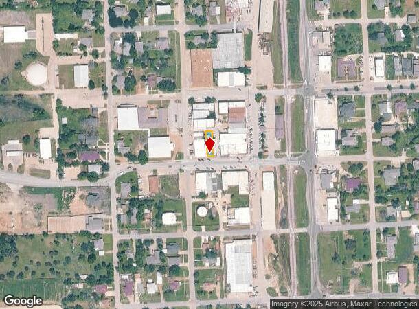
Nearby Places
Map Layers
Map Styles
 Street
 Aerial
- Restaurants
- Banks
- Shops
- Fitness
- Groceries
PUBLIC TRANSPORTATION
AIRPORT
Dallas Love Field
DRIVE
WALK
Distance
Dallas Love Field
38 min
26.5 mi
Dallas-Fort Worth International
DRIVE
WALK
Distance
Dallas-Fort Worth International
52 min
41.0 mi
Nearby Properties
Address
Land Use
TOTAL SIZE
Lot Size
Zoning
Address
Land Use
TOTAL SIZE
Lot Size
Zoning
62.41 AC
Z31
Address
Land Use
TOTAL SIZE
Lot Size
Zoning
36.33 AC
Z31
Address
Land Use
TOTAL SIZE
Lot Size
Zoning
1,021,601 SF
79.42 AC
Z268
Address
Land Use
TOTAL SIZE
Lot Size
Zoning
392,066 SF
23.52 AC
Address
Land Use
TOTAL SIZE
Lot Size
Zoning
266,199 SF
33.27 AC
Address
Land Use
TOTAL SIZE
Lot Size
Zoning
174,802 SF
8.67 AC
Address
Land Use
TOTAL SIZE
Lot Size
Zoning
143,771 SF
130.33 AC
Z123
Address
Land Use
TOTAL SIZE
Lot Size
Zoning
174,802 SF
8.67 AC
Z05
Address
Land Use
TOTAL SIZE
Lot Size
Zoning
89,387 SF
29.86 AC
Address
Land Use
TOTAL SIZE
Lot Size
Zoning
97,372 SF
42.82 AC
Z31
Address
Land Use
TOTAL SIZE
Lot Size
Zoning
12,444 SF
5 AC
Address
Land Use
TOTAL SIZE
Lot Size
Zoning
84.71 AC
Z268
Address
Land Use
TOTAL SIZE
Lot Size
Zoning
116,081 SF
19.03 AC
Address
Land Use
TOTAL SIZE
Lot Size
Zoning
1,400 SF
75.81 AC
Z05
Address
Land Use
TOTAL SIZE
Lot Size
Zoning
56,023 SF
7.52 AC
Address
Land Use
TOTAL SIZE
Lot Size
Zoning
13,000 SF
4.99 AC
Address
Land Use
TOTAL SIZE
Lot Size
Zoning
70,799 SF
15.41 AC
Address
Land Use
TOTAL SIZE
Lot Size
Zoning
25,780 SF
100.30 AC
Z05
Address
Land Use
TOTAL SIZE
Lot Size
Zoning
26.47 AC
Z05
Address
Land Use
TOTAL SIZE
Lot Size
Zoning
42,384 SF
5.91 AC
Address
Land Use
TOTAL SIZE
Lot Size
Zoning
22,736 SF
9.03 AC
Address
Land Use
TOTAL SIZE
Lot Size
Zoning
49,320 SF
25.10 AC
Address
Land Use
TOTAL SIZE
Lot Size
Zoning
15,000 SF
133.63 AC
Address
Land Use
TOTAL SIZE
Lot Size
Zoning
12,711 SF
268.57 AC
Address
Land Use
TOTAL SIZE
Lot Size
Zoning
35.11 AC
Z05
Address
Land Use
TOTAL SIZE
Lot Size
Zoning
45.44 AC
Z05
Address
Land Use
TOTAL SIZE
Lot Size
Zoning
4,820.86 AC
Address
Land Use
TOTAL SIZE
Lot Size
Zoning
26,779 SF
11.29 AC
Address
Land Use
TOTAL SIZE
Lot Size
Zoning
17,175 SF
30.59 AC
Address
Land Use
TOTAL SIZE
Lot Size
Zoning
7,884 SF
1.15 AC
The World's #1 Commercial Real Estate Marketplace
Connect with us
© 2026 CoStar Group
The information above has been obtained from sources believed reliable. While we do not doubt its accuracy we have not verified it and make no guarantee, warranty or representation about it. It is your responsibility to independently confirm its accuracy and completeness. Any projections, opinions, assumptions, or estimates used are for example only and do not represent the current or future performance of the property. The value of this transaction to you depends on tax and other factors which should be evaluated by your tax, financial, and legal advisors. You and your advisors should conduct a careful, independent investigation of the property to determine to your satisfaction the suitability of the property for your needs.