Property Record
2150 E Army Post Rd, Des Moines, IA 50320
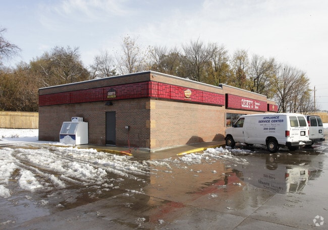


Property Detail
2150 E Army Post Rd
Des Moines-West Des Moines, IA
-EX E 12F- & -EX BEG SE COR THN W 449.11F N 46.8F E 400.2F NE 45.82F E 12F S 72.3F TO POB & BEG NE COR LOT 87 THN S 200.06F W12F N 199.99F E 12F TO POB- & -EX COM SE COR SEC 26-78-24 THN N ALNG E LN SE 1/4 SEC 26 105.84F THN W 45F TO WLY ROW E INDIAN
120-03367286007
Polk
Storebuilding
Iowa
B and X Area of moderate flood hazard, usually the area between the limits of the 100-year and 500-year floods.
86
2024
2.21 AC
2025
South
010805
Des Moines
3,485 SF
NEARBY LISTINGS FOR SALE OR LEASE
DEMOGRAPHICS near 2150 E Army Post Rd
1 mile
3 mile
5 mile
2025 Total Population
5,394
48,432
91,490
2030 Population
5,565
50,185
95,507
Pop Growth 2025-2030
+ 3.17%
+ 3.62%
+ 4.39%
Average Age
37
37
38
2025 Total Households
1,964
18,196
38,260
HH Growth 2025-2030
+ 3.36%
+ 3.81%
+ 4.84%
Median Household Inc
$83,317
$65,830
$63,488
Avg Household Size
2.70
2.60
2.30
2025 Avg HH Vehicles
2.00
2.00
2.00
Median Home Value
$244,857
$185,662
$188,261
Median Year Built
1999
1976
1974
Nearby Places
Map Layers
Map Styles
 Street
 Aerial
Layers
 Traffic
 Biking
Places
Listings with unknown addresses are not visible on the map
- Restaurants
- Banks
- Shops
- Fitness
- Groceries
PUBLIC TRANSPORTATION
AIRPORT
Des Moines International
Drive
Walk
Distance
Des Moines International
11 min
5.1 mi
Nearby Properties
Address
Land Use
TOTAL SIZE
Lot Size
Zoning
Address
Land Use
TOTAL SIZE
Lot Size
Zoning
208,456 SF
14.42 AC
PUD
Address
Land Use
TOTAL SIZE
Lot Size
Zoning
231,168 SF
22.29 AC
PUD
Address
Land Use
TOTAL SIZE
Lot Size
Zoning
178,415 SF
13.35 AC
R-6
Address
Land Use
TOTAL SIZE
Lot Size
Zoning
38.16 AC
PUD
Address
Land Use
TOTAL SIZE
Lot Size
Zoning
160,680 SF
20.08 AC
C-2
Address
Land Use
TOTAL SIZE
Lot Size
Zoning
684,064 SF
2 AC
C-3
Address
Land Use
TOTAL SIZE
Lot Size
Zoning
155,640 SF
9.15 AC
R-6
Address
Land Use
TOTAL SIZE
Lot Size
Zoning
138,490 SF
10.01 AC
R-6
Address
Land Use
TOTAL SIZE
Lot Size
Zoning
51,965 SF
3.83 AC
C-4
Address
Land Use
TOTAL SIZE
Lot Size
Zoning
169,201 SF
13.66 AC
C-4
Address
Land Use
TOTAL SIZE
Lot Size
Zoning
147,173 SF
20.84 AC
PUD
Address
Land Use
TOTAL SIZE
Lot Size
Zoning
58,366 SF
11.58 AC
Address
Land Use
TOTAL SIZE
Lot Size
Zoning
301,434 SF
29.03 AC
C4
Address
Land Use
TOTAL SIZE
Lot Size
Zoning
121,200 SF
10.32 AC
C-2
Address
Land Use
TOTAL SIZE
Lot Size
Zoning
310,851 SF
18.05 AC
C-4
Address
Land Use
TOTAL SIZE
Lot Size
Zoning
92,232 SF
6.01 AC
R-3
Address
Land Use
TOTAL SIZE
Lot Size
Zoning
110,260 SF
9.56 AC
PUD
Address
Land Use
TOTAL SIZE
Lot Size
Zoning
147,400 SF
15.05 AC
C-2
Address
Land Use
TOTAL SIZE
Lot Size
Zoning
50,969 SF
4.64 AC
R-2
Address
Land Use
TOTAL SIZE
Lot Size
Zoning
102,532 SF
10.71 AC
C-2
Address
Land Use
TOTAL SIZE
Lot Size
Zoning
64,004 SF
5.22 AC
C-4
Address
Land Use
TOTAL SIZE
Lot Size
Zoning
82,290 SF
6.88 AC
PUD
Address
Land Use
TOTAL SIZE
Lot Size
Zoning
125,300 SF
9.75 AC
C-2
Address
Land Use
TOTAL SIZE
Lot Size
Zoning
67,104 SF
4.04 AC
R-6
Address
Land Use
TOTAL SIZE
Lot Size
Zoning
86,400 SF
4.49 AC
R-3
Address
Land Use
TOTAL SIZE
Lot Size
Zoning
25,764 SF
4.73 AC
C-2
Address
Land Use
TOTAL SIZE
Lot Size
Zoning
67,096 SF
2.34 AC
R-4
Address
Land Use
TOTAL SIZE
Lot Size
Zoning
112,146 SF
15.67 AC
The World's #1 Commercial Real Estate Marketplace
Connect with us
© 2026 CoStar Group
The information above has been obtained from sources believed reliable. While we do not doubt its accuracy we have not verified it and make no guarantee, warranty or representation about it. It is your responsibility to independently confirm its accuracy and completeness. Any projections, opinions, assumptions, or estimates used are for example only and do not represent the current or future performance of the property. The value of this transaction to you depends on tax and other factors which should be evaluated by your tax, financial, and legal advisors. You and your advisors should conduct a careful, independent investigation of the property to determine to your satisfaction the suitability of the property for your needs.