Property Record
2150 S Peachtree Rd, Balch Springs, TX 75180
NEARBY LISTINGS FOR SALE OR LEASE
Property Detail
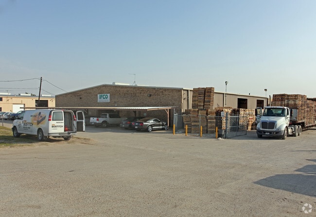
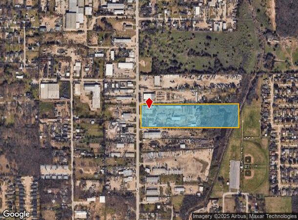
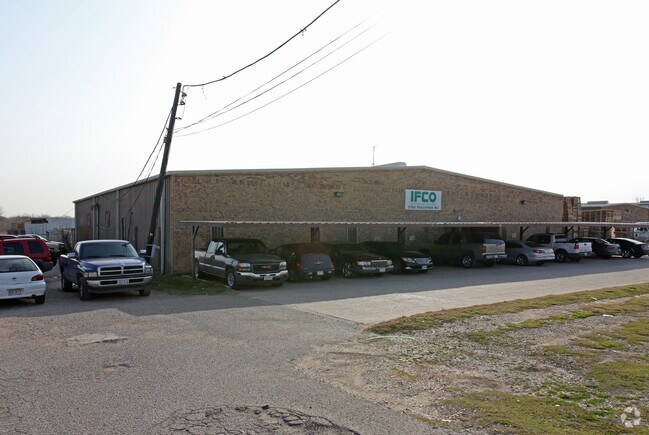
2150 S Peachtree Rd
65093784510070000
Watt Marks
Lightindustrial
WATT MARKS ABST 937 PG 845 TR 7 ACS 9.550 VOL92124/0928 EX061992 CO-DALLAS 0937845100700 31209378451
AE
Dallas
48113C0510K
Texas
2024
9.55 AC
2025
East Dallas/Mesquite
017201
Dallas/Ft Worth
12,500 SF
Dallas-Fort Worth-Arlington, TX
DEMOGRAPHICS near 2150 S Peachtree Rd
1 Mile
3 Mile
5 Mile
2024 Total Population
13,089
118,883
268,470
2029 Population
12,991
117,200
264,963
Pop Growth 2024-2029
(0.75%)
(1.42%)
(1.31%)
Average Age
33
34
34
2024 Total Households
3,651
34,801
79,926
HH Growth 2024-2029
(0.96%)
(1.72%)
(1.59%)
Median Household Inc
$50,595
$49,154
$52,656
Avg Household Size
3.40
3.30
3.20
2024 Avg HH Vehicles
2.00
2.00
2.00
Median Home Value
$142,825
$161,222
$168,516
Median Year Built
1973
1977
1978
Nearby Places
Map Layers
Map Styles
 Street
 Aerial
- Restaurants
- Banks
- Shops
- Fitness
- Groceries
PUBLIC TRANSPORTATION
AIRPORT
Dallas Love Field
DRIVE
WALK
Distance
Dallas Love Field
31 min
17.6 mi
Dallas-Fort Worth International
DRIVE
WALK
Distance
Dallas-Fort Worth International
47 min
33.5 mi
Nearby Properties
Address
Land Use
TOTAL SIZE
Lot Size
Zoning
Address
Land Use
TOTAL SIZE
Lot Size
Zoning
768,482 SF
40.44 AC
Z109
Address
Land Use
TOTAL SIZE
Lot Size
Zoning
199,246 SF
15.32 AC
Z250
Address
Land Use
TOTAL SIZE
Lot Size
Zoning
257,745 SF
31.54 AC
Z298
Address
Land Use
TOTAL SIZE
Lot Size
Zoning
194,385 SF
44.63 AC
Z396
Address
Land Use
TOTAL SIZE
Lot Size
Zoning
144,858 SF
9.69 AC
Z206
Address
Land Use
TOTAL SIZE
Lot Size
Zoning
184,728 SF
21.62 AC
Z298
Address
Land Use
TOTAL SIZE
Lot Size
Zoning
255,008 SF
30.39 AC
Z250
Address
Land Use
TOTAL SIZE
Lot Size
Zoning
290,916 SF
8.24 AC
Address
Land Use
TOTAL SIZE
Lot Size
Zoning
487,200 SF
29.56 AC
Z109
Address
Land Use
TOTAL SIZE
Lot Size
Zoning
902,719 SF
50.31 AC
Z109
Address
Land Use
TOTAL SIZE
Lot Size
Zoning
491,561 SF
27.70 AC
Z109
Address
Land Use
TOTAL SIZE
Lot Size
Zoning
457,076 SF
27.74 AC
Z109
Address
Land Use
TOTAL SIZE
Lot Size
Zoning
214,853 SF
6.60 AC
Z372
Address
Land Use
TOTAL SIZE
Lot Size
Zoning
395,065 SF
24.18 AC
Z206
Address
Land Use
TOTAL SIZE
Lot Size
Zoning
364,000 SF
40.25 AC
Z236
Address
Land Use
TOTAL SIZE
Lot Size
Zoning
389,005 SF
25.25 AC
Z109
Address
Land Use
TOTAL SIZE
Lot Size
Zoning
298,150 SF
20.01 AC
Z14
Address
Land Use
TOTAL SIZE
Lot Size
Zoning
199,372 SF
10.05 AC
Z164
Address
Land Use
TOTAL SIZE
Lot Size
Zoning
291,689 SF
11.21 AC
Z239
Address
Land Use
TOTAL SIZE
Lot Size
Zoning
241,512 SF
12.61 AC
Address
Land Use
TOTAL SIZE
Lot Size
Zoning
80,461 SF
6.48 AC
Z372
Address
Land Use
TOTAL SIZE
Lot Size
Zoning
107,376 SF
38.55 AC
Z372
Address
Land Use
TOTAL SIZE
Lot Size
Zoning
330,158 SF
18 AC
Z109
Address
Land Use
TOTAL SIZE
Lot Size
Zoning
95,000 SF
8.02 AC
Z298
Address
Land Use
TOTAL SIZE
Lot Size
Zoning
173,509 SF
8.79 AC
Z164
Address
Land Use
TOTAL SIZE
Lot Size
Zoning
267,011 SF
11.11 AC
Z250
Address
Land Use
TOTAL SIZE
Lot Size
Zoning
174,200 SF
1 AC
Z372
Address
Land Use
TOTAL SIZE
Lot Size
Zoning
105,516 SF
13.09 AC
Z109
Address
Land Use
TOTAL SIZE
Lot Size
Zoning
110,668 SF
8.05 AC
Z372
Address
Land Use
TOTAL SIZE
Lot Size
Zoning
141,566 SF
23 AC
Z298
The World's #1 Commercial Real Estate Marketplace
Connect with us
© 2025 CoStar Group
The information above has been obtained from sources believed reliable. While we do not doubt its accuracy we have not verified it and make no guarantee, warranty or representation about it. It is your responsibility to independently confirm its accuracy and completeness. Any projections, opinions, assumptions, or estimates used are for example only and do not represent the current or future performance of the property. The value of this transaction to you depends on tax and other factors which should be evaluated by your tax, financial, and legal advisors. You and your advisors should conduct a careful, independent investigation of the property to determine to your satisfaction the suitability of the property for your needs.