Property Record
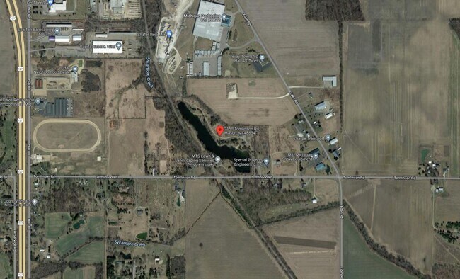
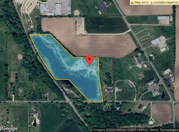
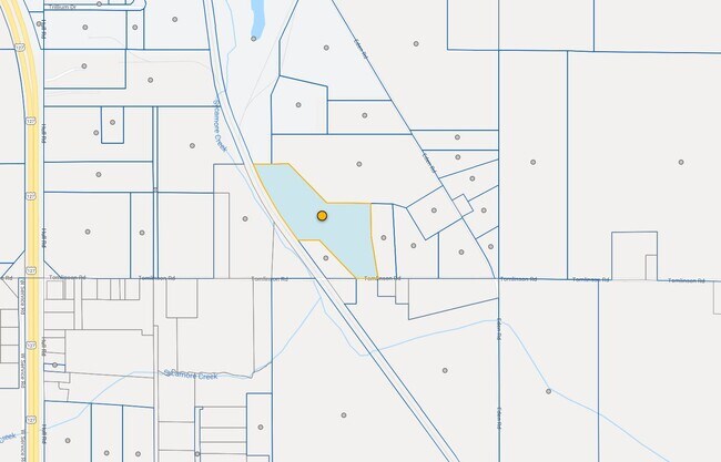
2150 Tomlinson Rd, Mason, MI 48854
NEARBY LISTINGS FOR SALE OR LEASE
Property Detail
2150 Tomlinson Rd
10-10-16-400-010
A PART OF SE 1/4 & SW 1/4 SEC 16 DESC AS COM @ THE SE COR SEC 16 -S89D46'W 1400 FT ON S SEC LN TO POB -CONT S89D46'W ON S SEC LN 604.43 FT -N36D24'56W ON E'LY R/W LN PC RR 741.55 FT -NW'LY ON RR R/W ON CRV RT 837.16 FT HAVING A LONG CHD OF 835.10 FT
Commercialnec
Ingham
A
Michigan
26065C0270D
19.88 AC
2024
Mason/SE Ingham County
2025
West Michigan
006302
Lansing-East Lansing, MI
1,800 SF
DEMOGRAPHICS near 2150 Tomlinson Rd
1 Mile
3 Mile
5 Mile
2024 Total Population
201
10,500
15,052
2029 Population
194
10,304
14,800
Pop Growth 2024-2029
(3.48%)
(1.87%)
(1.67%)
Average Age
40
41
41
2024 Total Households
79
4,299
5,970
HH Growth 2024-2029
(3.80%)
(1.95%)
(1.79%)
Median Household Inc
$71,999
$76,476
$80,894
Avg Household Size
2.60
2.30
2.40
2024 Avg HH Vehicles
2.00
2.00
2.00
Median Home Value
$217,857
$184,326
$193,892
Median Year Built
1982
1976
1976
Nearby Places
Map Layers
Map Styles
 Street
 Aerial
- Restaurants
- Banks
- Shops
- Fitness
- Groceries
PUBLIC TRANSPORTATION
AIRPORT
Capital Region International
DRIVE
WALK
Distance
Capital Region International
32 min
21.0 mi
Freight Ports
Port of Toledo
DRIVE
WALK
Distance
Port of Toledo
134 min
100.5 mi
Nearby Properties
Address
Land Use
TOTAL SIZE
Lot Size
Zoning
Address
Land Use
TOTAL SIZE
Lot Size
Zoning
22,819 SF
63.48 AC
M2
Address
Land Use
TOTAL SIZE
Lot Size
Zoning
32,160 SF
MIXED ZONI
Address
Land Use
TOTAL SIZE
Lot Size
Zoning
16,028 SF
30.69 AC
M2
Address
Land Use
TOTAL SIZE
Lot Size
Zoning
176,921 SF
26.92 AC
C2
Address
Land Use
TOTAL SIZE
Lot Size
Zoning
23,254 SF
1.58 AC
C1
Address
Land Use
TOTAL SIZE
Lot Size
Zoning
145,200 SF
MIXED ZONI
Address
Land Use
TOTAL SIZE
Lot Size
Zoning
5,000 SF
10.74 AC
M1
Address
Land Use
TOTAL SIZE
Lot Size
Zoning
18,468 SF
12.26 AC
RM
Address
Land Use
TOTAL SIZE
Lot Size
Zoning
55.34 AC
MH
Address
Land Use
TOTAL SIZE
Lot Size
Zoning
5,000 SF
16.45 AC
Address
Land Use
TOTAL SIZE
Lot Size
Zoning
11,520 SF
8.69 AC
RM
Address
Land Use
TOTAL SIZE
Lot Size
Zoning
216 SF
6.17 AC
RM
Address
Land Use
TOTAL SIZE
Lot Size
Zoning
18,468 SF
5.50 AC
RM
Address
Land Use
TOTAL SIZE
Lot Size
Zoning
15,704 SF
3.41 AC
RM
Address
Land Use
TOTAL SIZE
Lot Size
Zoning
31.63 AC
MH
Address
Land Use
TOTAL SIZE
Lot Size
Zoning
71,901 SF
14.27 AC
C2
Address
Land Use
TOTAL SIZE
Lot Size
Zoning
11,112 SF
10.96 AC
M2
Address
Land Use
TOTAL SIZE
Lot Size
Zoning
32,556 SF
6.52 AC
C2
Address
Land Use
TOTAL SIZE
Lot Size
Zoning
5,646 SF
85.13 AC
MH1
Address
Land Use
TOTAL SIZE
Lot Size
Zoning
6,745 SF
2.08 AC
C2
Address
Land Use
TOTAL SIZE
Lot Size
Zoning
24,589 SF
2.24 AC
RS1
Address
Land Use
TOTAL SIZE
Lot Size
Zoning
42,954 SF
3.11 AC
C2
Address
Land Use
TOTAL SIZE
Lot Size
Zoning
8,288 SF
2.72 AC
RM
Address
Land Use
TOTAL SIZE
Lot Size
Zoning
22,812 SF
1.80 AC
RM
Address
Land Use
TOTAL SIZE
Lot Size
Zoning
7,062 SF
10.35 AC
M1
Address
Land Use
TOTAL SIZE
Lot Size
Zoning
39,176 SF
4.96 AC
C2
Address
Land Use
TOTAL SIZE
Lot Size
Zoning
9,266 SF
1.22 AC
C2
Address
Land Use
TOTAL SIZE
Lot Size
Zoning
10,800 SF
8 AC
M1
Address
Land Use
TOTAL SIZE
Lot Size
Zoning
14,985 SF
1.42 AC
C2
Address
Land Use
TOTAL SIZE
Lot Size
Zoning
6,986 SF
0.32 AC
C1
The World's #1 Commercial Real Estate Marketplace
Connect with us
© 2025 CoStar Group
The information above has been obtained from sources believed reliable. While we do not doubt its accuracy we have not verified it and make no guarantee, warranty or representation about it. It is your responsibility to independently confirm its accuracy and completeness. Any projections, opinions, assumptions, or estimates used are for example only and do not represent the current or future performance of the property. The value of this transaction to you depends on tax and other factors which should be evaluated by your tax, financial, and legal advisors. You and your advisors should conduct a careful, independent investigation of the property to determine to your satisfaction the suitability of the property for your needs.