Property Record
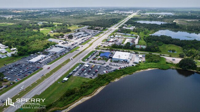
21500 Hwy 27, Lake Wales, FL 33859


NEARBY LISTINGS FOR SALE OR LEASE
Property Detail
21500 Hwy 27
27-29-27-000000-044020
Alameda Heights
Vehiclerentalsvehiclesales
BEG SE COR OF SW1/4 OF SW1/4 RUN E 110.3 FT TO W R/W US HWY 27 NWLY ALONG R/W 1425 FT TO POB RUN N 14 DEG 11 W 184.72 FT TO PT ON CURVE NWLY ALONG CURVE 460.30 FT TO PT ON N LINE OF S1/2 OF NW1/4 OF SW1/4 W TO LAKE SLY ALONG WATERS EDGE TO A POINT S
A
Polk
12105C0565H
Florida
2024
4.35 AC
2025
Polk County
014402
Tampa/St Petersburg
19,259 SF
Lakeland-Winter Haven, FL
DEMOGRAPHICS near 21500 Hwy 27
1 Mile
3 Mile
5 Mile
2024 Total Population
1,882
16,130
40,118
2029 Population
2,278
19,496
48,181
Pop Growth 2024-2029
+ 21.04%
+ 20.87%
+ 20.10%
Average Age
51
41
44
2024 Total Households
909
6,441
16,412
HH Growth 2024-2029
+ 20.90%
+ 20.77%
+ 20.00%
Median Household Inc
$25,577
$44,883
$51,656
Avg Household Size
2.10
2.40
2.40
2024 Avg HH Vehicles
1.00
2.00
2.00
Median Home Value
$84,852
$165,836
$213,807
Median Year Built
1995
1989
1996
Nearby Places
Map Layers
Map Styles
 Street
 Aerial
- Restaurants
- Banks
- Shops
- Fitness
- Groceries
SALE & LEASE HISTORY
LISTING DATE
SALE/LEASE

Oct 16, 2023
For Sale
Oct 09, 2023
For Sale
Nov 02, 2021
For Sale
Jun 19, 2023
For Lease
Aug 09, 2022
For Lease
Nearby Properties
Address
Land Use
TOTAL SIZE
Lot Size
Zoning
Address
Land Use
TOTAL SIZE
Lot Size
Zoning
333,492 SF
20.20 AC
Address
Land Use
TOTAL SIZE
Lot Size
Zoning
1,198,465 SF
111.76 AC
GI
Address
Land Use
TOTAL SIZE
Lot Size
Zoning
473,099 SF
40.47 AC
Address
Land Use
TOTAL SIZE
Lot Size
Zoning
225,246 SF
38.83 AC
Address
Land Use
TOTAL SIZE
Lot Size
Zoning
117,044 SF
14.53 AC
Address
Land Use
TOTAL SIZE
Lot Size
Zoning
200,853 SF
29.27 AC
RC
Address
Land Use
TOTAL SIZE
Lot Size
Zoning
402,037 SF
33.35 AC
GI
Address
Land Use
TOTAL SIZE
Lot Size
Zoning
69,349 SF
5.78 AC
Address
Land Use
TOTAL SIZE
Lot Size
Zoning
210,662 SF
43.12 AC
Address
Land Use
TOTAL SIZE
Lot Size
Zoning
196,737 SF
17.09 AC
Address
Land Use
TOTAL SIZE
Lot Size
Zoning
67,850 SF
2.67 AC
Address
Land Use
TOTAL SIZE
Lot Size
Zoning
73,669 SF
5.41 AC
Address
Land Use
TOTAL SIZE
Lot Size
Zoning
57,600 SF
8.28 AC
C2
Address
Land Use
TOTAL SIZE
Lot Size
Zoning
74,342 SF
5.05 AC
Address
Land Use
TOTAL SIZE
Lot Size
Zoning
138,275 SF
28.03 AC
Address
Land Use
TOTAL SIZE
Lot Size
Zoning
30,758 SF
89.52 AC
Address
Land Use
TOTAL SIZE
Lot Size
Zoning
156,400 SF
24.74 AC
Address
Land Use
TOTAL SIZE
Lot Size
Zoning
87,910 SF
8 AC
RP
Address
Land Use
TOTAL SIZE
Lot Size
Zoning
23,664 SF
11.30 AC
Address
Land Use
TOTAL SIZE
Lot Size
Zoning
42,594 SF
1.64 AC
Address
Land Use
TOTAL SIZE
Lot Size
Zoning
90,088 SF
544.03 AC
GI
Address
Land Use
TOTAL SIZE
Lot Size
Zoning
93,629 SF
8.42 AC
Address
Land Use
TOTAL SIZE
Lot Size
Zoning
78,830 SF
7.49 AC
Address
Land Use
TOTAL SIZE
Lot Size
Zoning
82,832 SF
6.40 AC
Address
Land Use
TOTAL SIZE
Lot Size
Zoning
45,984 SF
3.72 AC
Address
Land Use
TOTAL SIZE
Lot Size
Zoning
72,840 SF
528.61 AC
RC
Address
Land Use
TOTAL SIZE
Lot Size
Zoning
35,020 SF
19.23 AC
XX
Address
Land Use
TOTAL SIZE
Lot Size
Zoning
26,732 SF
8.08 AC
RC
Address
Land Use
TOTAL SIZE
Lot Size
Zoning
114,523 SF
43.67 AC
Address
Land Use
TOTAL SIZE
Lot Size
Zoning
101,500 SF
13.30 AC
The World's #1 Commercial Real Estate Marketplace
Connect with us
© 2026 CoStar Group
The information above has been obtained from sources believed reliable. While we do not doubt its accuracy we have not verified it and make no guarantee, warranty or representation about it. It is your responsibility to independently confirm its accuracy and completeness. Any projections, opinions, assumptions, or estimates used are for example only and do not represent the current or future performance of the property. The value of this transaction to you depends on tax and other factors which should be evaluated by your tax, financial, and legal advisors. You and your advisors should conduct a careful, independent investigation of the property to determine to your satisfaction the suitability of the property for your needs.