Property Record
21500 Laytonsville Rd, Gaithersburg, MD 20882


NEARBY LISTINGS FOR SALE OR LEASE
Property Detail
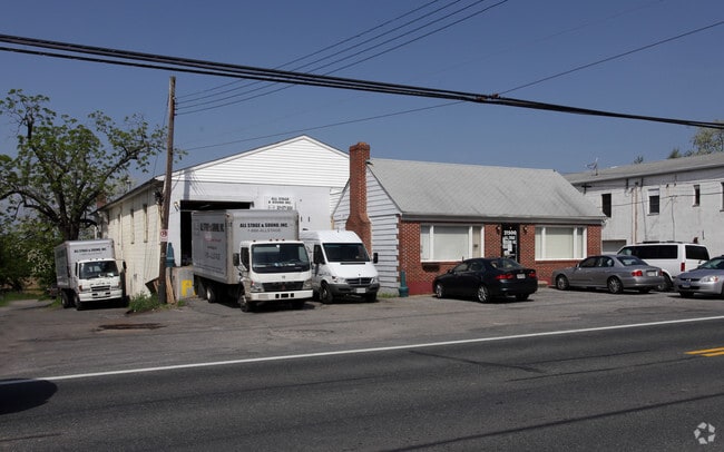
21500 Laytonsville Rd
Washington-Arlington-Alexandria, DC-VA-MD-WV
Brooke Grove
01-00011754
PT BROOKE GROVE LT I N LAYT ONSVIL LE
Warehouse
Montgomery
X
Maryland
24031C0184D
i
2024
0.50 AC
2025
E Montgomery Outlying
700101
Washington, DC
10,148 SF
DEMOGRAPHICS near 21500 Laytonsville Rd
1 Mile
3 Mile
5 Mile
2024 Total Population
1,290
19,702
106,007
2029 Population
1,265
19,317
104,312
Pop Growth 2024-2029
(1.94%)
(1.95%)
(1.60%)
Average Age
44
41
40
2024 Total Households
424
6,423
34,601
HH Growth 2024-2029
(2.12%)
(2.20%)
(1.75%)
Median Household Inc
$160,465
$131,666
$111,267
Avg Household Size
3.00
3.00
3.00
2024 Avg HH Vehicles
3.00
2.00
2.00
Median Home Value
$755,892
$563,170
$459,847
Median Year Built
1980
1985
1982
Nearby Places
Map Layers
Map Styles
 Street
 Aerial
- Restaurants
- Banks
- Shops
- Fitness
- Groceries
PUBLIC TRANSPORTATION
COMMUTER RAIL
Washington Grove (BRUNSWICK - WASHINGTON - Maryland Area Regional Commuter Trains (The MARC), Brunswick Line - Maryland Area Regional Commuter Trains (The MARC))
DRIVE
WALK
Distance
Washington Grove (BRUNSWICK - WASHINGTON - Maryland Area Regional Commuter Trains (The MARC), Brunswick Line - Maryland Area Regional Commuter Trains (The MARC))
13 min
6.4 mi
Gaithersburg (Brunswick Line - Maryland Area Regional Commuter Trains (The MARC))
DRIVE
WALK
Distance
Gaithersburg (Brunswick Line - Maryland Area Regional Commuter Trains (The MARC))
15 min
7.2 mi
AIRPORT
Ronald Reagan Washington Ntl
DRIVE
WALK
Distance
Ronald Reagan Washington Ntl
54 min
29.5 mi
Baltimore/Washington International Thurgood Marshall
DRIVE
WALK
Distance
Baltimore/Washington International Thurgood Marshall
52 min
33.0 mi
Washington Dulles International
DRIVE
WALK
Distance
Washington Dulles International
62 min
37.9 mi
Freight Ports
Port of Baltimore
DRIVE
WALK
Distance
Port of Baltimore
57 min
35.9 mi
Nearby Properties
Address
Land Use
TOTAL SIZE
Lot Size
Zoning
Address
Land Use
TOTAL SIZE
Lot Size
Zoning
185,040 SF
49.79 AC
IL1.0
Address
Land Use
TOTAL SIZE
Lot Size
Zoning
407,972 SF
44.95 AC
IL1.0
Address
Land Use
TOTAL SIZE
Lot Size
Zoning
161.53 AC
AR
Address
Land Use
TOTAL SIZE
Lot Size
Zoning
76,179 SF
10.47 AC
RE2
Address
Land Use
TOTAL SIZE
Lot Size
Zoning
79,786 SF
9.91 AC
NR0.2
Address
Land Use
TOTAL SIZE
Lot Size
Zoning
78,997 SF
4.90 AC
I4
Address
Land Use
TOTAL SIZE
Lot Size
Zoning
78,997 SF
6.16 AC
I4
Address
Land Use
TOTAL SIZE
Lot Size
Zoning
118,980 SF
9.06 AC
IL1.0
Address
Land Use
TOTAL SIZE
Lot Size
Zoning
35,885 SF
19.21 AC
RE1
Address
Land Use
TOTAL SIZE
Lot Size
Zoning
78,547 SF
29.77 AC
R90
Address
Land Use
TOTAL SIZE
Lot Size
Zoning
156,500 SF
11.51 AC
IL1.0
Address
Land Use
TOTAL SIZE
Lot Size
Zoning
2,816 SF
219.76 AC
R200
Address
Land Use
TOTAL SIZE
Lot Size
Zoning
84,948 SF
4.14 AC
IL1.0
Address
Land Use
TOTAL SIZE
Lot Size
Zoning
63,098 SF
8.25 AC
NR0.2
Address
Land Use
TOTAL SIZE
Lot Size
Zoning
40,000 SF
2.69 AC
IL1.0
Address
Land Use
TOTAL SIZE
Lot Size
Zoning
64,160 SF
1.39 AC
RE2
Address
Land Use
TOTAL SIZE
Lot Size
Zoning
22.72 AC
RE1
Address
Land Use
TOTAL SIZE
Lot Size
Zoning
89,400 SF
12.90 AC
RE1
Address
Land Use
TOTAL SIZE
Lot Size
Zoning
70,000 SF
3.52 AC
IL1.0
Address
Land Use
TOTAL SIZE
Lot Size
Zoning
50,506 SF
1.65 AC
IL1.0
Address
Land Use
TOTAL SIZE
Lot Size
Zoning
35.14 AC
AR
Address
Land Use
TOTAL SIZE
Lot Size
Zoning
45,840 SF
3.29 AC
IL1.0
Address
Land Use
TOTAL SIZE
Lot Size
Zoning
31,944 SF
1.90 AC
IL1.0
Address
Land Use
TOTAL SIZE
Lot Size
Zoning
47,000 SF
1.71 AC
IL1.0
Address
Land Use
TOTAL SIZE
Lot Size
Zoning
27,362 SF
3.24 AC
R200
Address
Land Use
TOTAL SIZE
Lot Size
Zoning
25,704 SF
3.83 AC
C1
Address
Land Use
TOTAL SIZE
Lot Size
Zoning
35,640 SF
2.24 AC
IL1.0
Address
Land Use
TOTAL SIZE
Lot Size
Zoning
56,307 SF
2.89 AC
IM2.5
Address
Land Use
TOTAL SIZE
Lot Size
Zoning
33,680 SF
2.05 AC
IL1.0
Address
Land Use
TOTAL SIZE
Lot Size
Zoning
22,366 SF
5.43 AC
RE2
The World's #1 Commercial Real Estate Marketplace
Connect with us
© 2025 CoStar Group
The information above has been obtained from sources believed reliable. While we do not doubt its accuracy we have not verified it and make no guarantee, warranty or representation about it. It is your responsibility to independently confirm its accuracy and completeness. Any projections, opinions, assumptions, or estimates used are for example only and do not represent the current or future performance of the property. The value of this transaction to you depends on tax and other factors which should be evaluated by your tax, financial, and legal advisors. You and your advisors should conduct a careful, independent investigation of the property to determine to your satisfaction the suitability of the property for your needs.