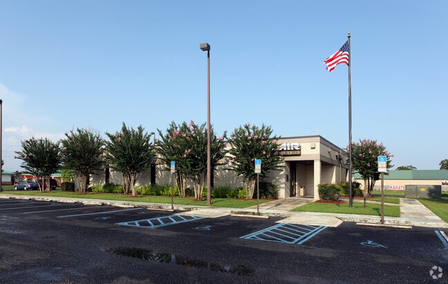
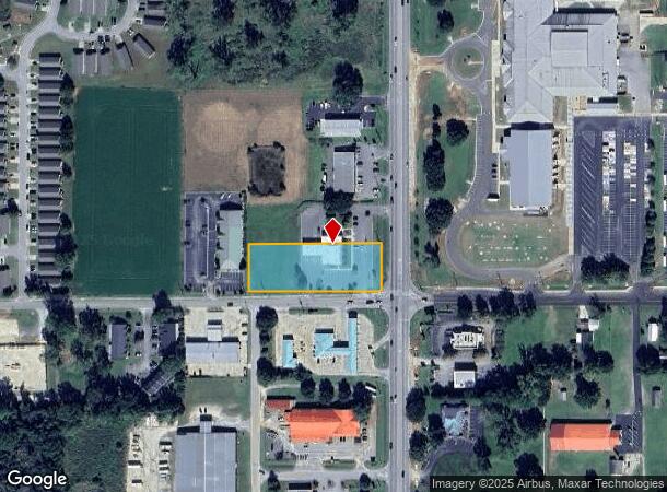
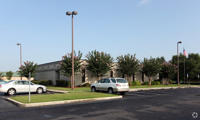
Property Record
21511 State Highway 59 S, Robertsdale, AL 36567
NEARBY LISTINGS FOR SALE OR LEASE
Property Detail
21511 State Highway 59 S
48-03-07-2-000-020.000
144'(S) X 410'(S) COM AT THE SE COR OF NW1/4 SEC 7 TH RUN NW 70' FOR POB, TH N 144'(S), TH W 410'(S), TH S 146'(S), TH E 401'
Financialbuilding
Baldwin
X
Alabama
01003C0687M
1.39 AC
2024
Baldwin County
2024
Mobile
010908
Daphne-Fairhope-Foley, AL
5,940 SF
DEMOGRAPHICS near 21511 State Highway 59 S
1 Mile
3 Mile
5 Mile
2024 Total Population
2,167
9,371
19,399
2029 Population
2,418
10,586
22,038
Pop Growth 2024-2029
+ 11.58%
+ 12.97%
+ 13.60%
Average Age
36
37
38
2024 Total Households
796
3,399
6,996
HH Growth 2024-2029
+ 10.93%
+ 12.42%
+ 13.11%
Median Household Inc
$62,334
$58,191
$59,720
Avg Household Size
2.70
2.70
2.60
2024 Avg HH Vehicles
2.00
2.00
2.00
Median Home Value
$227,638
$184,389
$197,526
Median Year Built
1997
1996
1996
Nearby Places
- Restaurants
- Banks
- Shops
- Fitness
- Groceries
PUBLIC TRANSPORTATION
AIRPORT
Mobile International
DRIVE
WALK
Distance
Mobile International
42 min
31.1 mi
Freight Ports
Port of Mobile
DRIVE
WALK
Distance
Port of Mobile
37 min
27.7 mi
Nearby Properties
Address
Land Use
TOTAL SIZE
Lot Size
Zoning
Address
Land Use
TOTAL SIZE
Lot Size
Zoning
2,673 SF
14 AC
Address
Land Use
TOTAL SIZE
Lot Size
Zoning
129,533 SF
17 AC
Address
Land Use
TOTAL SIZE
Lot Size
Zoning
46,778 SF
3.65 AC
Address
Land Use
TOTAL SIZE
Lot Size
Zoning
39,816 SF
3.80 AC
Address
Land Use
TOTAL SIZE
Lot Size
Zoning
Address
Land Use
TOTAL SIZE
Lot Size
Zoning
24,873 SF
32 AC
Address
Land Use
TOTAL SIZE
Lot Size
Zoning
11,810 SF
17 AC
Address
Land Use
TOTAL SIZE
Lot Size
Zoning
Address
Land Use
TOTAL SIZE
Lot Size
Zoning
9,272 SF
8.30 AC
Address
Land Use
TOTAL SIZE
Lot Size
Zoning
52,339 SF
5.20 AC
Address
Land Use
TOTAL SIZE
Lot Size
Zoning
4,442 SF
10 AC
Address
Land Use
TOTAL SIZE
Lot Size
Zoning
33,925 SF
4.40 AC
Address
Land Use
TOTAL SIZE
Lot Size
Zoning
54,922 SF
11 AC
Address
Land Use
TOTAL SIZE
Lot Size
Zoning
33,862 SF
2 AC
Address
Land Use
TOTAL SIZE
Lot Size
Zoning
31,359 SF
19 AC
Address
Land Use
TOTAL SIZE
Lot Size
Zoning
32,361 SF
8.50 AC
Address
Land Use
TOTAL SIZE
Lot Size
Zoning
13,140 SF
20 AC
Address
Land Use
TOTAL SIZE
Lot Size
Zoning
77,858 SF
3.20 AC
Address
Land Use
TOTAL SIZE
Lot Size
Zoning
44,289 SF
8.30 AC
Address
Land Use
TOTAL SIZE
Lot Size
Zoning
10,240 SF
20 AC
Address
Land Use
TOTAL SIZE
Lot Size
Zoning
25,718 SF
2.17 AC
Address
Land Use
TOTAL SIZE
Lot Size
Zoning
11,825 SF
6.60 AC
Address
Land Use
TOTAL SIZE
Lot Size
Zoning
3,000 SF
5.70 AC
Address
Land Use
TOTAL SIZE
Lot Size
Zoning
12,774 SF
11.20 AC
Address
Land Use
TOTAL SIZE
Lot Size
Zoning
26,742 SF
1.90 AC
Address
Land Use
TOTAL SIZE
Lot Size
Zoning
13,036 SF
4.90 AC
Address
Land Use
TOTAL SIZE
Lot Size
Zoning
53,144 SF
13 AC
Address
Land Use
TOTAL SIZE
Lot Size
Zoning
13,721 SF
1.04 AC
Address
Land Use
TOTAL SIZE
Lot Size
Zoning
58,099 SF
6.70 AC
Address
Land Use
TOTAL SIZE
Lot Size
Zoning
11,090 SF
3.30 AC
The World's #1 Commercial Real Estate Marketplace
Connect with us
© 2025 CoStar Group
The information above has been obtained from sources believed reliable. While we do not doubt its accuracy we have not verified it and make no guarantee, warranty or representation about it. It is your responsibility to independently confirm its accuracy and completeness. Any projections, opinions, assumptions, or estimates used are for example only and do not represent the current or future performance of the property. The value of this transaction to you depends on tax and other factors which should be evaluated by your tax, financial, and legal advisors. You and your advisors should conduct a careful, independent investigation of the property to determine to your satisfaction the suitability of the property for your needs.