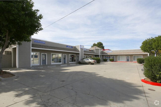
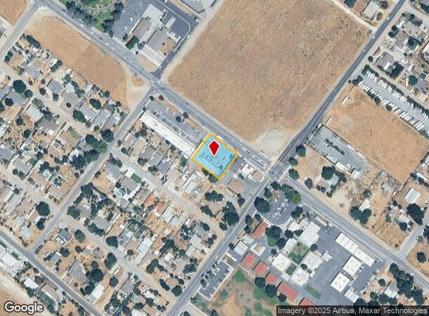
Property Record
21535 Palomar St, Wildomar, CA 92595

NEARBY LISTINGS FOR SALE OR LEASE
Property Detail
21535 Palomar St
Riverside-San Bernardino-Ontario, CA
Town Of Wildomar
376-052-002
.52 ACRES M/L IN LOTS 16, 17 & 18 BLK 32 MB 006/294 SD TOWN OF WILDOMAR
Regionalshoppingcenterormallwithanchorstore
Riverside
X
California
06073C0075F
18
2024
0.52 AC
2025
South Riverside
043271
Inland Empire (California)
5,910 SF
DEMOGRAPHICS near 21535 Palomar St
1 Mile
3 Mile
5 Mile
2024 Total Population
8,486
42,971
111,157
2029 Population
8,891
44,991
116,757
Pop Growth 2024-2029
+ 4.77%
+ 4.70%
+ 5.04%
Average Age
39
38
38
2024 Total Households
2,584
12,916
34,494
HH Growth 2024-2029
+ 4.26%
+ 4.20%
+ 4.57%
Median Household Inc
$94,054
$100,481
$99,226
Avg Household Size
3.20
3.20
3.10
2024 Avg HH Vehicles
3.00
3.00
2.00
Median Home Value
$520,330
$527,909
$504,948
Median Year Built
1994
1997
1998
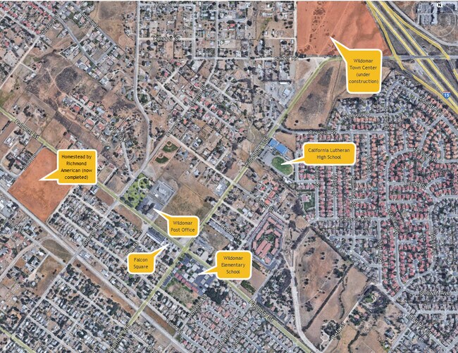
Nearby Places
Map Layers
Map Styles
 Street
 Aerial
- Restaurants
- Banks
- Shops
- Fitness
- Groceries
PUBLIC TRANSPORTATION
AIRPORT
Ontario International
DRIVE
WALK
Distance
Ontario International
53 min
43.4 mi
SALE & LEASE HISTORY
LISTING DATE
SALE/LEASE

Oct 04, 2022
For Sale
Jun 06, 2023
For Lease
Jul 22, 2022
For Lease
Jul 07, 2021
For Lease
Dec 07, 2022
For Lease
Apr 20, 2017
For Lease
Nearby Properties
Address
Land Use
TOTAL SIZE
Lot Size
Zoning
Address
Land Use
TOTAL SIZE
Lot Size
Zoning
380,129 SF
9.83 AC
IP
Address
Land Use
TOTAL SIZE
Lot Size
Zoning
61,794 SF
20.95 AC
CPS
Address
Land Use
TOTAL SIZE
Lot Size
Zoning
428,904 SF
20.20 AC
R3
Address
Land Use
TOTAL SIZE
Lot Size
Zoning
65,276 SF
8.56 AC
Address
Land Use
TOTAL SIZE
Lot Size
Zoning
201,528 SF
8.67 AC
M-SC
Address
Land Use
TOTAL SIZE
Lot Size
Zoning
127,555 SF
8.96 AC
Address
Land Use
TOTAL SIZE
Lot Size
Zoning
101,218 SF
9.19 AC
R3
Address
Land Use
TOTAL SIZE
Lot Size
Zoning
83,279 SF
7.20 AC
Address
Land Use
TOTAL SIZE
Lot Size
Zoning
58,756 SF
3.52 AC
IP
Address
Land Use
TOTAL SIZE
Lot Size
Zoning
13,834 SF
18.97 AC
Address
Land Use
TOTAL SIZE
Lot Size
Zoning
37,073 SF
4.91 AC
Address
Land Use
TOTAL SIZE
Lot Size
Zoning
49,031 SF
7.18 AC
RR
Address
Land Use
TOTAL SIZE
Lot Size
Zoning
69,299 SF
9.88 AC
RR
Address
Land Use
TOTAL SIZE
Lot Size
Zoning
60,949 SF
1.37 AC
Address
Land Use
TOTAL SIZE
Lot Size
Zoning
115,825 SF
9.46 AC
R3
Address
Land Use
TOTAL SIZE
Lot Size
Zoning
36,140 SF
2.33 AC
C1CP
Address
Land Use
TOTAL SIZE
Lot Size
Zoning
33,667 SF
3.73 AC
CPS
Address
Land Use
TOTAL SIZE
Lot Size
Zoning
57,687 SF
6.08 AC
CPS
Address
Land Use
TOTAL SIZE
Lot Size
Zoning
22,316 SF
2.49 AC
CPS
Address
Land Use
TOTAL SIZE
Lot Size
Zoning
31,884 SF
1.66 AC
Address
Land Use
TOTAL SIZE
Lot Size
Zoning
76,319 SF
5.77 AC
Address
Land Use
TOTAL SIZE
Lot Size
Zoning
17,272 SF
1.51 AC
C1CP
Address
Land Use
TOTAL SIZE
Lot Size
Zoning
20.66 AC
Address
Land Use
TOTAL SIZE
Lot Size
Zoning
12.79 AC
CPS
Address
Land Use
TOTAL SIZE
Lot Size
Zoning
42,856 SF
3.85 AC
Address
Land Use
TOTAL SIZE
Lot Size
Zoning
33,412 SF
7.75 AC
C1CP
Address
Land Use
TOTAL SIZE
Lot Size
Zoning
87,510 SF
4.75 AC
CPS
Address
Land Use
TOTAL SIZE
Lot Size
Zoning
44,232 SF
3.75 AC
IP
The World's #1 Commercial Real Estate Marketplace
Connect with us
© 2026 CoStar Group
The information above has been obtained from sources believed reliable. While we do not doubt its accuracy we have not verified it and make no guarantee, warranty or representation about it. It is your responsibility to independently confirm its accuracy and completeness. Any projections, opinions, assumptions, or estimates used are for example only and do not represent the current or future performance of the property. The value of this transaction to you depends on tax and other factors which should be evaluated by your tax, financial, and legal advisors. You and your advisors should conduct a careful, independent investigation of the property to determine to your satisfaction the suitability of the property for your needs.