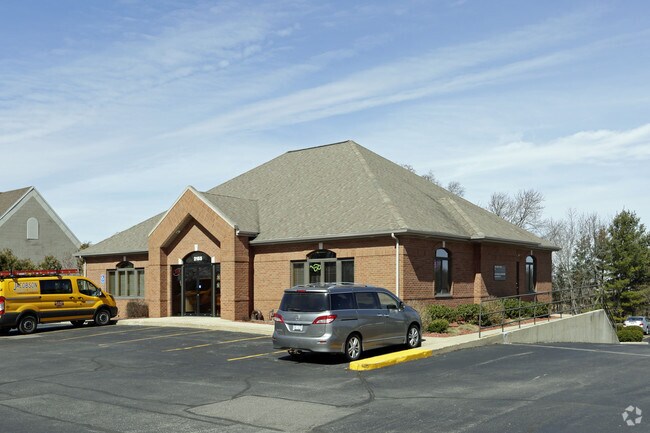
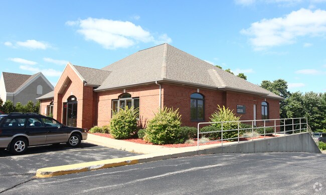
Property Record
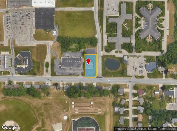
2155 84Th St Sw, Byron Center, MI 49315
NEARBY LISTINGS FOR SALE OR LEASE
Property Detail
2155 84Th St Sw
41-21-15-351-030
412115351030 S 260.0 FT OF E 115.5 FT OF W 1/4 E 1/2 SW 1/4 EX COM 33.0 FT N ALONG E LINE OF W 1/4 E 1/2 SW 1/4 TH N ALONG SD
Commercialnec
Kent
X
Michigan
26005C0125G
0.60 AC
2024
Byron/Gaines
2025
West Michigan
014606
Grand Rapids-Wyoming, MI
3,252 SF
DEMOGRAPHICS near 2155 84Th St Sw
1 Mile
3 Mile
5 Mile
2024 Total Population
6,623
22,901
76,078
2029 Population
6,723
23,201
77,178
Pop Growth 2024-2029
+ 1.51%
+ 1.31%
+ 1.45%
Average Age
40
41
39
2024 Total Households
2,250
8,421
27,967
HH Growth 2024-2029
+ 1.56%
+ 1.35%
+ 1.45%
Median Household Inc
$96,383
$87,566
$76,553
Avg Household Size
2.90
2.70
2.70
2024 Avg HH Vehicles
2.00
2.00
2.00
Median Home Value
$295,895
$295,908
$263,331
Median Year Built
1996
1995
1992
Nearby Places
Map Layers
Map Styles
 Street
 Aerial
- Restaurants
- Banks
- Shops
- Fitness
- Groceries
PUBLIC TRANSPORTATION
AIRPORT
Gerald R Ford International
DRIVE
WALK
Distance
Gerald R Ford International
24 min
15.5 mi
Freight Ports
Port Milwaukee
DRIVE
WALK
Distance
Port Milwaukee
302 min
255.1 mi
SALE & LEASE HISTORY
LISTING DATE
SALE/LEASE

Jun 04, 2020
For Lease
Apr 26, 2017
For Lease
Nearby Properties
Address
Land Use
TOTAL SIZE
Lot Size
Zoning
Address
Land Use
TOTAL SIZE
Lot Size
Zoning
490,769 SF
42.25 AC
B3
Address
Land Use
TOTAL SIZE
Lot Size
Zoning
63,788 SF
124.62 AC
D1
Address
Land Use
TOTAL SIZE
Lot Size
Zoning
487,739 SF
73.87 AC
RR
Address
Land Use
TOTAL SIZE
Lot Size
Zoning
Address
Land Use
TOTAL SIZE
Lot Size
Zoning
Address
Land Use
TOTAL SIZE
Lot Size
Zoning
58.30 AC
RA
Address
Land Use
TOTAL SIZE
Lot Size
Zoning
20.50 AC
RR
Address
Land Use
TOTAL SIZE
Lot Size
Zoning
108,911 SF
10.80 AC
D1
Address
Land Use
TOTAL SIZE
Lot Size
Zoning
140,742 SF
18.57 AC
D1
Address
Land Use
TOTAL SIZE
Lot Size
Zoning
30,869 SF
5.06 AC
PUD3
Address
Land Use
TOTAL SIZE
Lot Size
Zoning
Address
Land Use
TOTAL SIZE
Lot Size
Zoning
Address
Land Use
TOTAL SIZE
Lot Size
Zoning
98,960 SF
6.15 AC
I1
Address
Land Use
TOTAL SIZE
Lot Size
Zoning
Address
Land Use
TOTAL SIZE
Lot Size
Zoning
20.50 AC
Address
Land Use
TOTAL SIZE
Lot Size
Zoning
201,500 SF
11.98 AC
D1
Address
Land Use
TOTAL SIZE
Lot Size
Zoning
Address
Land Use
TOTAL SIZE
Lot Size
Zoning
Address
Land Use
TOTAL SIZE
Lot Size
Zoning
205,000 SF
9.88 AC
D1
Address
Land Use
TOTAL SIZE
Lot Size
Zoning
4.74 AC
D1PUD
Address
Land Use
TOTAL SIZE
Lot Size
Zoning
96,550 SF
19.95 AC
D1
Address
Land Use
TOTAL SIZE
Lot Size
Zoning
36.87 AC
RD
Address
Land Use
TOTAL SIZE
Lot Size
Zoning
24.27 AC
RD
Address
Land Use
TOTAL SIZE
Lot Size
Zoning
55,110 SF
18.45 AC
Address
Land Use
TOTAL SIZE
Lot Size
Zoning
45,423 SF
6.25 AC
D1
Address
Land Use
TOTAL SIZE
Lot Size
Zoning
Address
Land Use
TOTAL SIZE
Lot Size
Zoning
189,537 SF
43.04 AC
D1
Address
Land Use
TOTAL SIZE
Lot Size
Zoning
210,000 SF
15.71 AC
D1
Address
Land Use
TOTAL SIZE
Lot Size
Zoning
Address
Land Use
TOTAL SIZE
Lot Size
Zoning
1,428 SF
7.75 AC
D1
The World's #1 Commercial Real Estate Marketplace
Connect with us
© 2025 CoStar Group
The information above has been obtained from sources believed reliable. While we do not doubt its accuracy we have not verified it and make no guarantee, warranty or representation about it. It is your responsibility to independently confirm its accuracy and completeness. Any projections, opinions, assumptions, or estimates used are for example only and do not represent the current or future performance of the property. The value of this transaction to you depends on tax and other factors which should be evaluated by your tax, financial, and legal advisors. You and your advisors should conduct a careful, independent investigation of the property to determine to your satisfaction the suitability of the property for your needs.