Property Record
2155 Calistoga Rd, Santa Rosa, CA 95404


NEARBY LISTINGS FOR SALE OR LEASE
-
-
View all Santa Rosa listings for sale on LoopNet.com
Property Detail
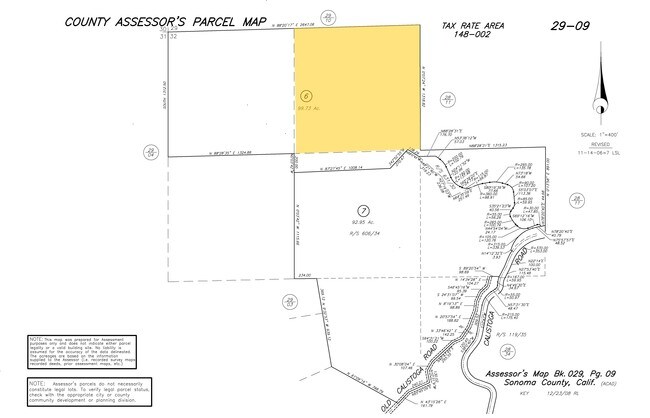
2155 Calistoga Rd
029-090-006
2007 FM REM 029-090-005 AFTER PTN OPEN TO RD
Vineyard
Sonoma
X
California
06097C0595E
99.73 AC
2024
Santa Rosa
2025
North Bay/Santa Rosa
152601
Santa Rosa, CA
DEMOGRAPHICS near 2155 Calistoga Rd
1 Mile
3 Mile
5 Mile
2024 Total Population
179
24,876
82,622
2029 Population
174
24,917
82,523
Pop Growth 2024-2029
(2.79%)
+ 0.16%
(0.12%)
Average Age
47
46
45
2024 Total Households
68
9,881
34,104
HH Growth 2024-2029
(2.94%)
+ 0.17%
(0.11%)
Median Household Inc
$138,888
$114,626
$97,984
Avg Household Size
2.70
2.50
2.30
2024 Avg HH Vehicles
3.00
2.00
2.00
Median Home Value
$983,332
$844,250
$798,792
Median Year Built
1988
1984
1976
Nearby Places
Map Layers
Map Styles
 Street
 Aerial
- Restaurants
- Banks
- Shops
- Fitness
- Groceries
PUBLIC TRANSPORTATION
COMMUTER RAIL
Santa Rosa North Smart (Main Line - Sonoma Marin Area Rail Transit)
DRIVE
WALK
Distance
Santa Rosa North Smart (Main Line - Sonoma Marin Area Rail Transit)
18 min
7.7 mi
Santa Rosa Downtown Smart (Main Line - Sonoma Marin Area Rail Transit)
DRIVE
WALK
Distance
Santa Rosa Downtown Smart (Main Line - Sonoma Marin Area Rail Transit)
17 min
7.9 mi
AIRPORT
Charles M Schulz - Sonoma County
DRIVE
WALK
Distance
Charles M Schulz - Sonoma County
26 min
12.4 mi
Freight Ports
Port of Richmond
DRIVE
WALK
Distance
Port of Richmond
77 min
56.1 mi
SALE & LEASE HISTORY
LISTING DATE
SALE/LEASE

Jan 22, 2019
For Sale
Nearby Properties
Address
Land Use
TOTAL SIZE
Lot Size
Zoning
Address
Land Use
TOTAL SIZE
Lot Size
Zoning
78,155 SF
6.57 AC
CITYSR
Address
Land Use
TOTAL SIZE
Lot Size
Zoning
67,872 SF
6.95 AC
Address
Land Use
TOTAL SIZE
Lot Size
Zoning
57,332 SF
5.37 AC
CITYSR
Address
Land Use
TOTAL SIZE
Lot Size
Zoning
28,394 SF
1.32 AC
A1
Address
Land Use
TOTAL SIZE
Lot Size
Zoning
60.35 AC
PC
Address
Land Use
TOTAL SIZE
Lot Size
Zoning
58,608 SF
3.91 AC
R3R
Address
Land Use
TOTAL SIZE
Lot Size
Zoning
29,146 SF
0.14 AC
CITYSR
Address
Land Use
TOTAL SIZE
Lot Size
Zoning
35,202 SF
18.12 AC
A
Address
Land Use
TOTAL SIZE
Lot Size
Zoning
15,057 SF
37.50 AC
Address
Land Use
TOTAL SIZE
Lot Size
Zoning
43,392 SF
61.51 AC
Address
Land Use
TOTAL SIZE
Lot Size
Zoning
4.38 AC
CITYSR
Address
Land Use
TOTAL SIZE
Lot Size
Zoning
24,504 SF
0.68 AC
R3
Address
Land Use
TOTAL SIZE
Lot Size
Zoning
16,581 SF
1.21 AC
Address
Land Use
TOTAL SIZE
Lot Size
Zoning
210 SF
55.22 AC
Address
Land Use
TOTAL SIZE
Lot Size
Zoning
20,197 SF
53.53 AC
Address
Land Use
TOTAL SIZE
Lot Size
Zoning
101.52 AC
Address
Land Use
TOTAL SIZE
Lot Size
Zoning
32,718 SF
0.14 AC
Address
Land Use
TOTAL SIZE
Lot Size
Zoning
22,992 SF
1.25 AC
CITYSR
Address
Land Use
TOTAL SIZE
Lot Size
Zoning
27,250 SF
3.12 AC
CITYSR
Address
Land Use
TOTAL SIZE
Lot Size
Zoning
36,896 SF
1.37 AC
R315
Address
Land Use
TOTAL SIZE
Lot Size
Zoning
117.74 AC
Address
Land Use
TOTAL SIZE
Lot Size
Zoning
7,574 SF
4.39 AC
Address
Land Use
TOTAL SIZE
Lot Size
Zoning
5,699 SF
215.51 AC
Address
Land Use
TOTAL SIZE
Lot Size
Zoning
32,316 SF
0.75 AC
CITYSR
Address
Land Use
TOTAL SIZE
Lot Size
Zoning
7,860 SF
12.46 AC
RR5
Address
Land Use
TOTAL SIZE
Lot Size
Zoning
12,124 SF
47.07 AC
Address
Land Use
TOTAL SIZE
Lot Size
Zoning
26,353 SF
1.15 AC
Address
Land Use
TOTAL SIZE
Lot Size
Zoning
3,065 SF
33.33 AC
RRDB7FRZN
Address
Land Use
TOTAL SIZE
Lot Size
Zoning
34,200 SF
1.73 AC
The World's #1 Commercial Real Estate Marketplace
Connect with us
© 2025 CoStar Group
The information above has been obtained from sources believed reliable. While we do not doubt its accuracy we have not verified it and make no guarantee, warranty or representation about it. It is your responsibility to independently confirm its accuracy and completeness. Any projections, opinions, assumptions, or estimates used are for example only and do not represent the current or future performance of the property. The value of this transaction to you depends on tax and other factors which should be evaluated by your tax, financial, and legal advisors. You and your advisors should conduct a careful, independent investigation of the property to determine to your satisfaction the suitability of the property for your needs.