Property Record
2155 Nw 28Th St, Miami, FL 33142
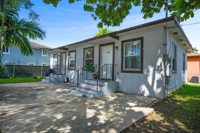
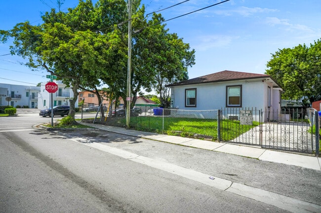
This Property Is For Sale
NEARBY LISTINGS FOR SALE OR LEASE
Property Detail
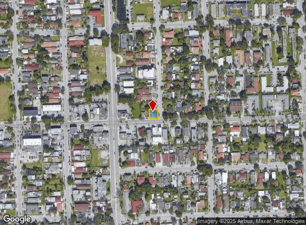
2155 Nw 28Th St
Miami-Miami Beach-Kendall, FL
Caples Amd Pl
01-3127-031-0072
Miami/Dade
Duplex
Florida
AE
0.08 AC
12086C0311L
Allapattah
1,014 SF
South Florida
DEMOGRAPHICS near 2155 Nw 28Th St
1 Mile
3 Mile
5 Mile
2024 Total Population
37,393
317,058
662,547
2029 Population
39,797
342,264
712,270
Pop Growth 2024-2029
+ 6.43%
+ 7.95%
+ 7.50%
Average Age
42
41
42
2024 Total Households
13,261
125,006
266,912
HH Growth 2024-2029
+ 6.34%
+ 8.27%
+ 7.74%
Median Household Inc
$38,366
$52,623
$64,789
Avg Household Size
2.60
2.40
2.40
2024 Avg HH Vehicles
1.00
1.00
1.00
Median Home Value
$385,173
$463,533
$557,041
Median Year Built
1966
1973
1974
Nearby Places
- Restaurants
- Banks
- Shops
- Fitness
- Groceries
PUBLIC TRANSPORTATION
TRANSIT/SUBWAY
Earlington Heights (Metrorail Green Line - Miami-Dade Transit (Metrorail/Metromover))
DRIVE
WALK
Distance
Earlington Heights (Metrorail Green Line - Miami-Dade Transit (Metrorail/Metromover))
10 min
19 min
1.0 mi
COMMUTER RAIL
Earlington Heights (Metrorail Green Line - Miami-Dade Transit (Metrorail/Metromover))
DRIVE
WALK
Distance
Earlington Heights (Metrorail Green Line - Miami-Dade Transit (Metrorail/Metromover))
10 min
19 min
1.0 mi
Allapattah (Metrorail Green Line - Miami-Dade Transit (Metrorail/Metromover))
DRIVE
WALK
Distance
Allapattah (Metrorail Green Line - Miami-Dade Transit (Metrorail/Metromover))
4 min
1.4 mi
AIRPORT
Miami International
DRIVE
WALK
Distance
Miami International
18 min
7.6 mi
Fort Lauderdale/Hollywood International
DRIVE
WALK
Distance
Fort Lauderdale/Hollywood International
33 min
22.6 mi
Freight Ports
Port of Miami
DRIVE
WALK
Distance
Port of Miami
12 min
5.3 mi
Nearby Properties
Address
Land Use
TOTAL SIZE
Lot Size
Zoning
Address
Land Use
TOTAL SIZE
Lot Size
Zoning
955,966 SF
38.91 AC
9600
Address
Land Use
TOTAL SIZE
Lot Size
Zoning
928,000 SF
14.30 AC
8000
Address
Land Use
TOTAL SIZE
Lot Size
Zoning
16.13 AC
6100
Address
Land Use
TOTAL SIZE
Lot Size
Zoning
2,789,683 SF
33.23 AC
7300
Address
Land Use
TOTAL SIZE
Lot Size
Zoning
2,403,353 SF
7.37 AC
6100
Address
Land Use
TOTAL SIZE
Lot Size
Zoning
1,938,271 SF
6.62 AC
6402
Address
Land Use
TOTAL SIZE
Lot Size
Zoning
1,075,124 SF
1.61 AC
6405
Address
Land Use
TOTAL SIZE
Lot Size
Zoning
1,544,491 SF
0.97 AC
6401
Address
Land Use
TOTAL SIZE
Lot Size
Zoning
244,533 SF
3.53 AC
6600
Address
Land Use
TOTAL SIZE
Lot Size
Zoning
303,989 SF
1.47 AC
6600
Address
Land Use
TOTAL SIZE
Lot Size
Zoning
416,675 SF
6.48 AC
6401
Address
Land Use
TOTAL SIZE
Lot Size
Zoning
256,089 SF
20.35 AC
7600
Address
Land Use
TOTAL SIZE
Lot Size
Zoning
585,775 SF
1.86 AC
6101
Address
Land Use
TOTAL SIZE
Lot Size
Zoning
868,860 SF
2.14 AC
6402
Address
Land Use
TOTAL SIZE
Lot Size
Zoning
903,993 SF
0.60 AC
6412
Address
Land Use
TOTAL SIZE
Lot Size
Zoning
615,785 SF
3.81 AC
4604
Address
Land Use
TOTAL SIZE
Lot Size
Zoning
2 AC
8000
Address
Land Use
TOTAL SIZE
Lot Size
Zoning
1,262,330 SF
1.39 AC
6402
Address
Land Use
TOTAL SIZE
Lot Size
Zoning
845,870 SF
1.30 AC
6412
Address
Land Use
TOTAL SIZE
Lot Size
Zoning
790,139 SF
1.80 AC
6110
Address
Land Use
TOTAL SIZE
Lot Size
Zoning
604,146 SF
5.66 AC
6600
Address
Land Use
TOTAL SIZE
Lot Size
Zoning
570,694 SF
1.37 AC
4604
Address
Land Use
TOTAL SIZE
Lot Size
Zoning
655,148 SF
0.30 AC
6401
Address
Land Use
TOTAL SIZE
Lot Size
Zoning
990,766 SF
1.16 AC
6420
Address
Land Use
TOTAL SIZE
Lot Size
Zoning
566,165 SF
2.09 AC
6101
Address
Land Use
TOTAL SIZE
Lot Size
Zoning
701,056 SF
1.58 AC
6402
Address
Land Use
TOTAL SIZE
Lot Size
Zoning
996,100 SF
3.58 AC
9600
Address
Land Use
TOTAL SIZE
Lot Size
Zoning
600,250 SF
2.03 AC
6402
Address
Land Use
TOTAL SIZE
Lot Size
Zoning
25,427 SF
6.27 AC
6600
Address
Land Use
TOTAL SIZE
Lot Size
Zoning
787,433 SF
2.15 AC
6402
The World's #1 Commercial Real Estate Marketplace
Connect with us
© 2025 CoStar Group
The information above has been obtained from sources believed reliable. While we do not doubt its accuracy we have not verified it and make no guarantee, warranty or representation about it. It is your responsibility to independently confirm its accuracy and completeness. Any projections, opinions, assumptions, or estimates used are for example only and do not represent the current or future performance of the property. The value of this transaction to you depends on tax and other factors which should be evaluated by your tax, financial, and legal advisors. You and your advisors should conduct a careful, independent investigation of the property to determine to your satisfaction the suitability of the property for your needs.