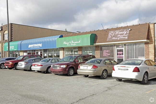
Property Record
21555 Kelly Rd, Eastpointe, MI 48021


NEARBY LISTINGS FOR SALE OR LEASE
Property Detail
21555 Kelly Rd
Detroit-Warren-Dearborn, MI
Obenauer Barber Laing Cos Ridgemont Par
02-14-32-401-012
OBENAUER BARBER LAING CO'S RIDGEMONT PARK LOTS 152 & 153 LIBER 9; PAGE 7
Storebuilding
Macomb
X
Michigan
26163C0135F
152-153
2025
0.09 AC
2025
Macomb East
258600
Detroit
2,800 SF
DEMOGRAPHICS near 21555 Kelly Rd
1 mile
3 mile
5 mile
2024 Total Population
19,366
163,191
348,529
2029 Population
19,038
161,006
345,556
Pop Growth 2024-2029
(1.69%)
(1.34%)
(0.85%)
Average Age
39
39
39
2024 Total Households
7,617
64,098
137,112
HH Growth 2024-2029
(1.82%)
(1.46%)
(0.99%)
Median Household Inc
$52,530
$55,556
$52,887
Avg Household Size
2.50
2.50
2.50
2024 Avg HH Vehicles
2.00
2.00
2.00
Median Home Value
$119,423
$132,798
$137,236
Median Year Built
1955
1954
1955
Nearby Places
Map Layers
Map Styles
 Street
 Aerial
Transit
 Traffic
 Biking
Places
Listings with unknown addresses are not visible on the map
- Restaurants
- Banks
- Shops
- Fitness
- Groceries
PUBLIC TRANSPORTATION
AIRPORT
Detroit City
Drive
Walk
Distance
Detroit City
20 min
11.9 mi
Detroit Metro Wayne County
Drive
Walk
Distance
Detroit Metro Wayne County
44 min
40.0 mi
SALE & LEASE HISTORY
LISTING DATE
SALE/LEASE

Sep 23, 2016
For Sale
May 22, 2017
For Lease
Nearby Properties
Address
Land Use
TOTAL SIZE
Lot Size
Zoning
Address
Land Use
TOTAL SIZE
Lot Size
Zoning
1,034,990 SF
28.60 AC
Address
Land Use
TOTAL SIZE
Lot Size
Zoning
9,937 SF
35.42 AC
CLD
Address
Land Use
TOTAL SIZE
Lot Size
Zoning
323,858 SF
20.66 AC
R-3
Address
Land Use
TOTAL SIZE
Lot Size
Zoning
575,081 SF
8.53 AC
R6
Address
Land Use
TOTAL SIZE
Lot Size
Zoning
182,866 SF
5.08 AC
PD
Address
Land Use
TOTAL SIZE
Lot Size
Zoning
362,350 SF
22.39 AC
M-2
Address
Land Use
TOTAL SIZE
Lot Size
Zoning
89,970 SF
2.86 AC
RM-1
Address
Land Use
TOTAL SIZE
Lot Size
Zoning
192,387 SF
11.26 AC
CLD
Address
Land Use
TOTAL SIZE
Lot Size
Zoning
101,733 SF
1.10 AC
C-2
Address
Land Use
TOTAL SIZE
Lot Size
Zoning
129,502 SF
3.17 AC
RM-1
Address
Land Use
TOTAL SIZE
Lot Size
Zoning
103,069 SF
11.41 AC
B-3
Address
Land Use
TOTAL SIZE
Lot Size
Zoning
92,800 SF
6.71 AC
R-3
Address
Land Use
TOTAL SIZE
Lot Size
Zoning
105,354 SF
2.33 AC
B-3
Address
Land Use
TOTAL SIZE
Lot Size
Zoning
115,307 SF
7.01 AC
RM-1
Address
Land Use
TOTAL SIZE
Lot Size
Zoning
75,284 SF
0.87 AC
C
Address
Land Use
TOTAL SIZE
Lot Size
Zoning
167,589 SF
16.80 AC
B-3
Address
Land Use
TOTAL SIZE
Lot Size
Zoning
202,788 SF
27.98 AC
CLD
Address
Land Use
TOTAL SIZE
Lot Size
Zoning
119,898 SF
14.65 AC
B-2
Address
Land Use
TOTAL SIZE
Lot Size
Zoning
133,611 SF
11.74 AC
B-3
Address
Land Use
TOTAL SIZE
Lot Size
Zoning
136,270 SF
3.42 AC
LI
Address
Land Use
TOTAL SIZE
Lot Size
Zoning
91,739 SF
6.54 AC
B-2
Address
Land Use
TOTAL SIZE
Lot Size
Zoning
30,244 SF
2.06 AC
B-1
Address
Land Use
TOTAL SIZE
Lot Size
Zoning
252,633 SF
10.78 AC
M-2
Address
Land Use
TOTAL SIZE
Lot Size
Zoning
28,300 SF
11.49 AC
I-1
Address
Land Use
TOTAL SIZE
Lot Size
Zoning
154,377 SF
8.07 AC
M-3
Address
Land Use
TOTAL SIZE
Lot Size
Zoning
131,120 SF
8.25 AC
M-2
Address
Land Use
TOTAL SIZE
Lot Size
Zoning
11,315 SF
41.52 AC
RA
Address
Land Use
TOTAL SIZE
Lot Size
Zoning
156,352 SF
2.72 AC
B-3
Address
Land Use
TOTAL SIZE
Lot Size
Zoning
7,797 SF
24.23 AC
CLD
Address
Land Use
TOTAL SIZE
Lot Size
Zoning
26,068 SF
5.57 AC
B-2
The World's #1 Commercial Real Estate Marketplace
Connect with us
© 2026 CoStar Group
The information above has been obtained from sources believed reliable. While we do not doubt its accuracy we have not verified it and make no guarantee, warranty or representation about it. It is your responsibility to independently confirm its accuracy and completeness. Any projections, opinions, assumptions, or estimates used are for example only and do not represent the current or future performance of the property. The value of this transaction to you depends on tax and other factors which should be evaluated by your tax, financial, and legal advisors. You and your advisors should conduct a careful, independent investigation of the property to determine to your satisfaction the suitability of the property for your needs.