Property Record
2156 Bach, Davison, MI 48423

Property Detail
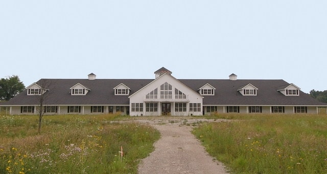
2156 Bach
05-02-300-024
A PARCEL OF LAND BEG N 89 DEG 14 MIN 18 SEC E 924.35 FT & N 0 DEG 51 MIN 12 SEC W 229.89 FT & S 89 DEG 14 MIN 18 SEC W 261 FT
Agriculturalland
Genesee
NOT AVAILA
Michigan
A Areas with a 1% annual chance of flooding and a 26% chance of flooding over the life of a 30-year mortgage.
32.51 AC
2024
Flint
2025
Detroit
011712
Flint, MI
NEARBY LISTINGS FOR SALE OR LEASE
-
-
View all Davison listings for sale on LoopNet.com
DEMOGRAPHICS near 2156 Bach
1 mile
3 mile
5 mile
2025 Total Population
2,005
17,731
37,076
2030 Population
2,032
17,631
36,706
Pop Growth 2025-2030
+ 1.35%
(0.56%)
(1.00%)
Average Age
42
43
42
2025 Total Households
813
7,746
15,685
HH Growth 2025-2030
+ 1.11%
(0.62%)
(1.05%)
Median Household Inc
$57,999
$61,031
$68,933
Avg Household Size
2.40
2.20
2.30
2025 Avg HH Vehicles
2.00
2.00
2.00
Median Home Value
$198,427
$206,100
$220,248
Median Year Built
1995
1982
1978
Nearby Places
Map Layers
Map Styles
 Street
 Aerial
Transit
 Traffic
 Biking
Places
Listings with unknown addresses are not visible on the map
- Restaurants
- Banks
- Shops
- Fitness
- Groceries
PUBLIC TRANSPORTATION
AIRPORT
Bishop International
Drive
Walk
Distance
Bishop International
35 min
20.0 mi
Freight Ports
Port of Toledo
Drive
Walk
Distance
Port of Toledo
149 min
109.8 mi
Nearby Properties
Address
Land Use
TOTAL SIZE
Lot Size
Zoning
Address
Land Use
TOTAL SIZE
Lot Size
Zoning
156,996 SF
NOT AVAILA
Address
Land Use
TOTAL SIZE
Lot Size
Zoning
19.05 AC
NOT AVAILA
Address
Land Use
TOTAL SIZE
Lot Size
Zoning
159,560 SF
9.96 AC
NOT AVAILA
Address
Land Use
TOTAL SIZE
Lot Size
Zoning
6,449 SF
90.81 AC
MH
Address
Land Use
TOTAL SIZE
Lot Size
Zoning
42,397 SF
15.14 AC
NOT AVAILA
Address
Land Use
TOTAL SIZE
Lot Size
Zoning
56,966 SF
1.81 AC
NOT AVAILA
Address
Land Use
TOTAL SIZE
Lot Size
Zoning
59,276 SF
3.40 AC
NOT AVAILA
Address
Land Use
TOTAL SIZE
Lot Size
Zoning
72,603 SF
4 AC
NOT AVAILA
Address
Land Use
TOTAL SIZE
Lot Size
Zoning
34,096 SF
131.93 AC
Address
Land Use
TOTAL SIZE
Lot Size
Zoning
12.16 AC
NOT AVAILA
Address
Land Use
TOTAL SIZE
Lot Size
Zoning
44,280 SF
5.48 AC
C-3
Address
Land Use
TOTAL SIZE
Lot Size
Zoning
46,464 SF
9.69 AC
NOT AVAILA
Address
Land Use
TOTAL SIZE
Lot Size
Zoning
38,881 SF
3.70 AC
NOT AVAILA
Address
Land Use
TOTAL SIZE
Lot Size
Zoning
79,677 SF
13.79 AC
B-1
Address
Land Use
TOTAL SIZE
Lot Size
Zoning
101,648 SF
18.65 AC
I
Address
Land Use
TOTAL SIZE
Lot Size
Zoning
59,420 SF
5.25 AC
C-3
Address
Land Use
TOTAL SIZE
Lot Size
Zoning
98,410 SF
4.34 AC
C-3
Address
Land Use
TOTAL SIZE
Lot Size
Zoning
1,438 SF
40.80 AC
NOT AVAILA
Address
Land Use
TOTAL SIZE
Lot Size
Zoning
49,688 SF
8.79 AC
NOT AVAILA
Address
Land Use
TOTAL SIZE
Lot Size
Zoning
127,708 SF
9.40 AC
B-1
Address
Land Use
TOTAL SIZE
Lot Size
Zoning
28.20 AC
Address
Land Use
TOTAL SIZE
Lot Size
Zoning
2,328 SF
79 AC
RRA
Address
Land Use
TOTAL SIZE
Lot Size
Zoning
2,244 SF
24 AC
Address
Land Use
TOTAL SIZE
Lot Size
Zoning
17,217 SF
2.98 AC
NOT AVAILA
Address
Land Use
TOTAL SIZE
Lot Size
Zoning
56.58 AC
Address
Land Use
TOTAL SIZE
Lot Size
Zoning
34,496 SF
2.95 AC
C-3
Address
Land Use
TOTAL SIZE
Lot Size
Zoning
1,850 SF
32.92 AC
B-2
Address
Land Use
TOTAL SIZE
Lot Size
Zoning
160 AC
NOT AVAILA
Address
Land Use
TOTAL SIZE
Lot Size
Zoning
61,770 SF
176 AC
B-1
Address
Land Use
TOTAL SIZE
Lot Size
Zoning
36,620 SF
47.81 AC
CB
The World's #1 Commercial Real Estate Marketplace
Connect with us
© 2026 CoStar Group
The information above has been obtained from sources believed reliable. While we do not doubt its accuracy we have not verified it and make no guarantee, warranty or representation about it. It is your responsibility to independently confirm its accuracy and completeness. Any projections, opinions, assumptions, or estimates used are for example only and do not represent the current or future performance of the property. The value of this transaction to you depends on tax and other factors which should be evaluated by your tax, financial, and legal advisors. You and your advisors should conduct a careful, independent investigation of the property to determine to your satisfaction the suitability of the property for your needs.