Property Record
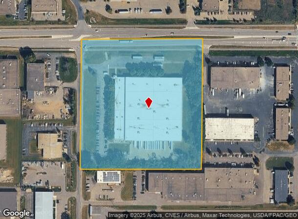
21560 Grenada Ave, Lakeville, MN 55044
Current Lease Availabilities
NEARBY LISTINGS FOR SALE OR LEASE
Property Detail
21560 Grenada Ave
22-03300-75-018
3311420 PT OF NE 1/4 OF SE 1/4 BEG NW COR E ON N LINE 693 FT S PARR W LINE 745 FT W PARR N LINE 693 FT TO W LINE N ON W LINE 745 FT TO BEG SUBJ TO RD N 85 FTSECTION 33 TWN 114 RANGE 20
Industrialgeneral
Dakota
X
Minnesota
27037C0213E
18
2024
11.85 AC
2024
South Central
060836
Minneapolis/St Paul
137,542 SF
Minneapolis-St. Paul-Bloomington, MN-WI
DEMOGRAPHICS near 21560 Grenada Ave
1 Mile
3 Mile
5 Mile
2024 Total Population
2,560
23,074
78,177
2029 Population
2,740
23,855
80,504
Pop Growth 2024-2029
+ 7.03%
+ 3.38%
+ 2.98%
Average Age
33
36
36
2024 Total Households
838
7,668
26,090
HH Growth 2024-2029
+ 7.04%
+ 3.31%
+ 3.08%
Median Household Inc
$87,085
$119,054
$116,754
Avg Household Size
3.00
3.00
2.90
2024 Avg HH Vehicles
2.00
2.00
2.00
Median Home Value
$389,139
$391,295
$369,623
Median Year Built
2010
2002
1998
Nearby Places
Map Layers
Map Styles
 Street
 Aerial
- Restaurants
- Banks
- Shops
- Fitness
- Groceries
PUBLIC TRANSPORTATION
AIRPORT
Minneapolis-St Paul International/Wold-Chamberlain
DRIVE
WALK
Distance
Minneapolis-St Paul International/Wold-Chamberlain
30 min
18.5 mi
Nearby Properties
Address
Land Use
TOTAL SIZE
Lot Size
Zoning
Address
Land Use
TOTAL SIZE
Lot Size
Zoning
749,550 SF
71.74 AC
Address
Land Use
TOTAL SIZE
Lot Size
Zoning
78.77 AC
Address
Land Use
TOTAL SIZE
Lot Size
Zoning
484,566 SF
98.37 AC
Address
Land Use
TOTAL SIZE
Lot Size
Zoning
512,208 SF
90.38 AC
Address
Land Use
TOTAL SIZE
Lot Size
Zoning
355,380 SF
75.32 AC
Address
Land Use
TOTAL SIZE
Lot Size
Zoning
292,384 SF
39.16 AC
Address
Land Use
TOTAL SIZE
Lot Size
Zoning
496,248 SF
28.67 AC
Address
Land Use
TOTAL SIZE
Lot Size
Zoning
342,606 SF
18.21 AC
Address
Land Use
TOTAL SIZE
Lot Size
Zoning
245,486 SF
5.29 AC
Address
Land Use
TOTAL SIZE
Lot Size
Zoning
360,000 SF
22.85 AC
Address
Land Use
TOTAL SIZE
Lot Size
Zoning
286,000 SF
18.85 AC
Address
Land Use
TOTAL SIZE
Lot Size
Zoning
179,859 SF
43.48 AC
Address
Land Use
TOTAL SIZE
Lot Size
Zoning
282,100 SF
18.86 AC
Address
Land Use
TOTAL SIZE
Lot Size
Zoning
359,914 SF
18.86 AC
Address
Land Use
TOTAL SIZE
Lot Size
Zoning
248,545 SF
21.65 AC
Address
Land Use
TOTAL SIZE
Lot Size
Zoning
374,622 SF
18.74 AC
Address
Land Use
TOTAL SIZE
Lot Size
Zoning
147,426 SF
29.47 AC
Address
Land Use
TOTAL SIZE
Lot Size
Zoning
157,593 SF
11.10 AC
Address
Land Use
TOTAL SIZE
Lot Size
Zoning
168,000 SF
14.31 AC
Address
Land Use
TOTAL SIZE
Lot Size
Zoning
276,560 SF
20.11 AC
Address
Land Use
TOTAL SIZE
Lot Size
Zoning
121,600 SF
27.55 AC
Address
Land Use
TOTAL SIZE
Lot Size
Zoning
275,666 SF
23.58 AC
Address
Land Use
TOTAL SIZE
Lot Size
Zoning
151,200 SF
17.20 AC
Address
Land Use
TOTAL SIZE
Lot Size
Zoning
158,698 SF
8.59 AC
Address
Land Use
TOTAL SIZE
Lot Size
Zoning
12.51 AC
Address
Land Use
TOTAL SIZE
Lot Size
Zoning
130,180 SF
9.01 AC
Address
Land Use
TOTAL SIZE
Lot Size
Zoning
109,440 SF
8.92 AC
Address
Land Use
TOTAL SIZE
Lot Size
Zoning
93,883 SF
4.17 AC
Address
Land Use
TOTAL SIZE
Lot Size
Zoning
210,012 SF
12.51 AC
Address
Land Use
TOTAL SIZE
Lot Size
Zoning
61,674 SF
10.31 AC
The World's #1 Commercial Real Estate Marketplace
Connect with us
© 2026 CoStar Group
The information above has been obtained from sources believed reliable. While we do not doubt its accuracy we have not verified it and make no guarantee, warranty or representation about it. It is your responsibility to independently confirm its accuracy and completeness. Any projections, opinions, assumptions, or estimates used are for example only and do not represent the current or future performance of the property. The value of this transaction to you depends on tax and other factors which should be evaluated by your tax, financial, and legal advisors. You and your advisors should conduct a careful, independent investigation of the property to determine to your satisfaction the suitability of the property for your needs.