Property Record
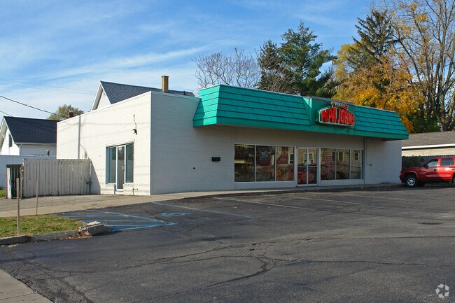
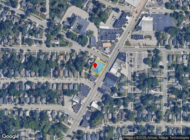
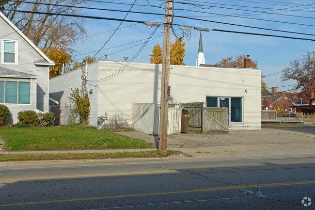
2157 Plainfield Ave Ne, Grand Rapids, MI 49505
NEARBY LISTINGS FOR SALE OR LEASE
Property Detail
2157 Plainfield Ave Ne
41-14-07-451-052
Of Riverside Gardens Add
Restaurantbuilding
THAT PART OF LOT 1 LYING ELY OF ELY LINE OF LOT 211 OF RIVERSIDE GARDENS ADD NO.6 EXT SLY * THE HEIGHTS * ALSO LOT 210 *
X
Kent
26081C0294D
Michigan
2024
0.26 AC
2025
Central Grand Rapids
001000
West Michigan
2,640 SF
Grand Rapids-Wyoming, MI
DEMOGRAPHICS near 2157 Plainfield Ave Ne
1 Mile
3 Mile
5 Mile
2024 Total Population
14,203
96,931
202,775
2029 Population
14,231
97,161
203,686
Pop Growth 2024-2029
+ 0.20%
+ 0.24%
+ 0.45%
Average Age
39
37
37
2024 Total Households
5,997
42,851
82,885
HH Growth 2024-2029
+ 0.22%
+ 0.34%
+ 0.52%
Median Household Inc
$67,391
$59,964
$65,040
Avg Household Size
2.30
2.20
2.30
2024 Avg HH Vehicles
2.00
2.00
2.00
Median Home Value
$194,743
$209,207
$229,487
Median Year Built
1949
1955
1958
Nearby Places
Map Layers
Map Styles
 Street
 Aerial
- Restaurants
- Banks
- Shops
- Fitness
- Groceries
PUBLIC TRANSPORTATION
COMMUTER RAIL
DRIVE
WALK
Distance
9 min
4.0 mi
AIRPORT
Gerald R Ford International
DRIVE
WALK
Distance
Gerald R Ford International
26 min
16.6 mi
Nearby Properties
Address
Land Use
TOTAL SIZE
Lot Size
Zoning
Address
Land Use
TOTAL SIZE
Lot Size
Zoning
226,925 SF
1.32 AC
TN-CC
Address
Land Use
TOTAL SIZE
Lot Size
Zoning
557,931 SF
2.12 AC
TN-CC
Address
Land Use
TOTAL SIZE
Lot Size
Zoning
537,080 SF
46.61 AC
RPUD - 2
Address
Land Use
TOTAL SIZE
Lot Size
Zoning
546,366 SF
28.40 AC
MH
Address
Land Use
TOTAL SIZE
Lot Size
Zoning
211,760 SF
TN-CC
Address
Land Use
TOTAL SIZE
Lot Size
Zoning
768,153 SF
3.20 AC
TN-CC
Address
Land Use
TOTAL SIZE
Lot Size
Zoning
347,500 SF
1.51 AC
TN-CC
Address
Land Use
TOTAL SIZE
Lot Size
Zoning
491,288 SF
2.79 AC
SD-PRD
Address
Land Use
TOTAL SIZE
Lot Size
Zoning
451,792 SF
32.60 AC
ARM - MULT
Address
Land Use
TOTAL SIZE
Lot Size
Zoning
138,122 SF
1.01 AC
TN-CC
Address
Land Use
TOTAL SIZE
Lot Size
Zoning
Address
Land Use
TOTAL SIZE
Lot Size
Zoning
281,488 SF
1.20 AC
TN-CC
Address
Land Use
TOTAL SIZE
Lot Size
Zoning
257,381 SF
7.08 AC
SD-PRD
Address
Land Use
TOTAL SIZE
Lot Size
Zoning
145,306 SF
0.75 AC
TN-CC
Address
Land Use
TOTAL SIZE
Lot Size
Zoning
Address
Land Use
TOTAL SIZE
Lot Size
Zoning
201,100 SF
0.90 AC
TN-CC
Address
Land Use
TOTAL SIZE
Lot Size
Zoning
18.07 AC
MON-LDR
Address
Land Use
TOTAL SIZE
Lot Size
Zoning
94,556 SF
1.03 AC
TN-TCC
Address
Land Use
TOTAL SIZE
Lot Size
Zoning
21.77 AC
MCN-MDR
Address
Land Use
TOTAL SIZE
Lot Size
Zoning
47,370 SF
8.18 AC
MON-LDR
Address
Land Use
TOTAL SIZE
Lot Size
Zoning
88,327 SF
2.74 AC
TN-CC
Address
Land Use
TOTAL SIZE
Lot Size
Zoning
366,447 SF
2.71 AC
TN-CC
Address
Land Use
TOTAL SIZE
Lot Size
Zoning
18.65 AC
MCN-MDR
Address
Land Use
TOTAL SIZE
Lot Size
Zoning
363,503 SF
2.20 AC
TN-CC
Address
Land Use
TOTAL SIZE
Lot Size
Zoning
68,560 SF
2.76 AC
TN-TCC
Address
Land Use
TOTAL SIZE
Lot Size
Zoning
Address
Land Use
TOTAL SIZE
Lot Size
Zoning
254,941 SF
0.79 AC
TN-CC
Address
Land Use
TOTAL SIZE
Lot Size
Zoning
109,482 SF
1.35 AC
SD-PRD
Address
Land Use
TOTAL SIZE
Lot Size
Zoning
310,790 SF
0.66 AC
TN-CC
Address
Land Use
TOTAL SIZE
Lot Size
Zoning
33.06 AC
R-3
The World's #1 Commercial Real Estate Marketplace
Connect with us
© 2025 CoStar Group
The information above has been obtained from sources believed reliable. While we do not doubt its accuracy we have not verified it and make no guarantee, warranty or representation about it. It is your responsibility to independently confirm its accuracy and completeness. Any projections, opinions, assumptions, or estimates used are for example only and do not represent the current or future performance of the property. The value of this transaction to you depends on tax and other factors which should be evaluated by your tax, financial, and legal advisors. You and your advisors should conduct a careful, independent investigation of the property to determine to your satisfaction the suitability of the property for your needs.