Property Record
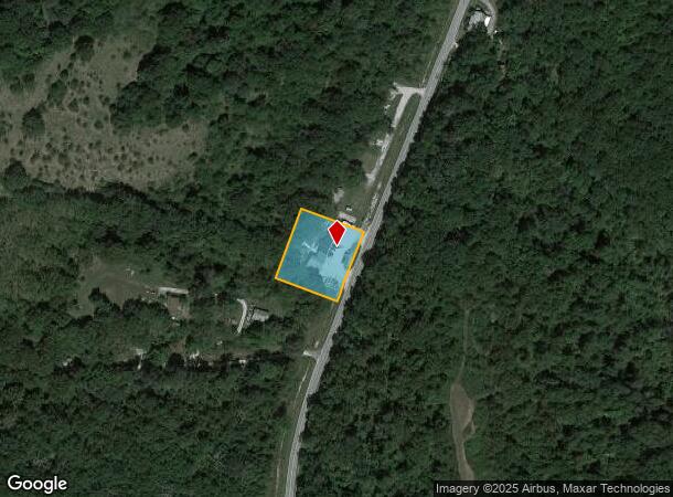
21591 Main St, Reeds Spring, MO 65737

NEARBY LISTINGS FOR SALE OR LEASE
Property Detail
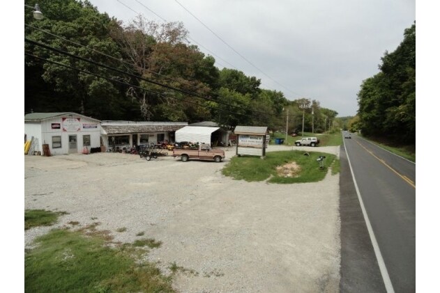
21591 Main St
Autorepair
BEG AT NE COR OF TRACT DESC AT BK 90 PG 309, AT THE INTERSECTION OF W R/W OF HWY 13, NE ALONG R/W 210 FT, NW 210 FT, SW 210 FT, SE 210 FT TO P O B
X
Stone
29209C0182D
Missouri
2024
1 AC
2025
Branson
090606
Other Market Areas
3,293 SF
08-7.0-35-000-000-017.000
DEMOGRAPHICS near 21591 Main St
1 Mile
3 Mile
5 Mile
2024 Total Population
1,204
2,659
4,965
2029 Population
1,283
2,844
5,342
Pop Growth 2024-2029
+ 6.56%
+ 6.96%
+ 7.59%
Average Age
42
43
44
2024 Total Households
473
1,047
1,982
HH Growth 2024-2029
+ 5.71%
+ 6.11%
+ 7.01%
Median Household Inc
$36,484
$41,085
$51,755
Avg Household Size
2.50
2.50
2.40
2024 Avg HH Vehicles
2.00
2.00
2.00
Median Home Value
$136,046
$158,365
$187,750
Median Year Built
1988
1990
1993
Nearby Places
Map Layers
Map Styles
 Street
 Aerial
- Restaurants
- Banks
- Shops
- Fitness
- Groceries
Nearby Properties
Address
Land Use
TOTAL SIZE
Lot Size
Zoning
Address
Land Use
TOTAL SIZE
Lot Size
Zoning
108,452 SF
47.84 AC
A-1
Address
Land Use
TOTAL SIZE
Lot Size
Zoning
153,535 SF
18.72 AC
NA
Address
Land Use
TOTAL SIZE
Lot Size
Zoning
6,000 SF
11.93 AC
NA
Address
Land Use
TOTAL SIZE
Lot Size
Zoning
74,763 SF
28.27 AC
NA
Address
Land Use
TOTAL SIZE
Lot Size
Zoning
14,748 SF
1.60 AC
NA
Address
Land Use
TOTAL SIZE
Lot Size
Zoning
15,000 SF
2.32 AC
NA
Address
Land Use
TOTAL SIZE
Lot Size
Zoning
93,998 SF
39 AC
NA
Address
Land Use
TOTAL SIZE
Lot Size
Zoning
23,640 SF
29.64 AC
NA
Address
Land Use
TOTAL SIZE
Lot Size
Zoning
25,052 SF
3.98 AC
NA
Address
Land Use
TOTAL SIZE
Lot Size
Zoning
8,100 SF
1.13 AC
Address
Land Use
TOTAL SIZE
Lot Size
Zoning
9,064 SF
1.40 AC
RR-1
Address
Land Use
TOTAL SIZE
Lot Size
Zoning
3,520 SF
1.30 AC
Address
Land Use
TOTAL SIZE
Lot Size
Zoning
5,932 SF
1.87 AC
NA
Address
Land Use
TOTAL SIZE
Lot Size
Zoning
8,964 SF
1.76 AC
NA
Address
Land Use
TOTAL SIZE
Lot Size
Zoning
6,625 SF
3.83 AC
NA
Address
Land Use
TOTAL SIZE
Lot Size
Zoning
15,039 SF
2 AC
NA
Address
Land Use
TOTAL SIZE
Lot Size
Zoning
9,974 SF
1.05 AC
NA
Address
Land Use
TOTAL SIZE
Lot Size
Zoning
12,338 SF
7.81 AC
C-2
Address
Land Use
TOTAL SIZE
Lot Size
Zoning
9,000 SF
1.80 AC
NA
Address
Land Use
TOTAL SIZE
Lot Size
Zoning
3,243 SF
6.80 AC
NA
Address
Land Use
TOTAL SIZE
Lot Size
Zoning
6,634 SF
24.06 AC
NA
Address
Land Use
TOTAL SIZE
Lot Size
Zoning
43,104 SF
5.86 AC
C-2
Address
Land Use
TOTAL SIZE
Lot Size
Zoning
5,249 SF
1.30 AC
NA
Address
Land Use
TOTAL SIZE
Lot Size
Zoning
22,500 SF
12.15 AC
NA
Address
Land Use
TOTAL SIZE
Lot Size
Zoning
3,321 SF
2.60 AC
R-1
Address
Land Use
TOTAL SIZE
Lot Size
Zoning
11,633 SF
13.80 AC
C-2
Address
Land Use
TOTAL SIZE
Lot Size
Zoning
3,192 SF
3.50 AC
C-2
Address
Land Use
TOTAL SIZE
Lot Size
Zoning
148,380 SF
38.15 AC
C-2
Address
Land Use
TOTAL SIZE
Lot Size
Zoning
16,320 SF
3.50 AC
NA
Address
Land Use
TOTAL SIZE
Lot Size
Zoning
18,200 SF
2.04 AC
NA
The World's #1 Commercial Real Estate Marketplace
Connect with us
© 2026 CoStar Group
The information above has been obtained from sources believed reliable. While we do not doubt its accuracy we have not verified it and make no guarantee, warranty or representation about it. It is your responsibility to independently confirm its accuracy and completeness. Any projections, opinions, assumptions, or estimates used are for example only and do not represent the current or future performance of the property. The value of this transaction to you depends on tax and other factors which should be evaluated by your tax, financial, and legal advisors. You and your advisors should conduct a careful, independent investigation of the property to determine to your satisfaction the suitability of the property for your needs.