Property Record
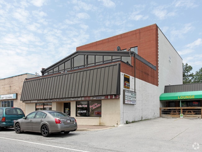
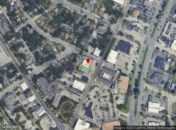
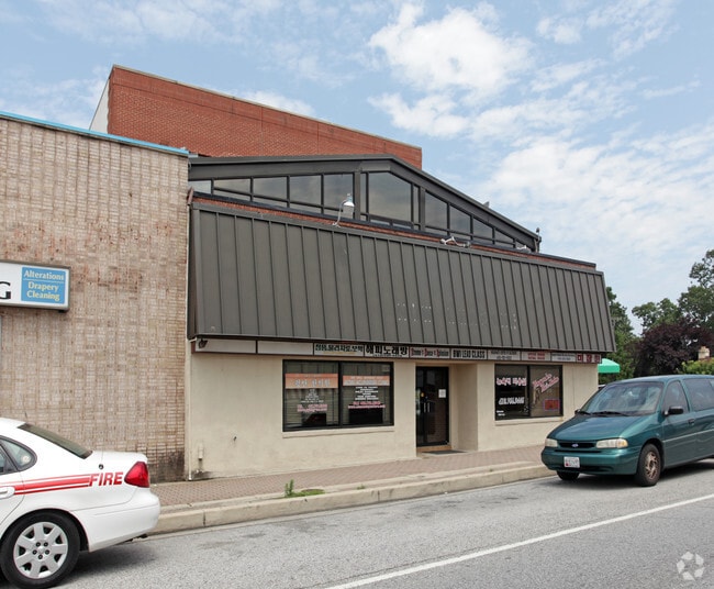
216 Crain Hwy N, Glen Burnie, MD 21061

Current Lease Availabilities
NEARBY LISTINGS FOR SALE OR LEASE
Property Detail
216 Crain Hwy N
Baltimore-Columbia-Towson, MD
Glen Burnie
05-326-15806700
LT 5 BK 3 GLEN BURNIE
Officebuilding
Anne Arundel
X
Maryland
24003C0061F
5
2024
0.18 AC
2025
Route 2 Corridor North
750900
Baltimore
14,225 SF
DEMOGRAPHICS near 216 Crain Hwy N
1 Mile
3 Mile
5 Mile
2024 Total Population
11,041
90,444
192,278
2029 Population
11,243
92,317
195,958
Pop Growth 2024-2029
+ 1.83%
+ 2.07%
+ 1.91%
Average Age
41
39
39
2024 Total Households
4,070
34,720
71,316
HH Growth 2024-2029
+ 1.82%
+ 2.10%
+ 1.99%
Median Household Inc
$78,649
$80,209
$89,853
Avg Household Size
2.70
2.50
2.60
2024 Avg HH Vehicles
2.00
2.00
2.00
Median Home Value
$281,233
$307,016
$335,977
Median Year Built
1955
1973
1975
Nearby Places
Map Layers
Map Styles
 Street
 Aerial
- Restaurants
- Banks
- Shops
- Fitness
- Groceries
PUBLIC TRANSPORTATION
TRANSIT/SUBWAY
Cromwell Station/Glen Burnie (Timonium & Cromwell - Maryland Transit Administration Light Rail (Baltimore Light Rail))
DRIVE
WALK
Distance
Cromwell Station/Glen Burnie (Timonium & Cromwell - Maryland Transit Administration Light Rail (Baltimore Light Rail))
1 min
13 min
0.7 mi
COMMUTER RAIL
Bwi Airport (Penn Line - Maryland Area Regional Commuter Trains (The MARC))
DRIVE
WALK
Distance
Bwi Airport (Penn Line - Maryland Area Regional Commuter Trains (The MARC))
12 min
6.1 mi
St Denis (Camden Line - Maryland Area Regional Commuter Trains (The MARC))
DRIVE
WALK
Distance
St Denis (Camden Line - Maryland Area Regional Commuter Trains (The MARC))
15 min
8.3 mi
AIRPORT
Baltimore/Washington International Thurgood Marshall
DRIVE
WALK
Distance
Baltimore/Washington International Thurgood Marshall
11 min
5.6 mi
Freight Ports
Port of Baltimore
DRIVE
WALK
Distance
Port of Baltimore
19 min
10.7 mi
Nearby Properties
Address
Land Use
TOTAL SIZE
Lot Size
Zoning
Address
Land Use
TOTAL SIZE
Lot Size
Zoning
637,060 SF
22.19 AC
C2
Address
Land Use
TOTAL SIZE
Lot Size
Zoning
467.03 AC
W2
Address
Land Use
TOTAL SIZE
Lot Size
Zoning
32.18 AC
R15
Address
Land Use
TOTAL SIZE
Lot Size
Zoning
176,405 SF
41.81 AC
C3
Address
Land Use
TOTAL SIZE
Lot Size
Zoning
383,697 SF
68.35 AC
R5
Address
Land Use
TOTAL SIZE
Lot Size
Zoning
60,200 SF
778.66 AC
R1
Address
Land Use
TOTAL SIZE
Lot Size
Zoning
11.57 AC
R22
Address
Land Use
TOTAL SIZE
Lot Size
Zoning
778.66 AC
R1
Address
Land Use
TOTAL SIZE
Lot Size
Zoning
289,829 SF
24.56 AC
C3
Address
Land Use
TOTAL SIZE
Lot Size
Zoning
28.02 AC
R15
Address
Land Use
TOTAL SIZE
Lot Size
Zoning
19.20 AC
R15
Address
Land Use
TOTAL SIZE
Lot Size
Zoning
14.21 AC
R15
Address
Land Use
TOTAL SIZE
Lot Size
Zoning
1,555.10 AC
R1
Address
Land Use
TOTAL SIZE
Lot Size
Zoning
15.33 AC
R15
Address
Land Use
TOTAL SIZE
Lot Size
Zoning
12.90 AC
R15
Address
Land Use
TOTAL SIZE
Lot Size
Zoning
233,408 SF
24.73 AC
C3
Address
Land Use
TOTAL SIZE
Lot Size
Zoning
21.45 AC
R15
Address
Land Use
TOTAL SIZE
Lot Size
Zoning
14.53 AC
R22
Address
Land Use
TOTAL SIZE
Lot Size
Zoning
14.58 AC
R22
Address
Land Use
TOTAL SIZE
Lot Size
Zoning
16.72 AC
R15
Address
Land Use
TOTAL SIZE
Lot Size
Zoning
7.07 AC
R15
Address
Land Use
TOTAL SIZE
Lot Size
Zoning
5.95 AC
R22
Address
Land Use
TOTAL SIZE
Lot Size
Zoning
277,203 SF
15.88 AC
R15
Address
Land Use
TOTAL SIZE
Lot Size
Zoning
9.45 AC
R22
Address
Land Use
TOTAL SIZE
Lot Size
Zoning
16.26 AC
R15
Address
Land Use
TOTAL SIZE
Lot Size
Zoning
187,814 SF
38.47 AC
R5
Address
Land Use
TOTAL SIZE
Lot Size
Zoning
12 AC
C3
Address
Land Use
TOTAL SIZE
Lot Size
Zoning
119,220 SF
6.99 AC
W1
Address
Land Use
TOTAL SIZE
Lot Size
Zoning
10.92 AC
R15
Address
Land Use
TOTAL SIZE
Lot Size
Zoning
218,565 SF
20.87 AC
C3
The World's #1 Commercial Real Estate Marketplace
Connect with us
© 2025 CoStar Group
The information above has been obtained from sources believed reliable. While we do not doubt its accuracy we have not verified it and make no guarantee, warranty or representation about it. It is your responsibility to independently confirm its accuracy and completeness. Any projections, opinions, assumptions, or estimates used are for example only and do not represent the current or future performance of the property. The value of this transaction to you depends on tax and other factors which should be evaluated by your tax, financial, and legal advisors. You and your advisors should conduct a careful, independent investigation of the property to determine to your satisfaction the suitability of the property for your needs.