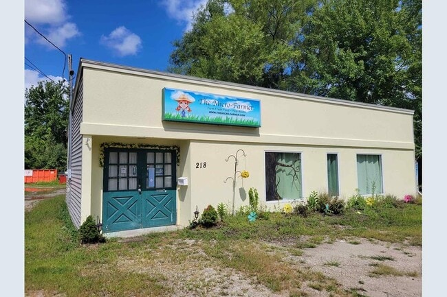
Property Record
214 Central St, Hudson, NH 03051
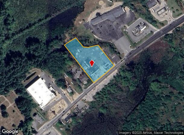
NEARBY LISTINGS FOR SALE OR LEASE
Property Detail
214 Central St
Commercialofficeresidentialmixeduse
Hillsborough
A
New Hampshire
33011C0518D
2.17 AC
2024
Hillsborough
2024
Boston
012202
Manchester-Nashua, NH
11,288 SF
HDSO-000176-000026
DEMOGRAPHICS near 214 Central St
1 Mile
3 Mile
5 Mile
2024 Total Population
4,771
43,347
110,379
2029 Population
4,917
44,334
112,881
Pop Growth 2024-2029
+ 3.06%
+ 2.28%
+ 2.27%
Average Age
42
41
41
2024 Total Households
1,801
17,541
43,892
HH Growth 2024-2029
+ 3.00%
+ 2.25%
+ 2.26%
Median Household Inc
$117,885
$84,524
$94,635
Avg Household Size
2.60
2.40
2.40
2024 Avg HH Vehicles
2.00
2.00
2.00
Median Home Value
$366,134
$370,855
$374,876
Median Year Built
1985
1971
1975
Nearby Places
- Restaurants
- Banks
- Shops
- Fitness
- Groceries
PUBLIC TRANSPORTATION
AIRPORT
Manchester Boston Regional
DRIVE
WALK
Distance
Manchester Boston Regional
32 min
17.7 mi
Freight Ports
Port of Boston
DRIVE
WALK
Distance
Port of Boston
67 min
46.6 mi
SALE & LEASE HISTORY
LISTING DATE
SALE/LEASE

Mar 23, 2018
For Lease
Jul 31, 2023
For Lease
Nearby Properties
Address
Land Use
TOTAL SIZE
Lot Size
Zoning
Address
Land Use
TOTAL SIZE
Lot Size
Zoning
27.98 AC
GI
Address
Land Use
TOTAL SIZE
Lot Size
Zoning
522,476 SF
74.89 AC
GD
Address
Land Use
TOTAL SIZE
Lot Size
Zoning
220,295 SF
4.34 AC
D1MU
Address
Land Use
TOTAL SIZE
Lot Size
Zoning
5.30 AC
GIMU
Address
Land Use
TOTAL SIZE
Lot Size
Zoning
133,390 SF
97.42 AC
R2
Address
Land Use
TOTAL SIZE
Lot Size
Zoning
231,216 SF
1.88 AC
GIMU
Address
Land Use
TOTAL SIZE
Lot Size
Zoning
188,520 SF
111.12 AC
GD
Address
Land Use
TOTAL SIZE
Lot Size
Zoning
37.57 AC
R9
Address
Land Use
TOTAL SIZE
Lot Size
Zoning
8.87 AC
RC
Address
Land Use
TOTAL SIZE
Lot Size
Zoning
21.16 AC
D3MU
Address
Land Use
TOTAL SIZE
Lot Size
Zoning
312,738 SF
25.84 AC
ID
Address
Land Use
TOTAL SIZE
Lot Size
Zoning
185,242 SF
35.75 AC
ID
Address
Land Use
TOTAL SIZE
Lot Size
Zoning
160,329 SF
16.13 AC
RB
Address
Land Use
TOTAL SIZE
Lot Size
Zoning
28.33 AC
GI
Address
Land Use
TOTAL SIZE
Lot Size
Zoning
243,335 SF
2.71 AC
GIMU
Address
Land Use
TOTAL SIZE
Lot Size
Zoning
127,825 SF
D1MU
Address
Land Use
TOTAL SIZE
Lot Size
Zoning
148,042 SF
28.53 AC
R2
Address
Land Use
TOTAL SIZE
Lot Size
Zoning
162,163 SF
14.23 AC
ID
Address
Land Use
TOTAL SIZE
Lot Size
Zoning
80,863 SF
18 AC
R1
Address
Land Use
TOTAL SIZE
Lot Size
Zoning
5.80 AC
GI
Address
Land Use
TOTAL SIZE
Lot Size
Zoning
57,128 SF
10.60 AC
BD
Address
Land Use
TOTAL SIZE
Lot Size
Zoning
2,724 SF
43.90 AC
RA
Address
Land Use
TOTAL SIZE
Lot Size
Zoning
2.22 AC
GI
Address
Land Use
TOTAL SIZE
Lot Size
Zoning
161 AC
R9
Address
Land Use
TOTAL SIZE
Lot Size
Zoning
84,710 SF
16.24 AC
BD
Address
Land Use
TOTAL SIZE
Lot Size
Zoning
27,847 SF
5.13 AC
BD
Address
Land Use
TOTAL SIZE
Lot Size
Zoning
51,564 SF
1.81 AC
RC
Address
Land Use
TOTAL SIZE
Lot Size
Zoning
81,662 SF
14.01 AC
R2
Address
Land Use
TOTAL SIZE
Lot Size
Zoning
12,876 SF
12.55 AC
BD
Address
Land Use
TOTAL SIZE
Lot Size
Zoning
119,504 SF
1.99 AC
D1MU
The World's #1 Commercial Real Estate Marketplace
Connect with us
© 2025 CoStar Group
The information above has been obtained from sources believed reliable. While we do not doubt its accuracy we have not verified it and make no guarantee, warranty or representation about it. It is your responsibility to independently confirm its accuracy and completeness. Any projections, opinions, assumptions, or estimates used are for example only and do not represent the current or future performance of the property. The value of this transaction to you depends on tax and other factors which should be evaluated by your tax, financial, and legal advisors. You and your advisors should conduct a careful, independent investigation of the property to determine to your satisfaction the suitability of the property for your needs.