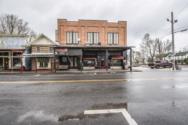
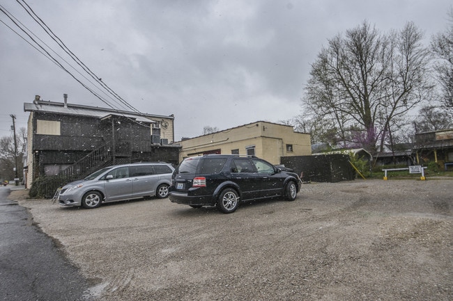
Property Record
216 E Main St, Glendale, KY 42740

Property Detail
216 E Main St
190-30-01-011
Hardin
Commercialnec
Kentucky
B and X Area of moderate flood hazard, usually the area between the limits of the 100-year and 500-year floods.
0.24 AC
2025
Kentucky West Area
2025
Other Market Areas
001603
Elizabethtown, KY
NEARBY LISTINGS FOR SALE OR LEASE
DEMOGRAPHICS near 216 E Main St
1 mile
3 mile
5 mile
2025 Total Population
444
2,529
8,432
2030 Population
439
2,519
8,485
Pop Growth 2025-2030
(1.13%)
(0.40%)
+ 0.63%
Average Age
42
42
40
2025 Total Households
167
952
3,065
HH Growth 2025-2030
(0.60%)
(0.21%)
+ 0.82%
Median Household Inc
$108,750
$99,476
$83,738
Avg Household Size
2.60
2.60
2.60
2025 Avg HH Vehicles
3.00
3.00
2.00
Median Home Value
$412,903
$356,140
$284,789
Median Year Built
1992
1993
1995
Nearby Places
Map Layers
Map Styles
 Street
 Aerial
Layers
 Traffic
 Biking
Places
Listings with unknown addresses are not visible on the map
- Restaurants
- Banks
- Shops
- Fitness
- Groceries
SALE & LEASE HISTORY
LISTING DATE
SALE/LEASE

Oct 27, 2016
For Sale
Feb 12, 2021
For Sale
Dec 20, 2019
For Sale
Nearby Properties
Address
Land Use
TOTAL SIZE
Lot Size
Zoning
Address
Land Use
TOTAL SIZE
Lot Size
Zoning
1,219 SF
1,503.41 AC
Address
Land Use
TOTAL SIZE
Lot Size
Zoning
Address
Land Use
TOTAL SIZE
Lot Size
Zoning
Address
Land Use
TOTAL SIZE
Lot Size
Zoning
Address
Land Use
TOTAL SIZE
Lot Size
Zoning
Address
Land Use
TOTAL SIZE
Lot Size
Zoning
1,120 SF
12.74 AC
Address
Land Use
TOTAL SIZE
Lot Size
Zoning
Address
Land Use
TOTAL SIZE
Lot Size
Zoning
Address
Land Use
TOTAL SIZE
Lot Size
Zoning
Address
Land Use
TOTAL SIZE
Lot Size
Zoning
Address
Land Use
TOTAL SIZE
Lot Size
Zoning
912 SF
0.37 AC
Address
Land Use
TOTAL SIZE
Lot Size
Zoning
Address
Land Use
TOTAL SIZE
Lot Size
Zoning
Address
Land Use
TOTAL SIZE
Lot Size
Zoning
1,176 SF
Address
Land Use
TOTAL SIZE
Lot Size
Zoning
43.12 AC
Address
Land Use
TOTAL SIZE
Lot Size
Zoning
Address
Land Use
TOTAL SIZE
Lot Size
Zoning
Address
Land Use
TOTAL SIZE
Lot Size
Zoning
2,497 SF
25 AC
Address
Land Use
TOTAL SIZE
Lot Size
Zoning
Address
Land Use
TOTAL SIZE
Lot Size
Zoning
Address
Land Use
TOTAL SIZE
Lot Size
Zoning
13.52 AC
Address
Land Use
TOTAL SIZE
Lot Size
Zoning
4,930 SF
91 AC
Address
Land Use
TOTAL SIZE
Lot Size
Zoning
4,100 SF
31.51 AC
Address
Land Use
TOTAL SIZE
Lot Size
Zoning
1,734 SF
87.90 AC
Address
Land Use
TOTAL SIZE
Lot Size
Zoning
2,968 SF
321 AC
Address
Land Use
TOTAL SIZE
Lot Size
Zoning
1,872 SF
41.09 AC
Address
Land Use
TOTAL SIZE
Lot Size
Zoning
3,493 SF
22.40 AC
Address
Land Use
TOTAL SIZE
Lot Size
Zoning
1.61 AC
Address
Land Use
TOTAL SIZE
Lot Size
Zoning
3,023 SF
5 AC
Address
Land Use
TOTAL SIZE
Lot Size
Zoning
1,462 SF
49 AC
The World's #1 Commercial Real Estate Marketplace
Connect with us
© 2026 CoStar Group
The information above has been obtained from sources believed reliable. While we do not doubt its accuracy we have not verified it and make no guarantee, warranty or representation about it. It is your responsibility to independently confirm its accuracy and completeness. Any projections, opinions, assumptions, or estimates used are for example only and do not represent the current or future performance of the property. The value of this transaction to you depends on tax and other factors which should be evaluated by your tax, financial, and legal advisors. You and your advisors should conduct a careful, independent investigation of the property to determine to your satisfaction the suitability of the property for your needs.