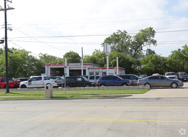
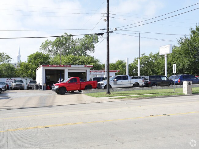
Property Record
216 E Northwest Hwy, Grapevine, TX 76051
NEARBY LISTINGS FOR SALE OR LEASE
Property Detail
216 E Northwest Hwy
Dallas-Fort Worth-Arlington, TX
Main Addition
04000374
430 MAIN ADDITION BLOCK 1 LOT 1
Commercialnec
Tarrant
X
Texas
48113C0150K
1
2024
0.71 AC
2025
Grapevine/Colleyville
113712
Dallas/Ft Worth
8,976 SF
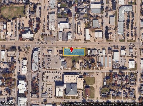
DEMOGRAPHICS near 216 E Northwest Hwy
1 mile
3 mile
5 mile
2024 Total Population
10,873
37,357
113,910
2029 Population
11,484
39,408
121,268
Pop Growth 2024-2029
+ 5.62%
+ 5.49%
+ 6.46%
Average Age
41
39
39
2024 Total Households
4,862
15,424
42,919
HH Growth 2024-2029
+ 5.57%
+ 5.28%
+ 6.64%
Median Household Inc
$86,109
$88,299
$121,216
Avg Household Size
2.20
2.40
2.60
2024 Avg HH Vehicles
2.00
2.00
2.00
Median Home Value
$413,528
$404,104
$484,404
Median Year Built
1993
1988
1994
Nearby Places
Map Layers
Map Styles
 Street
 Aerial
Transit
 Traffic
 Biking
Places
Listings with unknown addresses are not visible on the map
- Restaurants
- Banks
- Shops
- Fitness
- Groceries
PUBLIC TRANSPORTATION
COMMUTER RAIL
Drive
Walk
Distance
17 min
9.7 mi
Drive
Walk
Distance
17 min
10.0 mi
AIRPORT
Dallas-Fort Worth International
Drive
Walk
Distance
Dallas-Fort Worth International
11 min
6.0 mi
Dallas Love Field
Drive
Walk
Distance
Dallas Love Field
29 min
20.1 mi
Nearby Properties
Address
Land Use
TOTAL SIZE
Lot Size
Zoning
Address
Land Use
TOTAL SIZE
Lot Size
Zoning
7,321,782 SF
0.01 AC
Z392
Address
Land Use
TOTAL SIZE
Lot Size
Zoning
3,233,905 SF
51.24 AC
Address
Land Use
TOTAL SIZE
Lot Size
Zoning
2,545,604 SF
123.01 AC
Z402
Address
Land Use
TOTAL SIZE
Lot Size
Zoning
1,325,709 SF
124.50 AC
Address
Land Use
TOTAL SIZE
Lot Size
Zoning
680,063 SF
36.51 AC
Address
Land Use
TOTAL SIZE
Lot Size
Zoning
432,986 SF
10.57 AC
Address
Land Use
TOTAL SIZE
Lot Size
Zoning
500,000 SF
99.10 AC
Address
Land Use
TOTAL SIZE
Lot Size
Zoning
332,665 SF
9.83 AC
Address
Land Use
TOTAL SIZE
Lot Size
Zoning
630,765 SF
321.80 AC
Address
Land Use
TOTAL SIZE
Lot Size
Zoning
397,272 SF
12.35 AC
Address
Land Use
TOTAL SIZE
Lot Size
Zoning
457,738 SF
28.49 AC
Address
Land Use
TOTAL SIZE
Lot Size
Zoning
360,898 SF
5.51 AC
Address
Land Use
TOTAL SIZE
Lot Size
Zoning
464,476 SF
5.08 AC
Address
Land Use
TOTAL SIZE
Lot Size
Zoning
389,286 SF
21.86 AC
Address
Land Use
TOTAL SIZE
Lot Size
Zoning
397,935 SF
10.65 AC
Address
Land Use
TOTAL SIZE
Lot Size
Zoning
321,993 SF
18.20 AC
Address
Land Use
TOTAL SIZE
Lot Size
Zoning
263,119 SF
11.01 AC
Address
Land Use
TOTAL SIZE
Lot Size
Zoning
264,000 SF
15.06 AC
Address
Land Use
TOTAL SIZE
Lot Size
Zoning
329,353 SF
7.90 AC
Address
Land Use
TOTAL SIZE
Lot Size
Zoning
234,200 SF
274.75 AC
Address
Land Use
TOTAL SIZE
Lot Size
Zoning
270,453 SF
17.48 AC
Address
Land Use
TOTAL SIZE
Lot Size
Zoning
297,500 SF
99.10 AC
Address
Land Use
TOTAL SIZE
Lot Size
Zoning
320.42 AC
Address
Land Use
TOTAL SIZE
Lot Size
Zoning
235,902 SF
16.20 AC
Address
Land Use
TOTAL SIZE
Lot Size
Zoning
305,047 SF
10.16 AC
Address
Land Use
TOTAL SIZE
Lot Size
Zoning
77.10 AC
Z402
Address
Land Use
TOTAL SIZE
Lot Size
Zoning
150,510 SF
6.35 AC
Address
Land Use
TOTAL SIZE
Lot Size
Zoning
214,908 SF
13.55 AC
Address
Land Use
TOTAL SIZE
Lot Size
Zoning
384,878 SF
20 AC
Address
Land Use
TOTAL SIZE
Lot Size
Zoning
208,250 SF
99.10 AC
The World's #1 Commercial Real Estate Marketplace
Connect with us
© 2026 CoStar Group
The information above has been obtained from sources believed reliable. While we do not doubt its accuracy we have not verified it and make no guarantee, warranty or representation about it. It is your responsibility to independently confirm its accuracy and completeness. Any projections, opinions, assumptions, or estimates used are for example only and do not represent the current or future performance of the property. The value of this transaction to you depends on tax and other factors which should be evaluated by your tax, financial, and legal advisors. You and your advisors should conduct a careful, independent investigation of the property to determine to your satisfaction the suitability of the property for your needs.