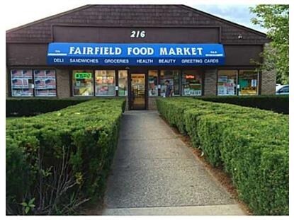
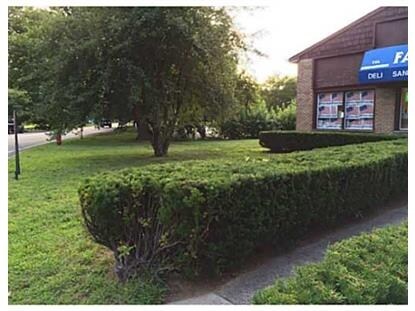
Property Record
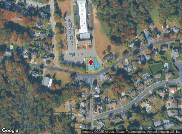
216 Horseneck Rd, Fairfield, NJ 07004
NEARBY LISTINGS FOR SALE OR LEASE
Property Detail
216 Horseneck Rd
07-05003-0000-00017
195X150
Officebuilding
Essex
AE
New Jersey
34027C0189F
17
2023
0.67 AC
2025
Suburban Essex/Rt 280
021601
Northern New Jersey
3,300 SF
Newark, NJ-PA
DEMOGRAPHICS near 216 Horseneck Rd
1 Mile
3 Mile
5 Mile
2024 Total Population
3,908
40,699
155,698
2029 Population
3,870
40,408
155,006
Pop Growth 2024-2029
(0.97%)
(0.72%)
(0.44%)
Average Age
43
43
43
2024 Total Households
1,328
15,059
57,462
HH Growth 2024-2029
(1.13%)
(0.82%)
(0.56%)
Median Household Inc
$98,519
$119,192
$122,552
Avg Household Size
2.90
2.60
2.60
2024 Avg HH Vehicles
2.00
2.00
2.00
Median Home Value
$587,625
$589,251
$587,985
Median Year Built
1966
1967
1966
Nearby Places
Map Layers
Map Styles
 Street
 Aerial
- Restaurants
- Banks
- Shops
- Fitness
- Groceries
PUBLIC TRANSPORTATION
COMMUTER RAIL
Wayne/Route 23 Transit Center (Montclair-Boonton Line - NJ Transit Commuter Rail (NJ Transit))
DRIVE
WALK
Distance
Wayne/Route 23 Transit Center (Montclair-Boonton Line - NJ Transit Commuter Rail (NJ Transit))
9 min
5.1 mi
Lincoln Park (Montclair-Boonton Line - NJ Transit Commuter Rail (NJ Transit))
DRIVE
WALK
Distance
Lincoln Park (Montclair-Boonton Line - NJ Transit Commuter Rail (NJ Transit))
12 min
6.2 mi
AIRPORT
Newark Liberty International
DRIVE
WALK
Distance
Newark Liberty International
30 min
24.9 mi
LaGuardia
DRIVE
WALK
Distance
LaGuardia
47 min
33.2 mi
Freight Ports
Port Newark Container Terminal
DRIVE
WALK
Distance
Port Newark Container Terminal
35 min
24.2 mi
Nearby Properties
Address
Land Use
TOTAL SIZE
Lot Size
Zoning
Address
Land Use
TOTAL SIZE
Lot Size
Zoning
667,698 SF
38.15 AC
Address
Land Use
TOTAL SIZE
Lot Size
Zoning
74.58 AC
S
Address
Land Use
TOTAL SIZE
Lot Size
Zoning
48.85 AC
R-3B
Address
Land Use
TOTAL SIZE
Lot Size
Zoning
98.27 AC
AH1
Address
Land Use
TOTAL SIZE
Lot Size
Zoning
4.60 AC
Address
Land Use
TOTAL SIZE
Lot Size
Zoning
119,552 SF
129 AC
I1A
Address
Land Use
TOTAL SIZE
Lot Size
Zoning
8,600 SF
27.27 AC
L3
Address
Land Use
TOTAL SIZE
Lot Size
Zoning
84.70 AC
Address
Land Use
TOTAL SIZE
Lot Size
Zoning
17.90 AC
B-2
Address
Land Use
TOTAL SIZE
Lot Size
Zoning
67.49 AC
Address
Land Use
TOTAL SIZE
Lot Size
Zoning
243,660 SF
20.53 AC
Address
Land Use
TOTAL SIZE
Lot Size
Zoning
27.50 AC
M-2
Address
Land Use
TOTAL SIZE
Lot Size
Zoning
38.40 AC
Address
Land Use
TOTAL SIZE
Lot Size
Zoning
Address
Land Use
TOTAL SIZE
Lot Size
Zoning
136,500 SF
12.65 AC
HD
Address
Land Use
TOTAL SIZE
Lot Size
Zoning
7,507 SF
18.82 AC
L-1
Address
Land Use
TOTAL SIZE
Lot Size
Zoning
259,325 SF
13.62 AC
I1A
Address
Land Use
TOTAL SIZE
Lot Size
Zoning
140,560 SF
49.81 AC
R27A
Address
Land Use
TOTAL SIZE
Lot Size
Zoning
10.69 AC
M-2
Address
Land Use
TOTAL SIZE
Lot Size
Zoning
92,287 SF
7.80 AC
B-3
Address
Land Use
TOTAL SIZE
Lot Size
Zoning
192,206 SF
7.73 AC
R-20
Address
Land Use
TOTAL SIZE
Lot Size
Zoning
598 SF
68.65 AC
HDL1
Address
Land Use
TOTAL SIZE
Lot Size
Zoning
143,548 SF
16.25 AC
M-2
Address
Land Use
TOTAL SIZE
Lot Size
Zoning
9,874 SF
9.20 AC
HD
Address
Land Use
TOTAL SIZE
Lot Size
Zoning
19.88 AC
I-3
Address
Land Use
TOTAL SIZE
Lot Size
Zoning
Address
Land Use
TOTAL SIZE
Lot Size
Zoning
Address
Land Use
TOTAL SIZE
Lot Size
Zoning
175,000 SF
12.54 AC
L-1
Address
Land Use
TOTAL SIZE
Lot Size
Zoning
6.48 AC
HD
Address
Land Use
TOTAL SIZE
Lot Size
Zoning
251,480 SF
36.14 AC
I1A
The World's #1 Commercial Real Estate Marketplace
Connect with us
© 2025 CoStar Group
The information above has been obtained from sources believed reliable. While we do not doubt its accuracy we have not verified it and make no guarantee, warranty or representation about it. It is your responsibility to independently confirm its accuracy and completeness. Any projections, opinions, assumptions, or estimates used are for example only and do not represent the current or future performance of the property. The value of this transaction to you depends on tax and other factors which should be evaluated by your tax, financial, and legal advisors. You and your advisors should conduct a careful, independent investigation of the property to determine to your satisfaction the suitability of the property for your needs.