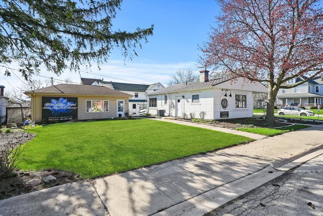
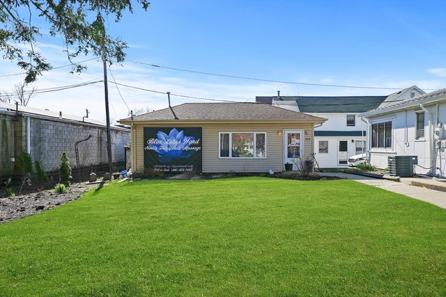
Property Record
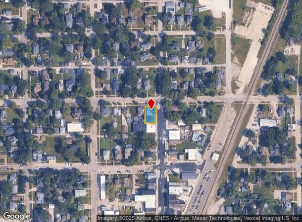
216 N Second St, Peotone, IL 60468
NEARBY LISTINGS FOR SALE OR LEASE
Property Detail
216 N Second St
Chicago-Naperville-Elgin, IL-IN
Crawfords Addn
17-20-24-213-005
THE N 100 FT OF LOT 1 BLK 5 IN CRAWFORDS ADDN TO THE VILLAGE OF PEOTONE, A SUB OF PRT OF THE W1/2 NE1/4 SEC 24, T33N-R12E.
Commercialnec
Will
X
Illinois
17197C0500G
1
2024
0.17 AC
2024
Far South
883904
Chicago
DEMOGRAPHICS near 216 N Second St
1 mile
3 mile
5 mile
2024 Total Population
3,599
4,798
6,017
2029 Population
3,505
4,655
5,838
Pop Growth 2024-2029
(2.61%)
(2.98%)
(2.97%)
Average Age
41
42
42
2024 Total Households
1,461
1,901
2,337
HH Growth 2024-2029
(2.46%)
(2.84%)
(2.87%)
Median Household Inc
$72,648
$75,829
$77,311
Avg Household Size
2.50
2.50
2.60
2024 Avg HH Vehicles
2.00
2.00
2.00
Median Home Value
$251,820
$261,167
$273,551
Median Year Built
1972
1974
1977
Nearby Places
Map Layers
Map Styles
 Street
 Aerial
Transit
 Traffic
 Biking
Places
Listings with unknown addresses are not visible on the map
- Restaurants
- Banks
- Shops
- Fitness
- Groceries
PUBLIC TRANSPORTATION
COMMUTER RAIL
University Park Station (Metra Electric Line - Northeast Illinois Regional Commuter Railroad (Metra))
Drive
Walk
Distance
University Park Station (Metra Electric Line - Northeast Illinois Regional Commuter Railroad (Metra))
16 min
9.7 mi
AIRPORT
Chicago Midway International
Drive
Walk
Distance
Chicago Midway International
54 min
33.2 mi
SALE & LEASE HISTORY
LISTING DATE
SALE/LEASE

Apr 19, 2023
For Sale
Nearby Properties
Address
Land Use
TOTAL SIZE
Lot Size
Zoning
Address
Land Use
TOTAL SIZE
Lot Size
Zoning
10.66 AC
Address
Land Use
TOTAL SIZE
Lot Size
Zoning
6.71 AC
Address
Land Use
TOTAL SIZE
Lot Size
Zoning
9.68 AC
Address
Land Use
TOTAL SIZE
Lot Size
Zoning
7.60 AC
Address
Land Use
TOTAL SIZE
Lot Size
Zoning
9.35 AC
Address
Land Use
TOTAL SIZE
Lot Size
Zoning
2.05 AC
Address
Land Use
TOTAL SIZE
Lot Size
Zoning
6.69 AC
Address
Land Use
TOTAL SIZE
Lot Size
Zoning
4.94 AC
Address
Land Use
TOTAL SIZE
Lot Size
Zoning
9,200 SF
0.45 AC
Address
Land Use
TOTAL SIZE
Lot Size
Zoning
1.69 AC
Address
Land Use
TOTAL SIZE
Lot Size
Zoning
2.50 AC
Address
Land Use
TOTAL SIZE
Lot Size
Zoning
1.23 AC
Address
Land Use
TOTAL SIZE
Lot Size
Zoning
Address
Land Use
TOTAL SIZE
Lot Size
Zoning
3.36 AC
Address
Land Use
TOTAL SIZE
Lot Size
Zoning
1.05 AC
Address
Land Use
TOTAL SIZE
Lot Size
Zoning
9.20 AC
Address
Land Use
TOTAL SIZE
Lot Size
Zoning
1.15 AC
Address
Land Use
TOTAL SIZE
Lot Size
Zoning
0.78 AC
Address
Land Use
TOTAL SIZE
Lot Size
Zoning
1.09 AC
Address
Land Use
TOTAL SIZE
Lot Size
Zoning
0.88 AC
Address
Land Use
TOTAL SIZE
Lot Size
Zoning
1.51 AC
Address
Land Use
TOTAL SIZE
Lot Size
Zoning
1.74 AC
Address
Land Use
TOTAL SIZE
Lot Size
Zoning
1.51 AC
Address
Land Use
TOTAL SIZE
Lot Size
Zoning
1.07 AC
Address
Land Use
TOTAL SIZE
Lot Size
Zoning
119.88 AC
Address
Land Use
TOTAL SIZE
Lot Size
Zoning
Address
Land Use
TOTAL SIZE
Lot Size
Zoning
0.49 AC
Address
Land Use
TOTAL SIZE
Lot Size
Zoning
4.19 AC
Address
Land Use
TOTAL SIZE
Lot Size
Zoning
0.67 AC
Address
Land Use
TOTAL SIZE
Lot Size
Zoning
0.80 AC
The World's #1 Commercial Real Estate Marketplace
Connect with us
© 2026 CoStar Group
The information above has been obtained from sources believed reliable. While we do not doubt its accuracy we have not verified it and make no guarantee, warranty or representation about it. It is your responsibility to independently confirm its accuracy and completeness. Any projections, opinions, assumptions, or estimates used are for example only and do not represent the current or future performance of the property. The value of this transaction to you depends on tax and other factors which should be evaluated by your tax, financial, and legal advisors. You and your advisors should conduct a careful, independent investigation of the property to determine to your satisfaction the suitability of the property for your needs.