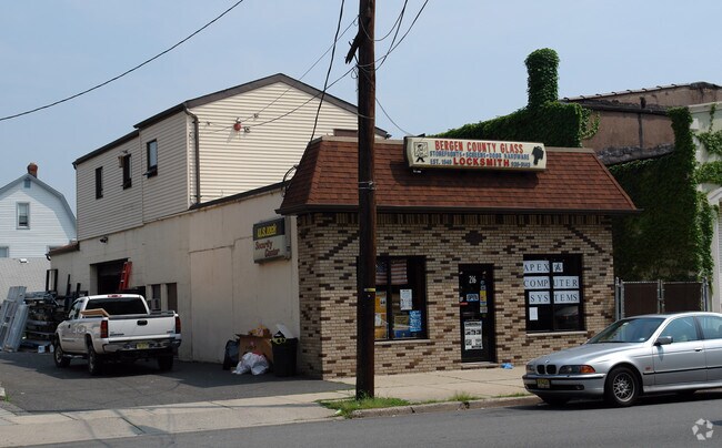
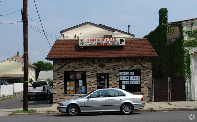
Property Record
216 Ridge Rd, Lyndhurst, NJ 07071

Property Detail
216 Ridge Rd
32-00093-0000-00016
50X100
Commercialnec
Bergen
B
New Jersey
B and X Area of moderate flood hazard, usually the area between the limits of the 100-year and 500-year floods.
16
2024
0.12 AC
2025
Meadowlands
031100
Northern New Jersey
3,398 SF
New York-Jersey City-White Plains, NY-NJ
NEARBY LISTINGS FOR SALE OR LEASE
DEMOGRAPHICS near 216 Ridge Rd
1 mile
3 mile
5 mile
2025 Total Population
23,652
173,677
567,851
2030 Population
23,808
177,608
581,070
Pop Growth 2025-2030
+ 0.66%
+ 2.26%
+ 2.33%
Average Age
42
41
40
2025 Total Households
9,057
65,238
207,066
HH Growth 2025-2030
+ 0.60%
+ 2.31%
+ 2.47%
Median Household Inc
$112,333
$107,325
$87,992
Avg Household Size
2.50
2.60
2.70
2025 Avg HH Vehicles
2.00
2.00
2.00
Median Home Value
$581,739
$492,163
$480,056
Median Year Built
1949
1952
1953
Nearby Places
Map Layers
Map Styles
 Street
 Aerial
Layers
 Traffic
 Biking
Places
Listings with unknown addresses are not visible on the map
- Restaurants
- Banks
- Shops
- Fitness
- Groceries
PUBLIC TRANSPORTATION
COMMUTER RAIL
Kingsland (Main/Port Jervis Line - NJ Transit Commuter Rail (NJ Transit))
Drive
Walk
Distance
Kingsland (Main/Port Jervis Line - NJ Transit Commuter Rail (NJ Transit))
0 min
2 min
0.1 mi
Lyndhurst (Main/Port Jervis Line - NJ Transit Commuter Rail (NJ Transit))
Drive
Walk
Distance
Lyndhurst (Main/Port Jervis Line - NJ Transit Commuter Rail (NJ Transit))
2 min
13 min
0.6 mi
AIRPORT
Newark Liberty International
Drive
Walk
Distance
Newark Liberty International
17 min
12.5 mi
LaGuardia
Drive
Walk
Distance
LaGuardia
37 min
19.0 mi
John F Kennedy International
Drive
Walk
Distance
John F Kennedy International
47 min
27.1 mi
Freight Ports
Maher Terminal
Drive
Walk
Distance
Maher Terminal
26 min
13.5 mi
Nearby Properties
Address
Land Use
TOTAL SIZE
Lot Size
Zoning
Address
Land Use
TOTAL SIZE
Lot Size
Zoning
Address
Land Use
TOTAL SIZE
Lot Size
Zoning
Address
Land Use
TOTAL SIZE
Lot Size
Zoning
4,014 SF
21 AC
Address
Land Use
TOTAL SIZE
Lot Size
Zoning
612 AC
SEA
Address
Land Use
TOTAL SIZE
Lot Size
Zoning
Address
Land Use
TOTAL SIZE
Lot Size
Zoning
Address
Land Use
TOTAL SIZE
Lot Size
Zoning
Address
Land Use
TOTAL SIZE
Lot Size
Zoning
Address
Land Use
TOTAL SIZE
Lot Size
Zoning
9.57 AC
I2
Address
Land Use
TOTAL SIZE
Lot Size
Zoning
3,956 SF
250 AC
C2
Address
Land Use
TOTAL SIZE
Lot Size
Zoning
68.93 AC
Address
Land Use
TOTAL SIZE
Lot Size
Zoning
2,500 SF
43.35 AC
Address
Land Use
TOTAL SIZE
Lot Size
Zoning
Address
Land Use
TOTAL SIZE
Lot Size
Zoning
602,220 SF
25.91 AC
Address
Land Use
TOTAL SIZE
Lot Size
Zoning
5.80 AC
CGI
Address
Land Use
TOTAL SIZE
Lot Size
Zoning
433,716 SF
10.49 AC
Address
Land Use
TOTAL SIZE
Lot Size
Zoning
8.88 AC
ORD
Address
Land Use
TOTAL SIZE
Lot Size
Zoning
1,218 SF
41.30 AC
RB
Address
Land Use
TOTAL SIZE
Lot Size
Zoning
100,014 SF
8.80 AC
M2
Address
Land Use
TOTAL SIZE
Lot Size
Zoning
1.12 AC
M-O
Address
Land Use
TOTAL SIZE
Lot Size
Zoning
7.29 AC
Address
Land Use
TOTAL SIZE
Lot Size
Zoning
Address
Land Use
TOTAL SIZE
Lot Size
Zoning
275,260 SF
11.88 AC
Address
Land Use
TOTAL SIZE
Lot Size
Zoning
18.30 AC
Address
Land Use
TOTAL SIZE
Lot Size
Zoning
138,764 SF
1.47 AC
LM
Address
Land Use
TOTAL SIZE
Lot Size
Zoning
24.29 AC
Address
Land Use
TOTAL SIZE
Lot Size
Zoning
71,634 SF
12.31 AC
M1
Address
Land Use
TOTAL SIZE
Lot Size
Zoning
87,032 SF
6.67 AC
Address
Land Use
TOTAL SIZE
Lot Size
Zoning
860 SF
0.96 AC
R100
Address
Land Use
TOTAL SIZE
Lot Size
Zoning
267,069 SF
6.15 AC
The World's #1 Commercial Real Estate Marketplace
Connect with us
© 2026 CoStar Group
The information above has been obtained from sources believed reliable. While we do not doubt its accuracy we have not verified it and make no guarantee, warranty or representation about it. It is your responsibility to independently confirm its accuracy and completeness. Any projections, opinions, assumptions, or estimates used are for example only and do not represent the current or future performance of the property. The value of this transaction to you depends on tax and other factors which should be evaluated by your tax, financial, and legal advisors. You and your advisors should conduct a careful, independent investigation of the property to determine to your satisfaction the suitability of the property for your needs.