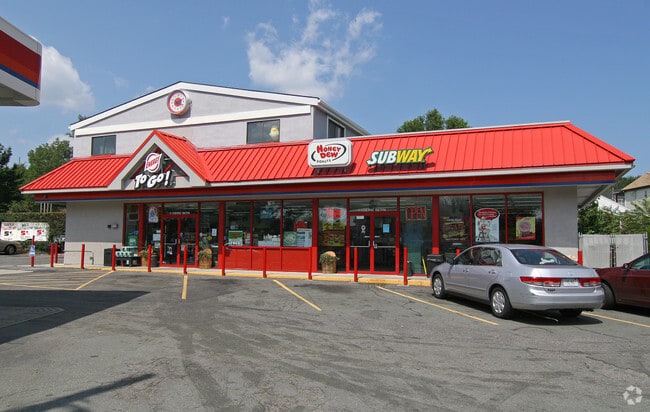
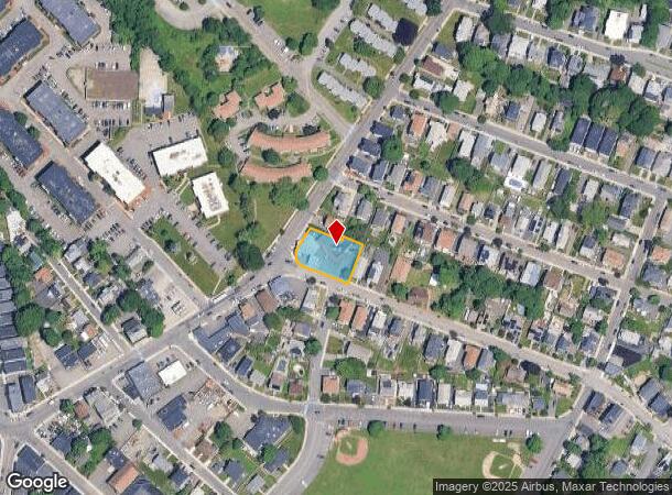
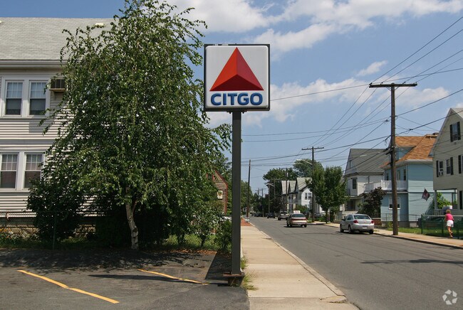
Property Record
216 Shirley St, Winthrop, MA 02152
NEARBY LISTINGS FOR SALE OR LEASE
Property Detail
216 Shirley St
WINT-000056-000000-000008
Suffolk
Commercialnec
Massachusetts
X
8
25025C0038J
0.37 AC
2025
Chelsea/Revere
2025
Boston
180400
Boston-Cambridge-Newton, MA-NH
4,785 SF
DEMOGRAPHICS near 216 Shirley St
1 Mile
3 Mile
5 Mile
2024 Total Population
16,066
101,693
331,519
2029 Population
14,811
95,040
316,371
Pop Growth 2024-2029
(7.81%)
(6.54%)
(4.57%)
Average Age
44
39
38
2024 Total Households
6,741
36,896
137,158
HH Growth 2024-2029
(8.41%)
(6.96%)
(4.68%)
Median Household Inc
$82,114
$71,743
$92,301
Avg Household Size
2.30
2.60
2.30
2024 Avg HH Vehicles
1.00
1.00
1.00
Median Home Value
$621,866
$554,177
$670,453
Median Year Built
1947
1948
1954
Nearby Places
Map Layers
Map Styles
 Street
 Aerial
- Restaurants
- Banks
- Shops
- Fitness
- Groceries
PUBLIC TRANSPORTATION
COMMUTER RAIL
Chelsea (Newburyport/Rockport Line - MBTA)
DRIVE
WALK
Distance
Chelsea (Newburyport/Rockport Line - MBTA)
10 min
5.5 mi
North Station (Fitchburg/South Acton Line - Massachusetts Bay Transportation Authority Commuter Rail (Purple Line), Haverhill Line - Massachusetts Bay Transportation Authority Commuter Rail (Purple Line), Lowell Line - Massachusetts Bay Transportation Authority Commuter Rail (Purple Line), Newburyport/Rockport Line - Massachusetts Bay Transportation Authority Commuter Rail (Purple Line))
DRIVE
WALK
Distance
North Station (Fitchburg/South Acton Line - Massachusetts Bay Transportation Authority Commuter Rail (Purple Line), Haverhill Line - Massachusetts Bay Transportation Authority Commuter Rail (Purple Line), Lowell Line - Massachusetts Bay Transportation Authority Commuter Rail (Purple Line), Newburyport/Rockport Line - Massachusetts Bay Transportation Authority Commuter Rail (Purple Line))
12 min
5.7 mi
AIRPORT
General Edward Lawrence Logan International
DRIVE
WALK
Distance
General Edward Lawrence Logan International
9 min
4.6 mi
Freight Ports
Port of Boston
DRIVE
WALK
Distance
Port of Boston
15 min
7.3 mi
Nearby Properties
Address
Land Use
TOTAL SIZE
Lot Size
Zoning
Address
Land Use
TOTAL SIZE
Lot Size
Zoning
171,791 SF
166.88 AC
E
Address
Land Use
TOTAL SIZE
Lot Size
Zoning
247,013 SF
1.13 AC
RC2
Address
Land Use
TOTAL SIZE
Lot Size
Zoning
164,959 SF
96.81 AC
E
Address
Land Use
TOTAL SIZE
Lot Size
Zoning
211,294 SF
1.66 AC
RC2
Address
Land Use
TOTAL SIZE
Lot Size
Zoning
226,431 SF
4.31 AC
HB
Address
Land Use
TOTAL SIZE
Lot Size
Zoning
1.65 AC
RC2
Address
Land Use
TOTAL SIZE
Lot Size
Zoning
422,028 SF
16.10 AC
RB
Address
Land Use
TOTAL SIZE
Lot Size
Zoning
232,943 SF
3.87 AC
Address
Land Use
TOTAL SIZE
Lot Size
Zoning
154.16 AC
E
Address
Land Use
TOTAL SIZE
Lot Size
Zoning
172,043 SF
1.13 AC
RC1
Address
Land Use
TOTAL SIZE
Lot Size
Zoning
5,668 SF
20.05 AC
A
Address
Land Use
TOTAL SIZE
Lot Size
Zoning
391,884 SF
108.79 AC
C
Address
Land Use
TOTAL SIZE
Lot Size
Zoning
738 SF
20.71 AC
PORT
Address
Land Use
TOTAL SIZE
Lot Size
Zoning
449,900 SF
3.38 AC
I
Address
Land Use
TOTAL SIZE
Lot Size
Zoning
14.79 AC
INDUST
Address
Land Use
TOTAL SIZE
Lot Size
Zoning
214,895 SF
3.30 AC
A
Address
Land Use
TOTAL SIZE
Lot Size
Zoning
192,881 SF
6.08 AC
C
Address
Land Use
TOTAL SIZE
Lot Size
Zoning
224,868 SF
9.08 AC
I
Address
Land Use
TOTAL SIZE
Lot Size
Zoning
192,031 SF
8.34 AC
Address
Land Use
TOTAL SIZE
Lot Size
Zoning
130,120 SF
0.83 AC
RC2
Address
Land Use
TOTAL SIZE
Lot Size
Zoning
115,045 SF
6.90 AC
C
Address
Land Use
TOTAL SIZE
Lot Size
Zoning
181,959 SF
1.38 AC
RC2
Address
Land Use
TOTAL SIZE
Lot Size
Zoning
309,540 SF
1.20 AC
C
Address
Land Use
TOTAL SIZE
Lot Size
Zoning
208,440 SF
1.49 AC
GB
Address
Land Use
TOTAL SIZE
Lot Size
Zoning
81.22 AC
E
Address
Land Use
TOTAL SIZE
Lot Size
Zoning
190,368 SF
5.07 AC
E
Address
Land Use
TOTAL SIZE
Lot Size
Zoning
1.66 AC
PDD1
Address
Land Use
TOTAL SIZE
Lot Size
Zoning
117,516 SF
1.68 AC
R2
Address
Land Use
TOTAL SIZE
Lot Size
Zoning
6.19 AC
INDUST
Address
Land Use
TOTAL SIZE
Lot Size
Zoning
106,689 SF
3.85 AC
E
The World's #1 Commercial Real Estate Marketplace
Connect with us
© 2025 CoStar Group
The information above has been obtained from sources believed reliable. While we do not doubt its accuracy we have not verified it and make no guarantee, warranty or representation about it. It is your responsibility to independently confirm its accuracy and completeness. Any projections, opinions, assumptions, or estimates used are for example only and do not represent the current or future performance of the property. The value of this transaction to you depends on tax and other factors which should be evaluated by your tax, financial, and legal advisors. You and your advisors should conduct a careful, independent investigation of the property to determine to your satisfaction the suitability of the property for your needs.