Property Record
2160 Hahns Dairy Rd, Palmerton, PA 18071
NEARBY LISTINGS FOR SALE OR LEASE
-
-
No Photo
-
View all Palmerton listings for sale on LoopNet.com
Property Detail
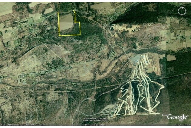
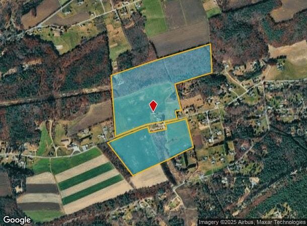
2160 Hahns Dairy Rd
17-32-B41
Carbon
Miscresidentialimprovement
Pennsylvania
2025
99.45 AC
2025
Lehigh Valley
020801
Philadelphia
1,768 SF
Allentown-Bethlehem-Easton, PA-NJ
DEMOGRAPHICS near 2160 Hahns Dairy Rd
1 Mile
3 Mile
5 Mile
2024 Total Population
503
7,390
19,750
2029 Population
504
7,443
19,880
Pop Growth 2024-2029
+ 0.20%
+ 0.72%
+ 0.66%
Average Age
47
45
45
2024 Total Households
217
3,040
8,104
HH Growth 2024-2029
0.00%
+ 0.76%
+ 0.73%
Median Household Inc
$74,658
$69,912
$68,120
Avg Household Size
2.30
2.40
2.40
2024 Avg HH Vehicles
3.00
2.00
2.00
Median Home Value
$230,263
$202,806
$212,840
Median Year Built
1980
1971
1973
Nearby Places
Map Layers
Map Styles
 Street
 Aerial
- Restaurants
- Banks
- Shops
- Fitness
- Groceries
PUBLIC TRANSPORTATION
AIRPORT
Lehigh Valley International
DRIVE
WALK
Distance
Lehigh Valley International
39 min
22.9 mi
Freight Ports
Port of Philadelphia
DRIVE
WALK
Distance
Port of Philadelphia
111 min
78.8 mi
Nearby Properties
Address
Land Use
TOTAL SIZE
Lot Size
Zoning
Address
Land Use
TOTAL SIZE
Lot Size
Zoning
1,926 SF
322.55 AC
Address
Land Use
TOTAL SIZE
Lot Size
Zoning
3,325 SF
55.50 AC
Address
Land Use
TOTAL SIZE
Lot Size
Zoning
4,132 SF
13.32 AC
Address
Land Use
TOTAL SIZE
Lot Size
Zoning
2,070 SF
12.51 AC
Address
Land Use
TOTAL SIZE
Lot Size
Zoning
49.52 AC
R-40
Address
Land Use
TOTAL SIZE
Lot Size
Zoning
1,100 SF
40.77 AC
Address
Land Use
TOTAL SIZE
Lot Size
Zoning
Address
Land Use
TOTAL SIZE
Lot Size
Zoning
434.68 AC
A
Address
Land Use
TOTAL SIZE
Lot Size
Zoning
682.58 AC
RA
Address
Land Use
TOTAL SIZE
Lot Size
Zoning
4,020 SF
25.30 AC
Address
Land Use
TOTAL SIZE
Lot Size
Zoning
1,100 SF
8.01 AC
Address
Land Use
TOTAL SIZE
Lot Size
Zoning
0.35 AC
Address
Land Use
TOTAL SIZE
Lot Size
Zoning
768 SF
0.85 AC
Address
Land Use
TOTAL SIZE
Lot Size
Zoning
1,176 SF
0.31 AC
Address
Land Use
TOTAL SIZE
Lot Size
Zoning
1,288 SF
1.05 AC
Address
Land Use
TOTAL SIZE
Lot Size
Zoning
Address
Land Use
TOTAL SIZE
Lot Size
Zoning
1,508 SF
39.29 AC
Address
Land Use
TOTAL SIZE
Lot Size
Zoning
Address
Land Use
TOTAL SIZE
Lot Size
Zoning
9.78 AC
Address
Land Use
TOTAL SIZE
Lot Size
Zoning
1,308 SF
1.03 AC
Address
Land Use
TOTAL SIZE
Lot Size
Zoning
6,439 SF
11.30 AC
Address
Land Use
TOTAL SIZE
Lot Size
Zoning
1,824 SF
0.92 AC
Address
Land Use
TOTAL SIZE
Lot Size
Zoning
1,232 SF
101.20 AC
Address
Land Use
TOTAL SIZE
Lot Size
Zoning
Address
Land Use
TOTAL SIZE
Lot Size
Zoning
1,008 SF
4.55 AC
Address
Land Use
TOTAL SIZE
Lot Size
Zoning
768 SF
0.51 AC
Address
Land Use
TOTAL SIZE
Lot Size
Zoning
1,308 SF
0.59 AC
Address
Land Use
TOTAL SIZE
Lot Size
Zoning
1,094 SF
103.08 AC
Address
Land Use
TOTAL SIZE
Lot Size
Zoning
1,236 SF
3.89 AC
Address
Land Use
TOTAL SIZE
Lot Size
Zoning
1,094 SF
44.11 AC
The World's #1 Commercial Real Estate Marketplace
Connect with us
© 2025 CoStar Group
The information above has been obtained from sources believed reliable. While we do not doubt its accuracy we have not verified it and make no guarantee, warranty or representation about it. It is your responsibility to independently confirm its accuracy and completeness. Any projections, opinions, assumptions, or estimates used are for example only and do not represent the current or future performance of the property. The value of this transaction to you depends on tax and other factors which should be evaluated by your tax, financial, and legal advisors. You and your advisors should conduct a careful, independent investigation of the property to determine to your satisfaction the suitability of the property for your needs.