Property Record
21620 N 19Th Ave, Phoenix, AZ 85027


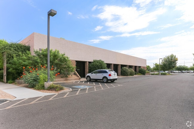
Property Detail
21620 N 19Th Ave
209-06-017K
E 410F OF E2 N2 NE4 NE4 EX N 285F TH/OF & ALSO E X E 65F RD
Officebuilding
Maricopa
C-G
Arizona
C and X Area of minimal flood hazard, usually depicted on FIRMs as above the 500-year flood level.
2.97 AC
2025
Deer Valley/Airport
2025
Phoenix
614700
Phoenix-Mesa-Chandler, AZ
38,169 SF
NEARBY LISTINGS FOR SALE OR LEASE
DEMOGRAPHICS near 21620 N 19Th Ave
1 mile
3 mile
5 mile
2025 Total Population
5,379
82,629
247,046
2030 Population
5,560
85,510
256,618
Pop Growth 2025-2030
+ 3.36%
+ 3.49%
+ 3.87%
Average Age
37
38
39
2025 Total Households
2,356
33,317
98,595
HH Growth 2025-2030
+ 3.57%
+ 3.61%
+ 4.08%
Median Household Inc
$58,378
$77,990
$84,627
Avg Household Size
2.20
2.40
2.40
2025 Avg HH Vehicles
2.00
2.00
2.00
Median Home Value
$325,450
$376,029
$436,001
Median Year Built
1986
1988
1990
Nearby Places
Map Layers
Map Styles
 Street
 Aerial
Layers
 Traffic
 Biking
Places
Listings with unknown addresses are not visible on the map
- Restaurants
- Banks
- Shops
- Fitness
- Groceries
PUBLIC TRANSPORTATION
AIRPORT
Phoenix Sky Harbor International
Drive
Walk
Distance
Phoenix Sky Harbor International
35 min
24.3 mi
SALE & LEASE HISTORY
LISTING DATE
SALE/LEASE

Sep 24, 2016
For Lease
Nov 30, 2017
For Lease
Nov 21, 2016
For Lease
May 03, 2018
For Lease
Jan 02, 2026
For Lease
Apr 17, 2018
For Lease
Nearby Properties
Address
Land Use
TOTAL SIZE
Lot Size
Zoning
Address
Land Use
TOTAL SIZE
Lot Size
Zoning
159,642 SF
11.85 AC
C-C
Address
Land Use
TOTAL SIZE
Lot Size
Zoning
132,348 SF
9.16 AC
I-P
Address
Land Use
TOTAL SIZE
Lot Size
Zoning
2,354,235 SF
83.18 AC
CPGCP
Address
Land Use
TOTAL SIZE
Lot Size
Zoning
Address
Land Use
TOTAL SIZE
Lot Size
Zoning
526,912 SF
55.64 AC
Address
Land Use
TOTAL SIZE
Lot Size
Zoning
53,813 SF
1,286.11 AC
Address
Land Use
TOTAL SIZE
Lot Size
Zoning
267,397 SF
108.70 AC
R-43AG
Address
Land Use
TOTAL SIZE
Lot Size
Zoning
704,521 SF
15.12 AC
C-C
Address
Land Use
TOTAL SIZE
Lot Size
Zoning
625,318 SF
15.79 AC
Address
Land Use
TOTAL SIZE
Lot Size
Zoning
16.84 AC
Address
Land Use
TOTAL SIZE
Lot Size
Zoning
434,799 SF
69.70 AC
R-8
Address
Land Use
TOTAL SIZE
Lot Size
Zoning
289,901 SF
12.30 AC
A-1
Address
Land Use
TOTAL SIZE
Lot Size
Zoning
355,901 SF
40.61 AC
Address
Land Use
TOTAL SIZE
Lot Size
Zoning
471,671 SF
18.04 AC
I-1
Address
Land Use
TOTAL SIZE
Lot Size
Zoning
17,365 SF
1.50 AC
C-G
Address
Land Use
TOTAL SIZE
Lot Size
Zoning
389,967 SF
245.48 AC
I-1
Address
Land Use
TOTAL SIZE
Lot Size
Zoning
264,909 SF
219.16 AC
I-1
Address
Land Use
TOTAL SIZE
Lot Size
Zoning
968,899 SF
76.37 AC
I-1
Address
Land Use
TOTAL SIZE
Lot Size
Zoning
361,228 SF
24.60 AC
I-P
Address
Land Use
TOTAL SIZE
Lot Size
Zoning
339,800 SF
43.53 AC
INDPK
Address
Land Use
TOTAL SIZE
Lot Size
Zoning
296,753 SF
9.53 AC
CPBP
Address
Land Use
TOTAL SIZE
Lot Size
Zoning
307,891 SF
15.89 AC
Address
Land Use
TOTAL SIZE
Lot Size
Zoning
28.71 AC
Address
Land Use
TOTAL SIZE
Lot Size
Zoning
312,070 SF
20.04 AC
A1
Address
Land Use
TOTAL SIZE
Lot Size
Zoning
291,059 SF
16.54 AC
I-1
Address
Land Use
TOTAL SIZE
Lot Size
Zoning
240.86 AC
IND.PK.
Address
Land Use
TOTAL SIZE
Lot Size
Zoning
228,085 SF
7.84 AC
I-P
Address
Land Use
TOTAL SIZE
Lot Size
Zoning
149,165 SF
12.33 AC
C2
Address
Land Use
TOTAL SIZE
Lot Size
Zoning
355,606 SF
11.35 AC
C-C
Address
Land Use
TOTAL SIZE
Lot Size
Zoning
244,787 SF
5.83 AC
The World's #1 Commercial Real Estate Marketplace
Connect with us
© 2026 CoStar Group
The information above has been obtained from sources believed reliable. While we do not doubt its accuracy we have not verified it and make no guarantee, warranty or representation about it. It is your responsibility to independently confirm its accuracy and completeness. Any projections, opinions, assumptions, or estimates used are for example only and do not represent the current or future performance of the property. The value of this transaction to you depends on tax and other factors which should be evaluated by your tax, financial, and legal advisors. You and your advisors should conduct a careful, independent investigation of the property to determine to your satisfaction the suitability of the property for your needs.