Property Record
2164 Glendale Ave, Hanford, CA 93230


Save to a Folder
{{folder.Name}}
{{folder.ListingIds.length}} Properties
{{folder.ListingIds.length}} Property
Create a New Folder
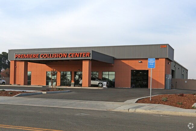
Property Detail
2164 Glendale Ave
011030013000
PARCEL A OF PM 20-62 SEC 34/18/21
Commercialnec
KINGS
C-S
California
B and X Area of moderate flood hazard, usually the area between the limits of the 100-year and 500-year floods.
1.61 AC
2025
Hanford/Armona
2026
Fresno
001001
Hanford-Corcoran, CA
14,000 SF
NEARBY LISTINGS FOR SALE OR LEASE
DEMOGRAPHICS near 2164 Glendale Ave
1 mile
3 mile
5 mile
2025 Total Population
6,494
49,969
73,304
2030 Population
6,589
50,543
73,776
Pop Growth 2025-2030
+ 1.46%
+ 1.15%
+ 0.64%
Average Age
34
36
36
2025 Total Households
1,882
15,724
23,959
HH Growth 2025-2030
+ 1.65%
+ 1.16%
+ 0.66%
Median Household Inc
$74,555
$67,244
$72,164
Avg Household Size
3.30
3.10
3.00
2025 Avg HH Vehicles
2.00
2.00
2.00
Median Home Value
$345,412
$365,705
$369,179
Median Year Built
1996
1984
1986
Nearby Places
Map Layers
Map Styles
 Street
 Aerial
Layers
 Traffic
 Biking
Places
Listings with unknown addresses are not visible on the map
- Restaurants
- Banks
- Shops
- Fitness
- Groceries
PUBLIC TRANSPORTATION
COMMUTER RAIL
Hanford (San Joaquins - Amtrak)
Drive
Walk
Distance
Hanford (San Joaquins - Amtrak)
6 min
2.4 mi
Freight Ports
Port of Stockton
Drive
Walk
Distance
Port of Stockton
192 min
172.7 mi
Nearby Properties
Address
Land Use
TOTAL SIZE
Lot Size
Zoning
Address
Land Use
TOTAL SIZE
Lot Size
Zoning
190,329 SF
27.94 AC
O
Address
Land Use
TOTAL SIZE
Lot Size
Zoning
14.37 AC
O
Address
Land Use
TOTAL SIZE
Lot Size
Zoning
62,349 SF
1.11 AC
O
Address
Land Use
TOTAL SIZE
Lot Size
Zoning
152,210 SF
8.91 AC
R-M
Address
Land Use
TOTAL SIZE
Lot Size
Zoning
169,750 SF
21.54 AC
H1
Address
Land Use
TOTAL SIZE
Lot Size
Zoning
201,832 SF
19.55 AC
PF
Address
Land Use
TOTAL SIZE
Lot Size
Zoning
139,410 SF
12.60 AC
AL10
Address
Land Use
TOTAL SIZE
Lot Size
Zoning
123,414 SF
9.85 AC
C-R
Address
Land Use
TOTAL SIZE
Lot Size
Zoning
48,606 SF
0.80 AC
O
Address
Land Use
TOTAL SIZE
Lot Size
Zoning
127,832 SF
12.64 AC
RC
Address
Land Use
TOTAL SIZE
Lot Size
Zoning
3,382 SF
4.60 AC
R-H
Address
Land Use
TOTAL SIZE
Lot Size
Zoning
76,233 SF
13.60 AC
RC
Address
Land Use
TOTAL SIZE
Lot Size
Zoning
39,703 SF
0.97 AC
SC
Address
Land Use
TOTAL SIZE
Lot Size
Zoning
53,577 SF
1.46 AC
C-H
Address
Land Use
TOTAL SIZE
Lot Size
Zoning
7.65 AC
RC
Address
Land Use
TOTAL SIZE
Lot Size
Zoning
27,459 SF
1.93 AC
R-M
Address
Land Use
TOTAL SIZE
Lot Size
Zoning
96,199 SF
10.07 AC
RC
Address
Land Use
TOTAL SIZE
Lot Size
Zoning
2.11 AC
PF
Address
Land Use
TOTAL SIZE
Lot Size
Zoning
58,416 SF
5.46 AC
MXC
Address
Land Use
TOTAL SIZE
Lot Size
Zoning
49,136 SF
1.98 AC
C-S
Address
Land Use
TOTAL SIZE
Lot Size
Zoning
41,033 SF
2.18 AC
SC
Address
Land Use
TOTAL SIZE
Lot Size
Zoning
1.59 AC
R-H
Address
Land Use
TOTAL SIZE
Lot Size
Zoning
2.12 AC
O
Address
Land Use
TOTAL SIZE
Lot Size
Zoning
64,973 SF
8.39 AC
H1
Address
Land Use
TOTAL SIZE
Lot Size
Zoning
21,925 SF
2.14 AC
RM3
Address
Land Use
TOTAL SIZE
Lot Size
Zoning
77,948 SF
6.73 AC
RC
Address
Land Use
TOTAL SIZE
Lot Size
Zoning
39,542 SF
3.38 AC
CC
Address
Land Use
TOTAL SIZE
Lot Size
Zoning
53,040 SF
4.99 AC
RM3
The World's #1 Commercial Real Estate Marketplace
Connect with us
© 2026 CoStar Group
The information above has been obtained from sources believed reliable. While we do not doubt its accuracy we have not verified it and make no guarantee, warranty or representation about it. It is your responsibility to independently confirm its accuracy and completeness. Any projections, opinions, assumptions, or estimates used are for example only and do not represent the current or future performance of the property. The value of this transaction to you depends on tax and other factors which should be evaluated by your tax, financial, and legal advisors. You and your advisors should conduct a careful, independent investigation of the property to determine to your satisfaction the suitability of the property for your needs.