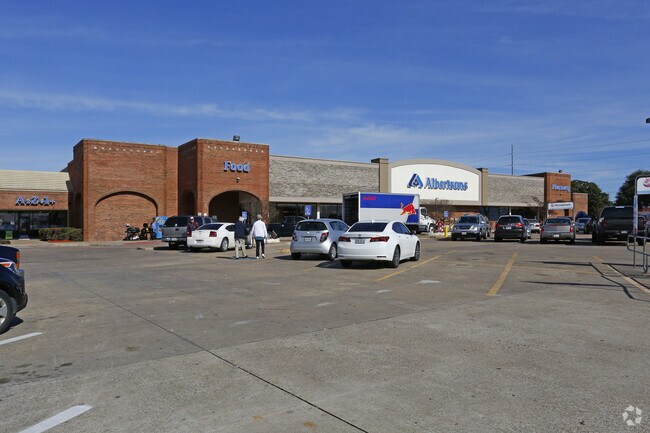
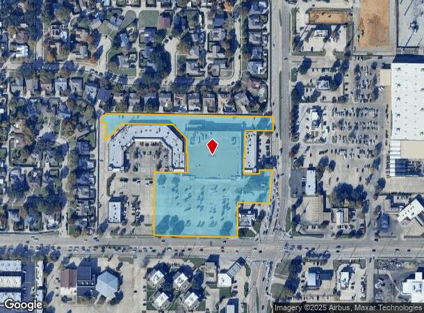
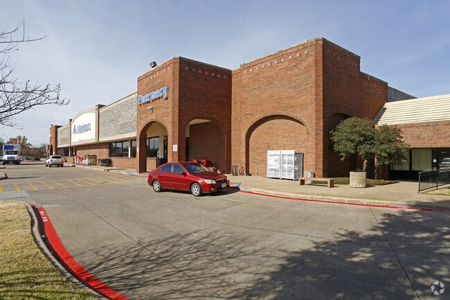
Property Record
2165 Buckingham Rd, Richardson, TX 75081
NEARBY LISTINGS FOR SALE OR LEASE
Property Detail
2165 Buckingham Rd
Dallas-Fort Worth-Arlington, TX
Remington Center
42146750000010000
REMINGTON CENTER LOT 1 ACS 5.6868 INT200600188712 DD05192006 CO-DC 1467500000100 3CR14675000
Supermarket
Dallas
X
Texas
48113C0220L
1
2024
5.69 AC
2025
Richardson
019024
Dallas/Ft Worth
70,882 SF
DEMOGRAPHICS near 2165 Buckingham Rd
1 Mile
3 Mile
5 Mile
2024 Total Population
17,766
145,761
371,390
2029 Population
17,568
144,192
373,307
Pop Growth 2024-2029
(1.11%)
(1.08%)
+ 0.52%
Average Age
39
37
37
2024 Total Households
5,651
52,177
138,324
HH Growth 2024-2029
(1.47%)
(1.22%)
+ 0.83%
Median Household Inc
$72,674
$58,114
$63,776
Avg Household Size
3.00
2.70
2.60
2024 Avg HH Vehicles
2.00
2.00
2.00
Median Home Value
$244,920
$244,121
$275,745
Median Year Built
1976
1978
1978
Nearby Places
Map Layers
Map Styles
 Street
 Aerial
- Restaurants
- Banks
- Shops
- Fitness
- Groceries
PUBLIC TRANSPORTATION
AIRPORT
Dallas Love Field
DRIVE
WALK
Distance
Dallas Love Field
31 min
17.9 mi
Dallas-Fort Worth International
DRIVE
WALK
Distance
Dallas-Fort Worth International
35 min
26.7 mi
Nearby Properties
Address
Land Use
TOTAL SIZE
Lot Size
Zoning
Address
Land Use
TOTAL SIZE
Lot Size
Zoning
641,243 SF
20.67 AC
Z109
Address
Land Use
TOTAL SIZE
Lot Size
Zoning
428,956 SF
18.76 AC
Z291
Address
Land Use
TOTAL SIZE
Lot Size
Zoning
249,692 SF
244.62 AC
Z239
Address
Land Use
TOTAL SIZE
Lot Size
Zoning
426,467 SF
24.12 AC
Z142
Address
Land Use
TOTAL SIZE
Lot Size
Zoning
433,745 SF
15.18 AC
Z02
Address
Land Use
TOTAL SIZE
Lot Size
Zoning
316,085 SF
13.73 AC
Z107
Address
Land Use
TOTAL SIZE
Lot Size
Zoning
181,854 SF
14.51 AC
Z239
Address
Land Use
TOTAL SIZE
Lot Size
Zoning
388,059 SF
21.80 AC
Z239
Address
Land Use
TOTAL SIZE
Lot Size
Zoning
310,119 SF
9.65 AC
Z150
Address
Land Use
TOTAL SIZE
Lot Size
Zoning
244,025 SF
17.80 AC
Z02
Address
Land Use
TOTAL SIZE
Lot Size
Zoning
517,500 SF
29.97 AC
Z116
Address
Land Use
TOTAL SIZE
Lot Size
Zoning
431,982 SF
19.32 AC
Z164
Address
Land Use
TOTAL SIZE
Lot Size
Zoning
277,296 SF
13.54 AC
Z207
Address
Land Use
TOTAL SIZE
Lot Size
Zoning
107,686 SF
30.09 AC
Z386
Address
Land Use
TOTAL SIZE
Lot Size
Zoning
275,557 SF
13.64 AC
Z291
Address
Land Use
TOTAL SIZE
Lot Size
Zoning
347,718 SF
18.61 AC
Z163
Address
Land Use
TOTAL SIZE
Lot Size
Zoning
232,771 SF
15.69 AC
Z160
Address
Land Use
TOTAL SIZE
Lot Size
Zoning
245,596 SF
14.24 AC
Z160
Address
Land Use
TOTAL SIZE
Lot Size
Zoning
227,584 SF
12.03 AC
Z165
Address
Land Use
TOTAL SIZE
Lot Size
Zoning
333,298 SF
10.91 AC
Z149
Address
Land Use
TOTAL SIZE
Lot Size
Zoning
286,500 SF
14.98 AC
Z160
Address
Land Use
TOTAL SIZE
Lot Size
Zoning
468,220 SF
20.60 AC
Z144
Address
Land Use
TOTAL SIZE
Lot Size
Zoning
270,114 SF
8.50 AC
Z150
Address
Land Use
TOTAL SIZE
Lot Size
Zoning
278,856 SF
9.57 AC
Z150
Address
Land Use
TOTAL SIZE
Lot Size
Zoning
244,032 SF
11.06 AC
Z163
Address
Land Use
TOTAL SIZE
Lot Size
Zoning
121,368 SF
7.18 AC
Z109
Address
Land Use
TOTAL SIZE
Lot Size
Zoning
121,349 SF
6.87 AC
Z109
Address
Land Use
TOTAL SIZE
Lot Size
Zoning
435,179 SF
20.20 AC
Z144
Address
Land Use
TOTAL SIZE
Lot Size
Zoning
112,023 SF
6.97 AC
Z109
Address
Land Use
TOTAL SIZE
Lot Size
Zoning
382,000 SF
20.11 AC
The World's #1 Commercial Real Estate Marketplace
Connect with us
© 2025 CoStar Group
The information above has been obtained from sources believed reliable. While we do not doubt its accuracy we have not verified it and make no guarantee, warranty or representation about it. It is your responsibility to independently confirm its accuracy and completeness. Any projections, opinions, assumptions, or estimates used are for example only and do not represent the current or future performance of the property. The value of this transaction to you depends on tax and other factors which should be evaluated by your tax, financial, and legal advisors. You and your advisors should conduct a careful, independent investigation of the property to determine to your satisfaction the suitability of the property for your needs.