Property Record
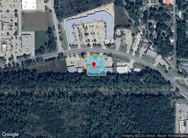
2165 Gause Blvd W, Slidell, LA 70460

NEARBY LISTINGS FOR SALE OR LEASE
Property Detail
2165 Gause Blvd W
New Orleans-Metairie, LA
Commercial Gause Blvd West
91723
TRACT 2A MEAS 196.0 X 255.74 X 233.74 X 233.82 X 217.93 SEC 37 8 14 CB 1457 313 INST NO 901874 INST NO 980520
Commercialnec
St Tammany
ARE
Louisiana
2025
1.11 AC
2024
Slidell
041105
New Orleans/Metairie/Kenner
9,000 SF
DEMOGRAPHICS near 2165 Gause Blvd W
1 Mile
3 Mile
5 Mile
2024 Total Population
2,503
22,784
63,534
2029 Population
2,683
24,510
68,420
Pop Growth 2024-2029
+ 7.19%
+ 7.58%
+ 7.69%
Average Age
39
40
40
2024 Total Households
933
8,713
24,637
HH Growth 2024-2029
+ 7.18%
+ 7.56%
+ 7.75%
Median Household Inc
$62,308
$55,620
$56,032
Avg Household Size
2.60
2.60
2.50
2024 Avg HH Vehicles
2.00
2.00
2.00
Median Home Value
$169,177
$168,247
$175,670
Median Year Built
1987
1986
1986
Nearby Places
Map Layers
Map Styles
 Street
 Aerial
- Restaurants
- Banks
- Shops
- Fitness
- Groceries
PUBLIC TRANSPORTATION
COMMUTER RAIL
DRIVE
WALK
Distance
5 min
3.4 mi
AIRPORT
Louis Armstrong New Orleans International
DRIVE
WALK
Distance
Louis Armstrong New Orleans International
59 min
46.2 mi
Freight Ports
Port of New Orleans
DRIVE
WALK
Distance
Port of New Orleans
53 min
38.5 mi
SALE & LEASE HISTORY
LISTING DATE
SALE/LEASE

Nov 12, 2020
For Lease
May 01, 2019
For Lease
Nearby Properties
Address
Land Use
TOTAL SIZE
Lot Size
Zoning
Address
Land Use
TOTAL SIZE
Lot Size
Zoning
192,685 SF
Address
Land Use
TOTAL SIZE
Lot Size
Zoning
208,769 SF
4.72 AC
Address
Land Use
TOTAL SIZE
Lot Size
Zoning
157,561 SF
10.06 AC
Address
Land Use
TOTAL SIZE
Lot Size
Zoning
144,638 SF
0.88 AC
Address
Land Use
TOTAL SIZE
Lot Size
Zoning
137,402 SF
76.02 AC
Address
Land Use
TOTAL SIZE
Lot Size
Zoning
127,681 SF
3 AC
Address
Land Use
TOTAL SIZE
Lot Size
Zoning
63,135 SF
12.49 AC
Address
Land Use
TOTAL SIZE
Lot Size
Zoning
67,517 SF
0.89 AC
Address
Land Use
TOTAL SIZE
Lot Size
Zoning
1,940 SF
1.77 AC
Address
Land Use
TOTAL SIZE
Lot Size
Zoning
54,188 SF
1.50 AC
Address
Land Use
TOTAL SIZE
Lot Size
Zoning
131,548 SF
2.99 AC
Address
Land Use
TOTAL SIZE
Lot Size
Zoning
142,482 SF
1.23 AC
Address
Land Use
TOTAL SIZE
Lot Size
Zoning
184,551 SF
20 AC
Address
Land Use
TOTAL SIZE
Lot Size
Zoning
115,666 SF
9.14 AC
Address
Land Use
TOTAL SIZE
Lot Size
Zoning
114,806 SF
10.22 AC
Address
Land Use
TOTAL SIZE
Lot Size
Zoning
108,003 SF
2.59 AC
Address
Land Use
TOTAL SIZE
Lot Size
Zoning
1,729 SF
1.22 AC
Address
Land Use
TOTAL SIZE
Lot Size
Zoning
66,130 SF
3 AC
Address
Land Use
TOTAL SIZE
Lot Size
Zoning
115,776 SF
7.50 AC
Address
Land Use
TOTAL SIZE
Lot Size
Zoning
78,962 SF
4.89 AC
Address
Land Use
TOTAL SIZE
Lot Size
Zoning
68,284 SF
7.20 AC
Address
Land Use
TOTAL SIZE
Lot Size
Zoning
21.34 AC
Address
Land Use
TOTAL SIZE
Lot Size
Zoning
30,002 SF
3.41 AC
Address
Land Use
TOTAL SIZE
Lot Size
Zoning
353,130 SF
38.95 AC
Address
Land Use
TOTAL SIZE
Lot Size
Zoning
97,162 SF
11.53 AC
Address
Land Use
TOTAL SIZE
Lot Size
Zoning
76,595 SF
7.50 AC
Address
Land Use
TOTAL SIZE
Lot Size
Zoning
34,159 SF
1.34 AC
Address
Land Use
TOTAL SIZE
Lot Size
Zoning
26,636 SF
1.06 AC
Address
Land Use
TOTAL SIZE
Lot Size
Zoning
32,375 SF
27.60 AC
Address
Land Use
TOTAL SIZE
Lot Size
Zoning
14,382 SF
1.87 AC
The World's #1 Commercial Real Estate Marketplace
Connect with us
© 2025 CoStar Group
The information above has been obtained from sources believed reliable. While we do not doubt its accuracy we have not verified it and make no guarantee, warranty or representation about it. It is your responsibility to independently confirm its accuracy and completeness. Any projections, opinions, assumptions, or estimates used are for example only and do not represent the current or future performance of the property. The value of this transaction to you depends on tax and other factors which should be evaluated by your tax, financial, and legal advisors. You and your advisors should conduct a careful, independent investigation of the property to determine to your satisfaction the suitability of the property for your needs.