Property Record
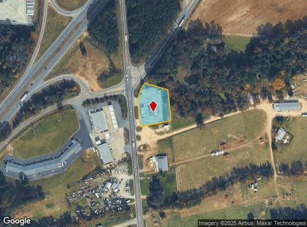
217 Us Highway 701 S, Four Oaks, NC 27524
NEARBY LISTINGS FOR SALE OR LEASE
Property Detail
217 Us Highway 701 S
08J11033H
Property Of Branans Inc
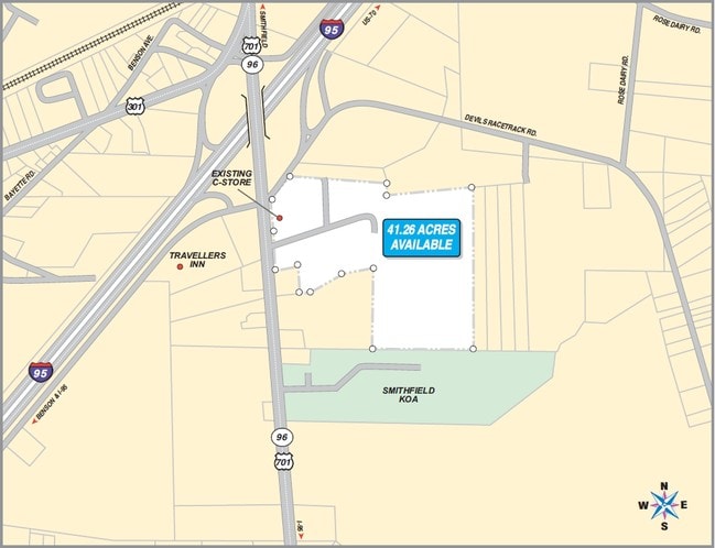
Conveniencestore
C G JOHNSON
X
Johnston
3720168200L
North Carolina
2025
1.03 AC
2025
Johnston County
041204
Raleigh/Durham
2,300 SF
Raleigh, NC
DEMOGRAPHICS near 217 Us Highway 701 S
1 Mile
3 Mile
5 Mile
2024 Total Population
989
6,029
17,198
2029 Population
1,192
7,285
20,916
Pop Growth 2024-2029
+ 20.53%
+ 20.83%
+ 21.62%
Average Age
41
41
41
2024 Total Households
367
2,310
6,704
HH Growth 2024-2029
+ 20.44%
+ 20.87%
+ 21.72%
Median Household Inc
$57,552
$56,772
$49,077
Avg Household Size
2.60
2.50
2.50
2024 Avg HH Vehicles
2.00
2.00
2.00
Median Home Value
$225,384
$240,389
$231,250
Median Year Built
1987
1983
1977
Nearby Places
- Restaurants
- Banks
- Shops
- Fitness
- Groceries
PUBLIC TRANSPORTATION
COMMUTER RAIL
DRIVE
WALK
Distance
13 min
9.6 mi
AIRPORT
Fayetteville Regional/Grannis Field
DRIVE
WALK
Distance
Fayetteville Regional/Grannis Field
58 min
46.0 mi
Raleigh-Durham International
DRIVE
WALK
Distance
Raleigh-Durham International
64 min
47.3 mi
SALE & LEASE HISTORY
LISTING DATE
SALE/LEASE

Sep 24, 2016
For Sale
Nearby Properties
Address
Land Use
TOTAL SIZE
Lot Size
Zoning
Address
Land Use
TOTAL SIZE
Lot Size
Zoning
705,050 SF
129.75 AC
IND
Address
Land Use
TOTAL SIZE
Lot Size
Zoning
122,012 SF
30.94 AC
IND
Address
Land Use
TOTAL SIZE
Lot Size
Zoning
24,142 SF
37.47 AC
RES
Address
Land Use
TOTAL SIZE
Lot Size
Zoning
249,045 SF
27.03 AC
IND
Address
Land Use
TOTAL SIZE
Lot Size
Zoning
17,808 SF
27.29 AC
RES
Address
Land Use
TOTAL SIZE
Lot Size
Zoning
2,234 SF
12.86 AC
IND
Address
Land Use
TOTAL SIZE
Lot Size
Zoning
2,304 SF
27.39 AC
COM
Address
Land Use
TOTAL SIZE
Lot Size
Zoning
11,922 SF
41.19 AC
IND
Address
Land Use
TOTAL SIZE
Lot Size
Zoning
141,516 SF
13.26 AC
COM
Address
Land Use
TOTAL SIZE
Lot Size
Zoning
5,913 SF
8.25 AC
RES
Address
Land Use
TOTAL SIZE
Lot Size
Zoning
936 SF
655.79 AC
RAG
Address
Land Use
TOTAL SIZE
Lot Size
Zoning
480 SF
4.37 AC
RES
Address
Land Use
TOTAL SIZE
Lot Size
Zoning
4,340 SF
8 AC
IND
Address
Land Use
TOTAL SIZE
Lot Size
Zoning
11,838 SF
27.65 AC
COM
Address
Land Use
TOTAL SIZE
Lot Size
Zoning
18,810 SF
5.20 AC
IND
Address
Land Use
TOTAL SIZE
Lot Size
Zoning
29,520 SF
4.11 AC
COM
Address
Land Use
TOTAL SIZE
Lot Size
Zoning
81,250 SF
12.71 AC
COM
Address
Land Use
TOTAL SIZE
Lot Size
Zoning
90,430 SF
4.19 AC
SUP
Address
Land Use
TOTAL SIZE
Lot Size
Zoning
555.66 AC
RAG
Address
Land Use
TOTAL SIZE
Lot Size
Zoning
78,880 SF
5.30 AC
IND
Address
Land Use
TOTAL SIZE
Lot Size
Zoning
9,600 SF
2.10 AC
COM
Address
Land Use
TOTAL SIZE
Lot Size
Zoning
464.68 AC
RAG
Address
Land Use
TOTAL SIZE
Lot Size
Zoning
15,420 SF
2.21 AC
IND
Address
Land Use
TOTAL SIZE
Lot Size
Zoning
4,508 SF
1.16 AC
COM
Address
Land Use
TOTAL SIZE
Lot Size
Zoning
37,288 SF
5.48 AC
COM
Address
Land Use
TOTAL SIZE
Lot Size
Zoning
2,650 SF
2.32 AC
COM
Address
Land Use
TOTAL SIZE
Lot Size
Zoning
44,520 SF
2.34 AC
COM
Address
Land Use
TOTAL SIZE
Lot Size
Zoning
15,776 SF
6.54 AC
IND
Address
Land Use
TOTAL SIZE
Lot Size
Zoning
50,000 SF
6 AC
COM
Address
Land Use
TOTAL SIZE
Lot Size
Zoning
214.65 AC
RAG
The World's #1 Commercial Real Estate Marketplace
Connect with us
© 2025 CoStar Group
The information above has been obtained from sources believed reliable. While we do not doubt its accuracy we have not verified it and make no guarantee, warranty or representation about it. It is your responsibility to independently confirm its accuracy and completeness. Any projections, opinions, assumptions, or estimates used are for example only and do not represent the current or future performance of the property. The value of this transaction to you depends on tax and other factors which should be evaluated by your tax, financial, and legal advisors. You and your advisors should conduct a careful, independent investigation of the property to determine to your satisfaction the suitability of the property for your needs.