Property Record
217 Hershberger Rd, Roanoke, VA 24012

Property Detail
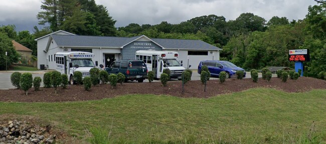
217 Hershberger Rd
038.15-01-08
TINKER CREEK
Daycare
Roanoke
C2
Virginia
AE The base floodplain where base flood elevations are provided. AE Zones are now used on new format FIRMs instead of A1-A30 Zones.
2.32 AC
2026
Northeast Roanoke
2026
Roanoke
030206
Roanoke, VA
4,581 SF
NEARBY LISTINGS FOR SALE OR LEASE
DEMOGRAPHICS near 217 Hershberger Rd
1 mile
3 mile
5 mile
2025 Total Population
10,090
50,290
120,524
2030 Population
10,079
50,242
120,451
Pop Growth 2025-2030
(0.11%)
(0.10%)
(0.06%)
Average Age
43
41
40
2025 Total Households
4,277
20,931
51,426
HH Growth 2025-2030
(0.19%)
(0.12%)
(0.09%)
Median Household Inc
$56,808
$57,419
$56,713
Avg Household Size
2.20
2.30
2.20
2025 Avg HH Vehicles
2.00
2.00
2.00
Median Home Value
$211,798
$219,263
$226,700
Median Year Built
1966
1968
1965
Nearby Places
Map Layers
Map Styles
 Street
 Aerial
Layers
 Traffic
 Biking
Places
Listings with unknown addresses are not visible on the map
- Restaurants
- Banks
- Shops
- Fitness
- Groceries
PUBLIC TRANSPORTATION
COMMUTER RAIL
Roanoke (Northeast Regional - Amtrak)
Drive
Walk
Distance
Roanoke (Northeast Regional - Amtrak)
9 min
5.0 mi
AIRPORT
Roanoke/Blacksburg Regional (Woodrum Field)
Drive
Walk
Distance
Roanoke/Blacksburg Regional (Woodrum Field)
7 min
2.6 mi
Freight Ports
Virginia Port Authority - Richmond
Drive
Walk
Distance
Virginia Port Authority - Richmond
215 min
188.9 mi
Nearby Properties
Address
Land Use
TOTAL SIZE
Lot Size
Zoning
Address
Land Use
TOTAL SIZE
Lot Size
Zoning
8,930 SF
604.76 AC
AD
Address
Land Use
TOTAL SIZE
Lot Size
Zoning
3,850 SF
60.20 AC
INPUD
Address
Land Use
TOTAL SIZE
Lot Size
Zoning
437,578 SF
14.74 AC
CLS
Address
Land Use
TOTAL SIZE
Lot Size
Zoning
96,620 SF
26.84 AC
D
Address
Land Use
TOTAL SIZE
Lot Size
Zoning
39,455 SF
12.01 AC
CLS
Address
Land Use
TOTAL SIZE
Lot Size
Zoning
4,901 SF
17.41 AC
MXPUD
Address
Land Use
TOTAL SIZE
Lot Size
Zoning
387,684 SF
27.44 AC
I-1
Address
Land Use
TOTAL SIZE
Lot Size
Zoning
142,048 SF
21.38 AC
I-1
Address
Land Use
TOTAL SIZE
Lot Size
Zoning
609,211 SF
41.01 AC
I1C
Address
Land Use
TOTAL SIZE
Lot Size
Zoning
206,978 SF
19.45 AC
CLS
Address
Land Use
TOTAL SIZE
Lot Size
Zoning
40.04 AC
M-2
Address
Land Use
TOTAL SIZE
Lot Size
Zoning
29.63 AC
I-1
Address
Land Use
TOTAL SIZE
Lot Size
Zoning
15,312 SF
182.27 AC
AG3
Address
Land Use
TOTAL SIZE
Lot Size
Zoning
10,878 SF
10.34 AC
RMF
Address
Land Use
TOTAL SIZE
Lot Size
Zoning
207,812 SF
22.62 AC
CLS
Address
Land Use
TOTAL SIZE
Lot Size
Zoning
1,109 SF
13.44 AC
INPUD
Address
Land Use
TOTAL SIZE
Lot Size
Zoning
164,753 SF
5.45 AC
INPUD
Address
Land Use
TOTAL SIZE
Lot Size
Zoning
71,238 SF
3.62 AC
CLS
Address
Land Use
TOTAL SIZE
Lot Size
Zoning
124,725 SF
6.53 AC
I1
Address
Land Use
TOTAL SIZE
Lot Size
Zoning
71,590 SF
2.49 AC
CLS
Address
Land Use
TOTAL SIZE
Lot Size
Zoning
446,526 SF
28.10 AC
I-1
Address
Land Use
TOTAL SIZE
Lot Size
Zoning
48,935 SF
9.15 AC
RMF
Address
Land Use
TOTAL SIZE
Lot Size
Zoning
32,080 SF
16 AC
INPUD
Address
Land Use
TOTAL SIZE
Lot Size
Zoning
139,654 SF
4.77 AC
C2S
Address
Land Use
TOTAL SIZE
Lot Size
Zoning
12,159 SF
8.77 AC
RMF
Address
Land Use
TOTAL SIZE
Lot Size
Zoning
22,950 SF
9.50 AC
R3
Address
Land Use
TOTAL SIZE
Lot Size
Zoning
1.86 AC
CLS
Address
Land Use
TOTAL SIZE
Lot Size
Zoning
333,572 SF
20 AC
I-1
Address
Land Use
TOTAL SIZE
Lot Size
Zoning
198,089 SF
46.65 AC
AD
Address
Land Use
TOTAL SIZE
Lot Size
Zoning
12,018 SF
8.78 AC
RMF
The World's #1 Commercial Real Estate Marketplace
Connect with us
© 2026 CoStar Group
The information above has been obtained from sources believed reliable. While we do not doubt its accuracy we have not verified it and make no guarantee, warranty or representation about it. It is your responsibility to independently confirm its accuracy and completeness. Any projections, opinions, assumptions, or estimates used are for example only and do not represent the current or future performance of the property. The value of this transaction to you depends on tax and other factors which should be evaluated by your tax, financial, and legal advisors. You and your advisors should conduct a careful, independent investigation of the property to determine to your satisfaction the suitability of the property for your needs.