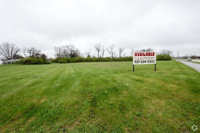
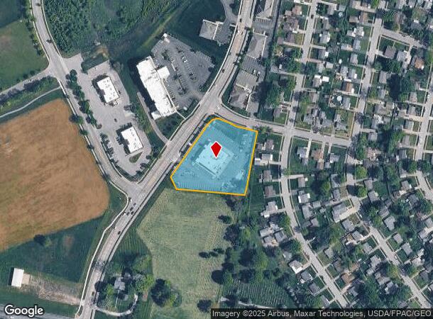
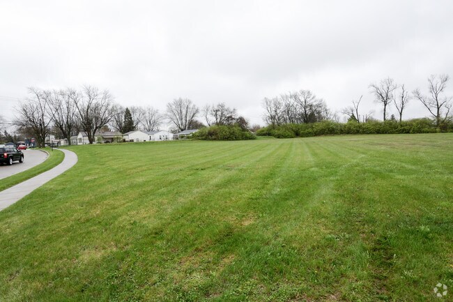
Property Record
217 S Progress Dr, Xenia, OH 45385
NEARBY LISTINGS FOR SALE OR LEASE
Property Detail
217 S Progress Dr
Dayton, OH
Progress Center
M40-0001-0023-0-0234-00
DRG RESTAURANT GROUP LOT 6A 1.840AC S PROGRESS DR
Commercialnec
Greene
X
Ohio
39057C0140E
6a
2024
1.84 AC
2024
Southeast Dayton
240200
Cincinnati/Dayton
DEMOGRAPHICS near 217 S Progress Dr
1 Mile
3 Mile
5 Mile
2024 Total Population
7,326
29,744
46,623
2029 Population
7,420
30,482
47,630
Pop Growth 2024-2029
+ 1.28%
+ 2.48%
+ 2.16%
Average Age
39
42
42
2024 Total Households
2,922
12,139
18,030
HH Growth 2024-2029
+ 1.13%
+ 2.49%
+ 2.20%
Median Household Inc
$53,416
$59,782
$75,532
Avg Household Size
2.30
2.30
2.40
2024 Avg HH Vehicles
2.00
2.00
2.00
Median Home Value
$96,393
$150,148
$209,107
Median Year Built
1967
1969
1973
Nearby Places
Map Layers
Map Styles
 Street
 Aerial
- Restaurants
- Banks
- Shops
- Fitness
- Groceries
PUBLIC TRANSPORTATION
AIRPORT
James M Cox Dayton International
DRIVE
WALK
Distance
James M Cox Dayton International
40 min
26.0 mi
Freight Ports
Port of Toledo
DRIVE
WALK
Distance
Port of Toledo
197 min
166.2 mi
SALE & LEASE HISTORY
LISTING DATE
SALE/LEASE

Apr 14, 2017
For Sale
Nearby Properties
Address
Land Use
TOTAL SIZE
Lot Size
Zoning
Address
Land Use
TOTAL SIZE
Lot Size
Zoning
286,260 SF
47.65 AC
Address
Land Use
TOTAL SIZE
Lot Size
Zoning
23,424 SF
7.42 AC
Address
Land Use
TOTAL SIZE
Lot Size
Zoning
2,984 SF
98.36 AC
Address
Land Use
TOTAL SIZE
Lot Size
Zoning
35,370 SF
23.27 AC
Address
Land Use
TOTAL SIZE
Lot Size
Zoning
2,853 SF
42.41 AC
Address
Land Use
TOTAL SIZE
Lot Size
Zoning
24,466 SF
34.44 AC
Address
Land Use
TOTAL SIZE
Lot Size
Zoning
136,667 SF
43.33 AC
Address
Land Use
TOTAL SIZE
Lot Size
Zoning
41,870 SF
13.21 AC
Address
Land Use
TOTAL SIZE
Lot Size
Zoning
217,579 SF
22.16 AC
Address
Land Use
TOTAL SIZE
Lot Size
Zoning
26,912 SF
3.26 AC
Address
Land Use
TOTAL SIZE
Lot Size
Zoning
320 SF
65.47 AC
Address
Land Use
TOTAL SIZE
Lot Size
Zoning
20,283 SF
19.18 AC
Address
Land Use
TOTAL SIZE
Lot Size
Zoning
43,510 SF
13.10 AC
Address
Land Use
TOTAL SIZE
Lot Size
Zoning
41,120 SF
149.37 AC
Address
Land Use
TOTAL SIZE
Lot Size
Zoning
136,915 SF
16.23 AC
Address
Land Use
TOTAL SIZE
Lot Size
Zoning
78,330 SF
35.06 AC
Address
Land Use
TOTAL SIZE
Lot Size
Zoning
77,924 SF
11.18 AC
Address
Land Use
TOTAL SIZE
Lot Size
Zoning
67,660 SF
5.45 AC
Address
Land Use
TOTAL SIZE
Lot Size
Zoning
24,466 SF
6.43 AC
Address
Land Use
TOTAL SIZE
Lot Size
Zoning
1,012 SF
464.56 AC
Address
Land Use
TOTAL SIZE
Lot Size
Zoning
15,600 SF
40.59 AC
Address
Land Use
TOTAL SIZE
Lot Size
Zoning
33,300 SF
20.35 AC
Address
Land Use
TOTAL SIZE
Lot Size
Zoning
11,664 SF
16.37 AC
Address
Land Use
TOTAL SIZE
Lot Size
Zoning
48,523 SF
6.26 AC
Address
Land Use
TOTAL SIZE
Lot Size
Zoning
15,160 SF
7.48 AC
Address
Land Use
TOTAL SIZE
Lot Size
Zoning
34,728 SF
0.99 AC
Address
Land Use
TOTAL SIZE
Lot Size
Zoning
110,592 SF
7.22 AC
Address
Land Use
TOTAL SIZE
Lot Size
Zoning
90,567 SF
0.18 AC
Address
Land Use
TOTAL SIZE
Lot Size
Zoning
43,365 SF
0.38 AC
Address
Land Use
TOTAL SIZE
Lot Size
Zoning
62,868 SF
8.35 AC
The World's #1 Commercial Real Estate Marketplace
Connect with us
© 2026 CoStar Group
The information above has been obtained from sources believed reliable. While we do not doubt its accuracy we have not verified it and make no guarantee, warranty or representation about it. It is your responsibility to independently confirm its accuracy and completeness. Any projections, opinions, assumptions, or estimates used are for example only and do not represent the current or future performance of the property. The value of this transaction to you depends on tax and other factors which should be evaluated by your tax, financial, and legal advisors. You and your advisors should conduct a careful, independent investigation of the property to determine to your satisfaction the suitability of the property for your needs.