Property Record
217 Sadds Mill Rd, Ellington, CT 06029
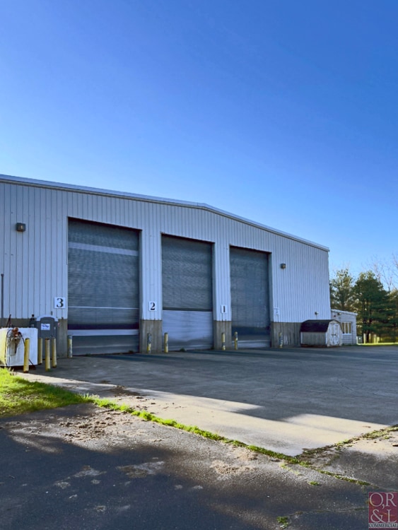

Property Detail
217 Sadds Mill Rd
ELLI-000117-000002
TOLLAND
Taxexempt
Connecticut
I
34.65 AC
2025
Tolland County
2025
Hartford
535102
Hartford-West Hartford-East Hartford, CT
NEARBY LISTINGS FOR SALE OR LEASE
DEMOGRAPHICS near 217 Sadds Mill Rd
1 mile
3 mile
5 mile
2025 Total Population
595
12,269
48,941
2030 Population
605
12,499
49,968
Pop Growth 2025-2030
+ 1.68%
+ 1.87%
+ 2.10%
Average Age
42
43
43
2025 Total Households
238
4,934
20,070
HH Growth 2025-2030
+ 2.10%
+ 1.95%
+ 2.15%
Median Household Inc
$117,999
$110,447
$107,168
Avg Household Size
2.50
2.40
2.40
2025 Avg HH Vehicles
2.00
2.00
2.00
Median Home Value
$365,277
$345,813
$315,041
Median Year Built
1979
1979
1972
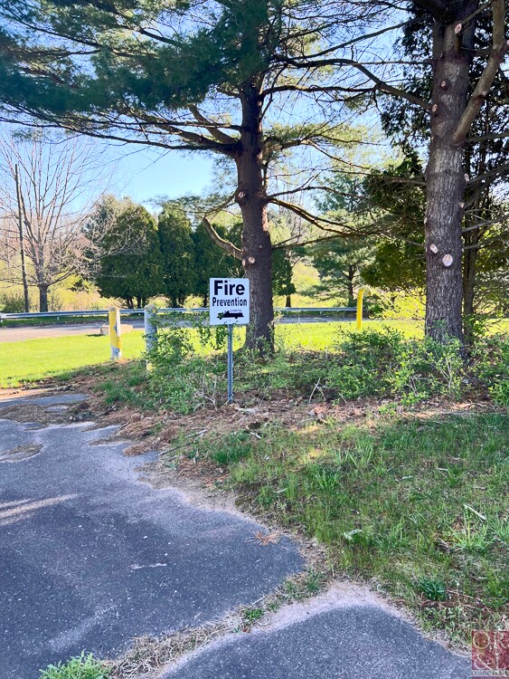
Nearby Places
Map Layers
Map Styles
 Street
 Aerial
Layers
 Traffic
 Biking
Places
Listings with unknown addresses are not visible on the map
- Restaurants
- Banks
- Shops
- Fitness
- Groceries
PUBLIC TRANSPORTATION
COMMUTER RAIL
Windsor Locks (Hartford Line - CT Rail (CTRail))
Drive
Walk
Distance
Windsor Locks (Hartford Line - CT Rail (CTRail))
16 min
9.0 mi
AIRPORT
Bradley International
Drive
Walk
Distance
Bradley International
33 min
14.2 mi
Freight Ports
Port of New Haven
Drive
Walk
Distance
Port of New Haven
77 min
56.0 mi
SALE & LEASE HISTORY
LISTING DATE
SALE/LEASE

Jun 07, 2024
For Lease
Jun 07, 2024
For Sale
Nearby Properties
Address
Land Use
TOTAL SIZE
Lot Size
Zoning
Address
Land Use
TOTAL SIZE
Lot Size
Zoning
4,418 SF
106 AC
MFDD
Address
Land Use
TOTAL SIZE
Lot Size
Zoning
9,244 SF
46.83 AC
MFDD
Address
Land Use
TOTAL SIZE
Lot Size
Zoning
59.25 AC
C
Address
Land Use
TOTAL SIZE
Lot Size
Zoning
75,238 SF
45.70 AC
R-1
Address
Land Use
TOTAL SIZE
Lot Size
Zoning
71,173 SF
14.30 AC
R-2
Address
Land Use
TOTAL SIZE
Lot Size
Zoning
47.78 AC
RAR
Address
Land Use
TOTAL SIZE
Lot Size
Zoning
24.66 AC
C
Address
Land Use
TOTAL SIZE
Lot Size
Zoning
20.27 AC
MF
Address
Land Use
TOTAL SIZE
Lot Size
Zoning
18.84 AC
MF
Address
Land Use
TOTAL SIZE
Lot Size
Zoning
4,066 SF
13.93 AC
ARHD
Address
Land Use
TOTAL SIZE
Lot Size
Zoning
24,465 SF
1.89 AC
R
Address
Land Use
TOTAL SIZE
Lot Size
Zoning
67.24 AC
R88
Address
Land Use
TOTAL SIZE
Lot Size
Zoning
5,288 SF
1 AC
B-1
Address
Land Use
TOTAL SIZE
Lot Size
Zoning
5.80 AC
R44
Address
Land Use
TOTAL SIZE
Lot Size
Zoning
10,847 SF
5 AC
PC
Address
Land Use
TOTAL SIZE
Lot Size
Zoning
4.25 AC
R
Address
Land Use
TOTAL SIZE
Lot Size
Zoning
5 AC
C
Address
Land Use
TOTAL SIZE
Lot Size
Zoning
6.54 AC
C
Address
Land Use
TOTAL SIZE
Lot Size
Zoning
8,750 SF
2 AC
R-2
Address
Land Use
TOTAL SIZE
Lot Size
Zoning
25.06 AC
RAR
Address
Land Use
TOTAL SIZE
Lot Size
Zoning
19,616 SF
3.72 AC
B-2
Address
Land Use
TOTAL SIZE
Lot Size
Zoning
60,540 SF
4.20 AC
I
Address
Land Use
TOTAL SIZE
Lot Size
Zoning
11,692 SF
6.65 AC
PC
Address
Land Use
TOTAL SIZE
Lot Size
Zoning
8.14 AC
C
Address
Land Use
TOTAL SIZE
Lot Size
Zoning
4.30 AC
I
Address
Land Use
TOTAL SIZE
Lot Size
Zoning
10,579 SF
2.74 AC
R
Address
Land Use
TOTAL SIZE
Lot Size
Zoning
36,927 SF
4.29 AC
C
Address
Land Use
TOTAL SIZE
Lot Size
Zoning
125 AC
I
Address
Land Use
TOTAL SIZE
Lot Size
Zoning
4.70 AC
I
The World's #1 Commercial Real Estate Marketplace
Connect with us
© 2026 CoStar Group
The information above has been obtained from sources believed reliable. While we do not doubt its accuracy we have not verified it and make no guarantee, warranty or representation about it. It is your responsibility to independently confirm its accuracy and completeness. Any projections, opinions, assumptions, or estimates used are for example only and do not represent the current or future performance of the property. The value of this transaction to you depends on tax and other factors which should be evaluated by your tax, financial, and legal advisors. You and your advisors should conduct a careful, independent investigation of the property to determine to your satisfaction the suitability of the property for your needs.