Property Record
217 State Rd E, Westminster, MA 01473


Property Detail
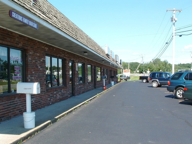
217 State Rd E
WMIN-000075-000000-000000-000007
Worcester
Regionalshoppingcenterormallwithanchorstore
Massachusetts
A Areas with a 1% annual chance of flooding and a 26% chance of flooding over the life of a 30-year mortgage.
7
2025
3 AC
2025
Outlying Worcester
708100
Boston
9,700 SF
Worcester, MA
NEARBY LISTINGS FOR SALE OR LEASE
-
-
View all Westminster listings for sale on LoopNet.com
DEMOGRAPHICS near 217 State Rd E
1 mile
3 mile
5 mile
2024 Total Population
1,614
18,692
57,452
2029 Population
1,670
19,119
58,944
Pop Growth 2024-2029
+ 3.47%
+ 2.28%
+ 2.60%
Average Age
42
42
40
2024 Total Households
609
7,339
22,077
HH Growth 2024-2029
+ 3.45%
+ 2.32%
+ 2.70%
Median Household Inc
$98,015
$88,659
$80,006
Avg Household Size
2.60
2.50
2.50
2024 Avg HH Vehicles
2.00
2.00
2.00
Median Home Value
$435,648
$369,667
$370,717
Median Year Built
1976
1961
1958
Nearby Places
Map Layers
Map Styles
 Street
 Aerial
Transit
 Traffic
 Biking
Places
Listings with unknown addresses are not visible on the map
- Restaurants
- Banks
- Shops
- Fitness
- Groceries
PUBLIC TRANSPORTATION
COMMUTER RAIL
Drive
Walk
Distance
5 min
2.2 mi
Fitchburg (Fitchburg/South Acton Line - Massachusetts Bay Transportation Authority Commuter Rail (Purple Line))
Drive
Walk
Distance
Fitchburg (Fitchburg/South Acton Line - Massachusetts Bay Transportation Authority Commuter Rail (Purple Line))
12 min
4.8 mi
AIRPORT
Worcester Regional
Drive
Walk
Distance
Worcester Regional
47 min
28.7 mi
Manchester Boston Regional
Drive
Walk
Distance
Manchester Boston Regional
75 min
40.8 mi
Freight Ports
Port of Boston
Drive
Walk
Distance
Port of Boston
81 min
52.8 mi
Nearby Properties
Address
Land Use
TOTAL SIZE
Lot Size
Zoning
Address
Land Use
TOTAL SIZE
Lot Size
Zoning
39.19 AC
CR
Address
Land Use
TOTAL SIZE
Lot Size
Zoning
276,822 SF
26.98 AC
I
Address
Land Use
TOTAL SIZE
Lot Size
Zoning
114,360 SF
6.10 AC
RA
Address
Land Use
TOTAL SIZE
Lot Size
Zoning
281,196 SF
8.70 AC
AI
Address
Land Use
TOTAL SIZE
Lot Size
Zoning
99,800 SF
20 AC
RA
Address
Land Use
TOTAL SIZE
Lot Size
Zoning
127.30 AC
AI
Address
Land Use
TOTAL SIZE
Lot Size
Zoning
87,326 SF
20.74 AC
Address
Land Use
TOTAL SIZE
Lot Size
Zoning
113,250 SF
34.55 AC
CR
Address
Land Use
TOTAL SIZE
Lot Size
Zoning
262,800 SF
32.80 AC
Address
Land Use
TOTAL SIZE
Lot Size
Zoning
3.65 AC
RC
Address
Land Use
TOTAL SIZE
Lot Size
Zoning
74.90 AC
Address
Land Use
TOTAL SIZE
Lot Size
Zoning
164,545 SF
50.64 AC
Address
Land Use
TOTAL SIZE
Lot Size
Zoning
56,475 SF
4.26 AC
I
Address
Land Use
TOTAL SIZE
Lot Size
Zoning
87,828 SF
AI
Address
Land Use
TOTAL SIZE
Lot Size
Zoning
72,336 SF
6.42 AC
I
Address
Land Use
TOTAL SIZE
Lot Size
Zoning
91,941 SF
10.55 AC
I
Address
Land Use
TOTAL SIZE
Lot Size
Zoning
4.01 AC
Address
Land Use
TOTAL SIZE
Lot Size
Zoning
36,419 SF
1.68 AC
Address
Land Use
TOTAL SIZE
Lot Size
Zoning
21,800 SF
16.48 AC
AI
Address
Land Use
TOTAL SIZE
Lot Size
Zoning
1,187.86 AC
Address
Land Use
TOTAL SIZE
Lot Size
Zoning
99,400 SF
8.58 AC
I
Address
Land Use
TOTAL SIZE
Lot Size
Zoning
4.74 AC
I
Address
Land Use
TOTAL SIZE
Lot Size
Zoning
45.86 AC
Address
Land Use
TOTAL SIZE
Lot Size
Zoning
83,408 SF
6.18 AC
I
Address
Land Use
TOTAL SIZE
Lot Size
Zoning
57.58 AC
Address
Land Use
TOTAL SIZE
Lot Size
Zoning
21,758 SF
15.01 AC
Address
Land Use
TOTAL SIZE
Lot Size
Zoning
Address
Land Use
TOTAL SIZE
Lot Size
Zoning
85,570 SF
5.98 AC
I
Address
Land Use
TOTAL SIZE
Lot Size
Zoning
101,226 SF
6.80 AC
I
Address
Land Use
TOTAL SIZE
Lot Size
Zoning
45.51 AC
The World's #1 Commercial Real Estate Marketplace
Connect with us
© 2026 CoStar Group
The information above has been obtained from sources believed reliable. While we do not doubt its accuracy we have not verified it and make no guarantee, warranty or representation about it. It is your responsibility to independently confirm its accuracy and completeness. Any projections, opinions, assumptions, or estimates used are for example only and do not represent the current or future performance of the property. The value of this transaction to you depends on tax and other factors which should be evaluated by your tax, financial, and legal advisors. You and your advisors should conduct a careful, independent investigation of the property to determine to your satisfaction the suitability of the property for your needs.